Doi Tung is best known for its beautifully flowered gardens and Phra Tamnak Doi Tung, a villa that served as the residence of Princess Srinagarindra, grandmother of the current King Rama X.
It remains a classic destination in the region, often included in day trips from Chiang Rai. But if you are traveling independently and are a little curious, there is much more to discover in the surrounding area.
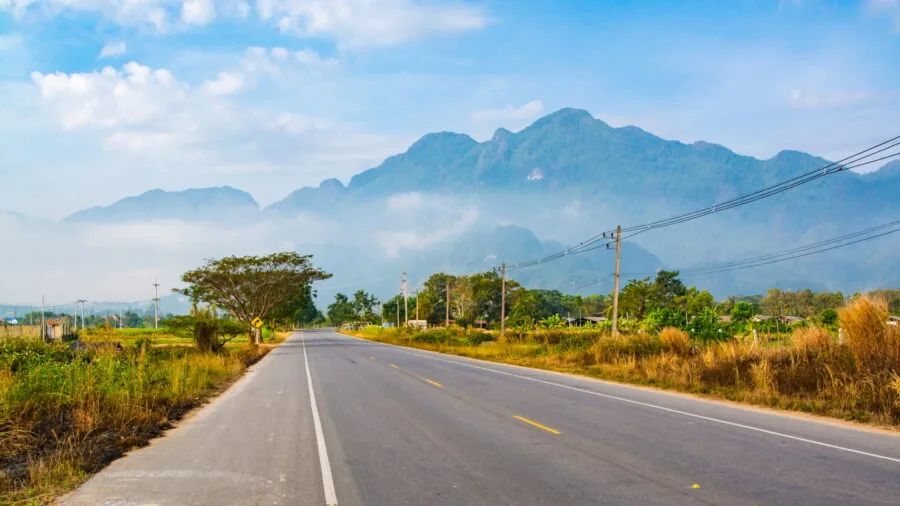
If Doi Tung is accessible in an hour from Chiang Rai, you can also make a nice loop in the day passing through Chiang Saen and the Golden Triangle park (which I am talking about here), combining with the Mae Sai border market before reaching Doi Tung via Route 1149.
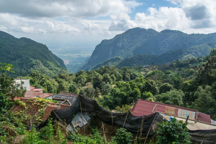
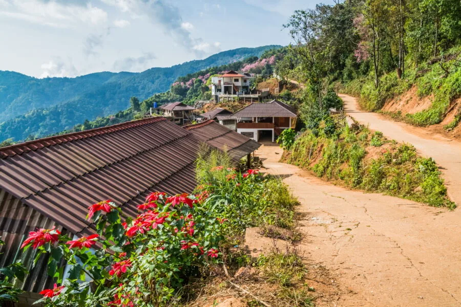
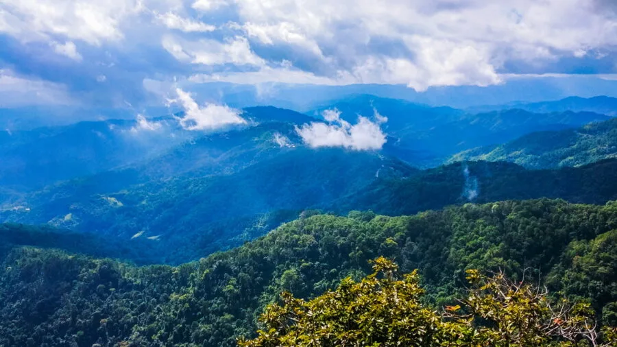
This small road climbs sharply into the mountains, running along the Burmese border. It passes through several coffee-producing villages, including Ban Pha Hi, and offers breathtaking views of the neighboring country.
Route 1149: a route bordering Burma
I was just talking about it, and it is the common thread of these visits. Route 1149 really comes back to flirting with Burma, the latter running along the crest of the Doi Nang Non mountain, which acts as a real natural border with its neighbor. Basically, the road starts from the crossroads with Route 1290, which comes directly from the Hall of Opium and the Golden Triangle.
This junction is close to Mae Sai city centre, just 3 km from the border post. It is also possible to reach this same road 1149 from Tessaban Road 5, located right next to Mae Sai market.
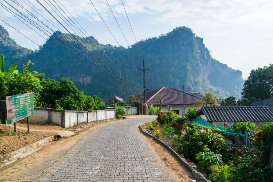
Ban Pha Mi, the starting point
For my part, I started this route from an intermediate road located 2 km from the crossroads. This leads to the village of Ban Pha Mi, which takes its name from the Doi Pha Mi located next door. A little bonus info, by passing through there, you are next to Tham Luang Nang Non, located only 2 km from the climb to the village.
The cave, actually a series of cavities located beneath Doi Nang Non, became famous after an incident involving 12 members of a local football team and their coach who were trapped in the cave following a heavy rainstorm in July 2018.
When I first passed through this road, the area remained relatively well-known only to locals and under the radar, but this sudden international spotlight was going to change things a bit... Because yes, this celebrity was not without consequences, with a marked desire among the population to discover this region, and therefore a craze for traveling the road and its villages.
If, due to its proximity to Mae Sai and the valley, Ban Pha Mi already enjoyed a certain popularity before that, with the proven presence of a few cafes on its slope, Ban Pha Hi, located a little further away, was transformed in just a few years following this event… but I'll come to that later.
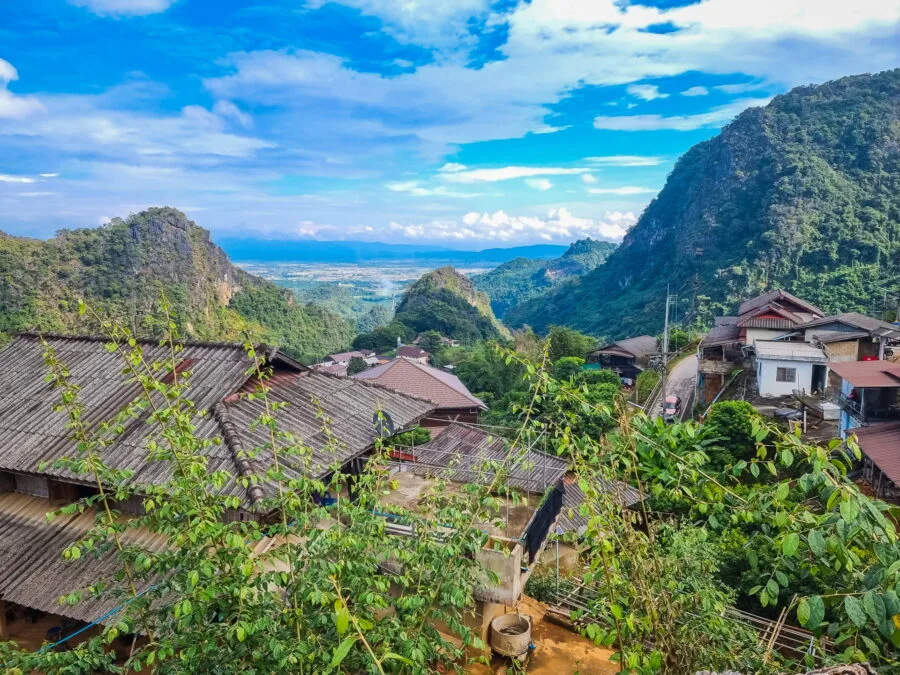
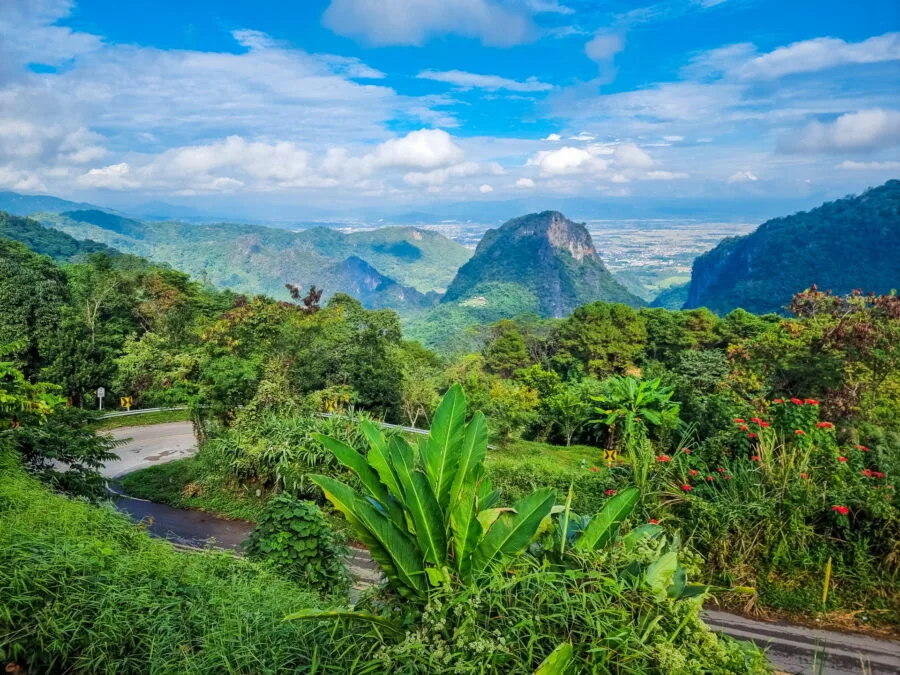
Still, the first time I went to the area, I was amazed by the mountains of karst rocks that appeared before me. I didn't know it yet at the time (I went there a few months later) but these are landscapes that are reminiscent, to a lesser extent, the mountains of northern Vietnam.
The road that winds through the village was still just a small paved road, barely wider than a car despite being two-way. And if since then it is tarmacked and a bit wider (but not that much), the climb up here is still worth it, especially since the view from the top of the village remains just as beautiful. A good warm-up for the rest which promised to be just as interesting.
On Doi Nang Non
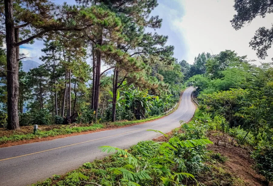
At the top of Ban Pha Mi, Route 1149 is available to you. If you turn right, you go back down towards Mae Sai. So it is to the left that I was engaging, starting the climb towards the crest of the Doi Nang Non, the main mountain over which Route 1149 winds before reaching Ban Pha Hi.
After 2 km, the climb becomes steeper with a series of hairpin bends. Before the last curve, I see a bamboo platform installed on the side of the road (downhill side), with a view that is clearly worth a stop. Too bad there is no parking, because by car, this requires stopping on the mountain side (watch out for the ditch), pulling in as tightly as possible so as not to obstruct traffic.
If you prefer to avoid stopping on the side of the road, an alternative is to go to the "Life Museum", which is not a museum but turns out to be a nice cafe-restaurant with a beautiful view. You can also opt for the Phamee Hill (ผาหมีฮิลล์), located a few meters before.
The climb is short but intense, with a steep gradient. Be careful not to encroach too much on the bends, because visibility is limited.
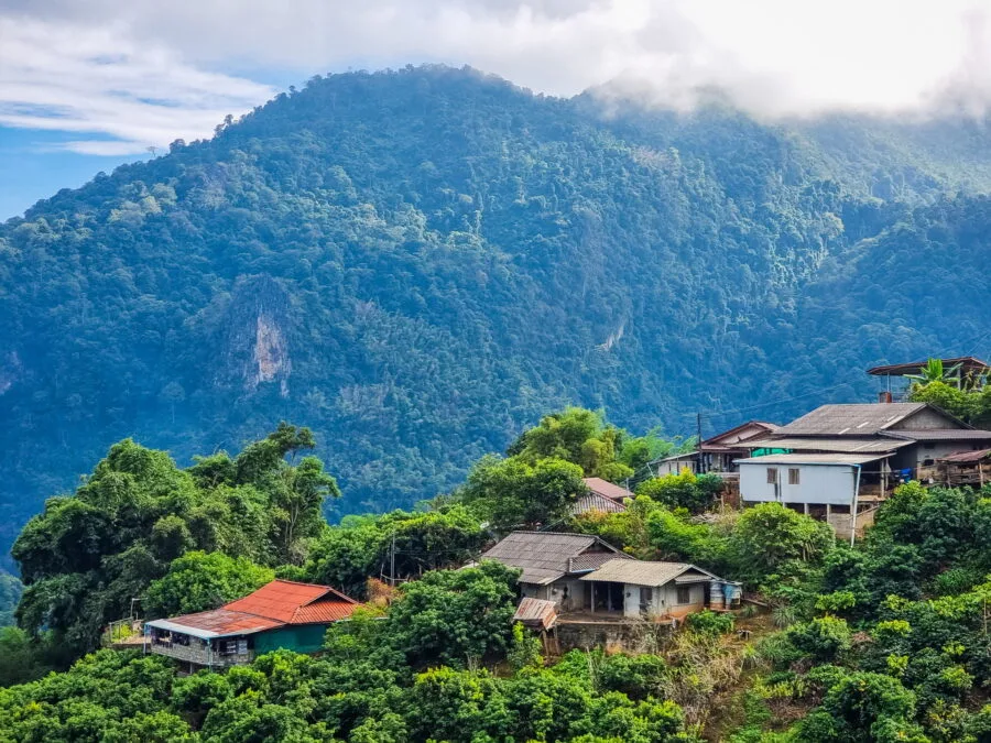
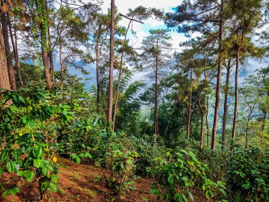
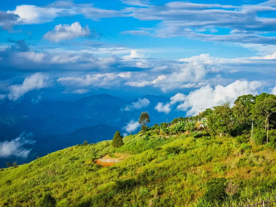
As you gain altitude, the vegetation changes gradually. From a certain point, pine trees begin to line the road. Depending on the year, the density of the vegetation varies on the right.
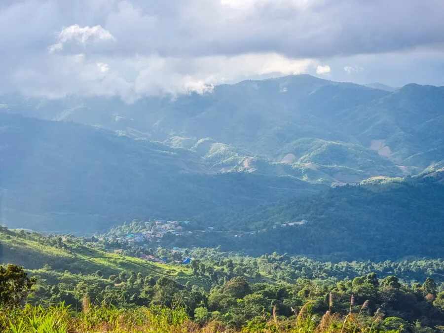
The first few times I passed through here, the landscape was pretty clear, which really encouraged to stop to enjoy the view. Which of course I did: after parking as best I could, I jumped over a small ditch on the side of the road and found myself facing the mountains of Myanmar.
It must be known that Doi Nang Non ridge officially marks the border. And since there is no no physical barriers along this stretch of road, technically, passing the ditch, I had feet in Burma when taking the panoramic photo below.
This road is usually deserted. You will come across a few locals on motorbikes, but it is easy to stop to take pictures. There are several obvious spots where you can enjoy the view of the nearby mountains.
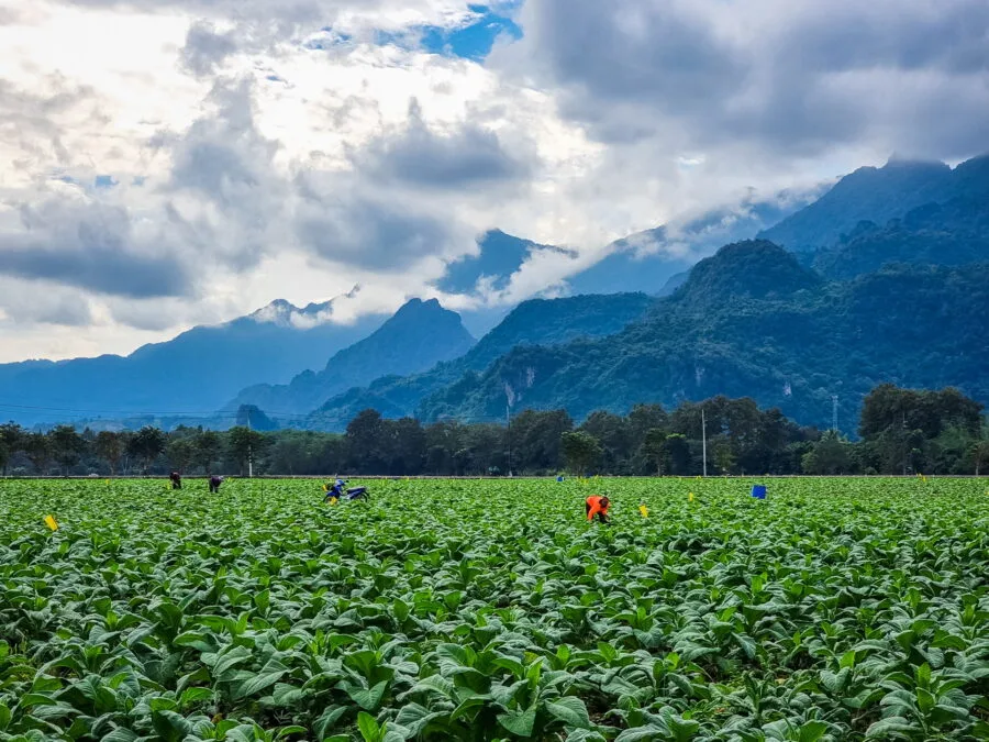
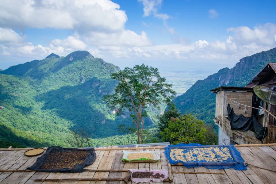
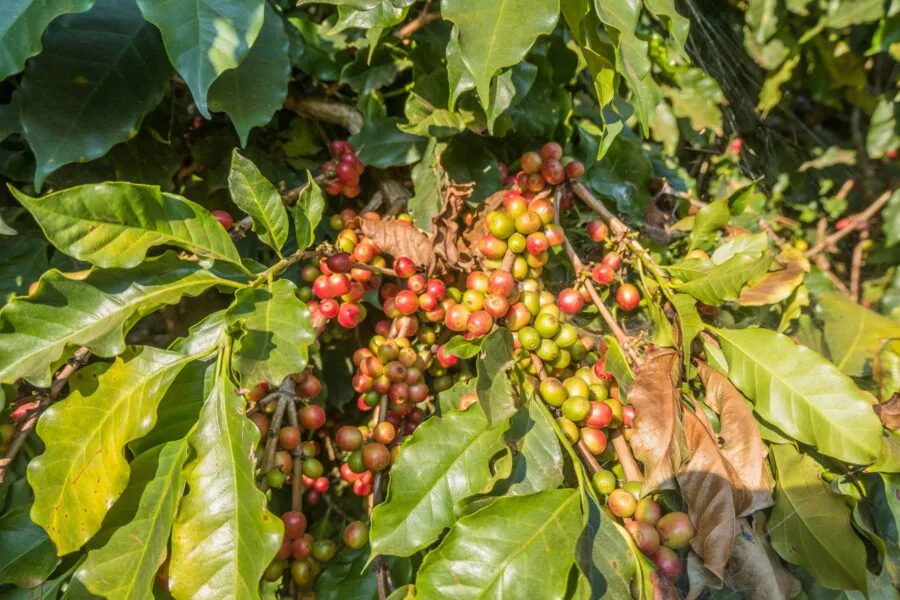
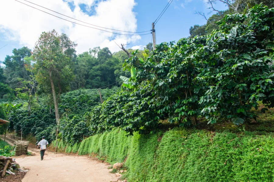
Along this portion of the 1149 route, you will also come across your first coffee plantationsThe coffee trees are planted directly at the edge of the road, on the side of the mountain, sheltered by the tall pine trees.
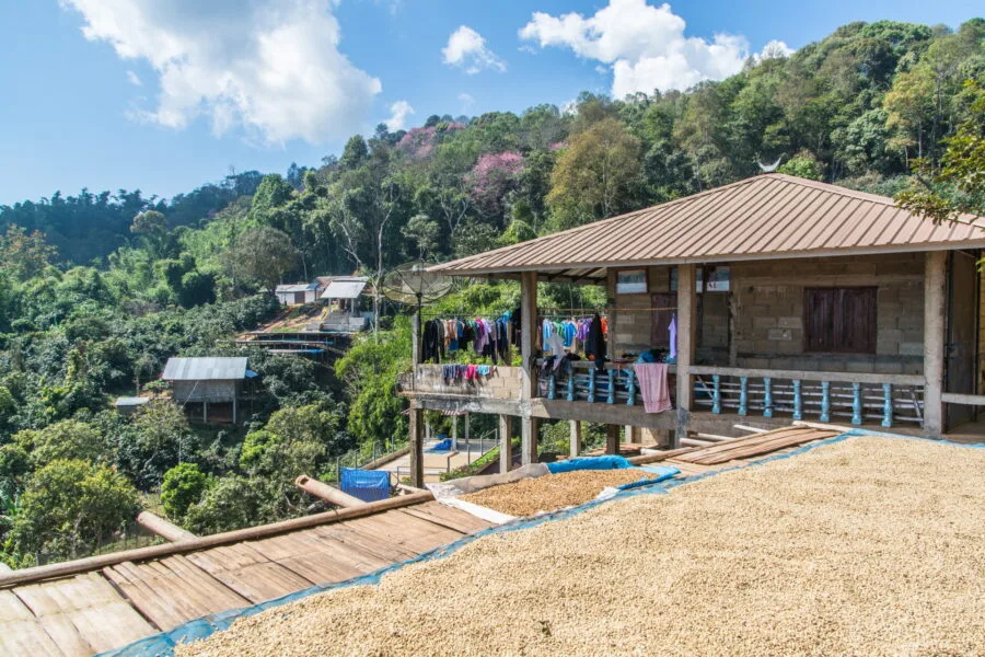
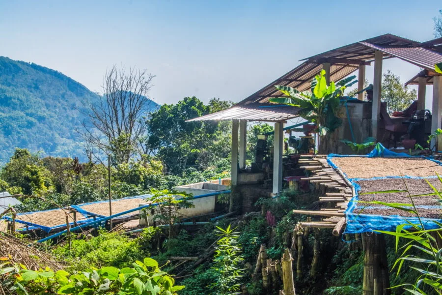
Ban Pha Hi: a hilltop Akha village and its local café
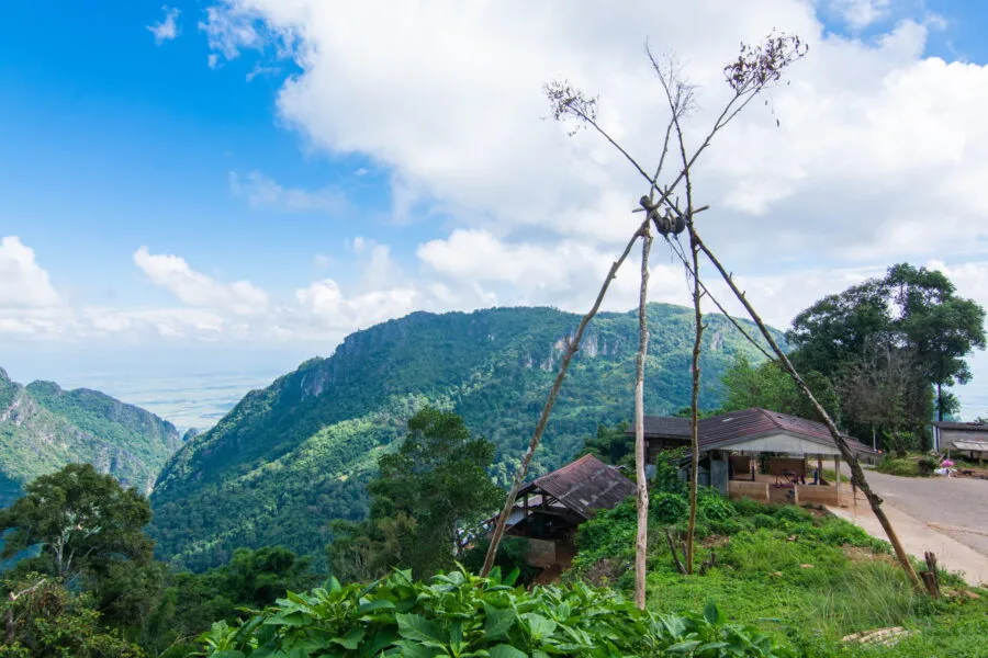
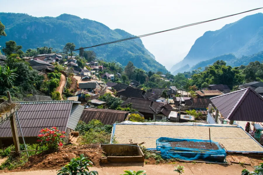
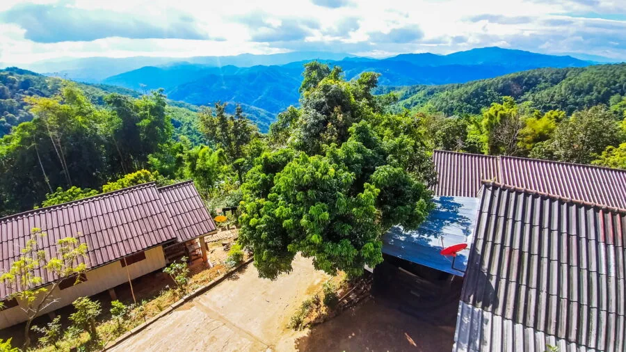
When I first discovered this mountain, it was precisely to reach Ban Pha Hi. I had noticed that coffee was produced there and that it was an Akha village. Afterwards, on this last point, it is not obvious, apart from the traditional swing that can be seen at the entrance to the village.
Otherwise, it looks more like a classic country village, except that it is perched at an altitude of 1 m and you can see more solid buildings than wooden houses, proof that the coffee business is a good business!
A village still discreet before Tham Luang
On my very first visit, Ban Pha Hi was still under the radarThere were hardly any visitors, the parking lot at the entrance to the village was used more as a playground for kids than anything else, and there were only two coffees in all.
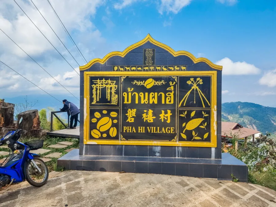
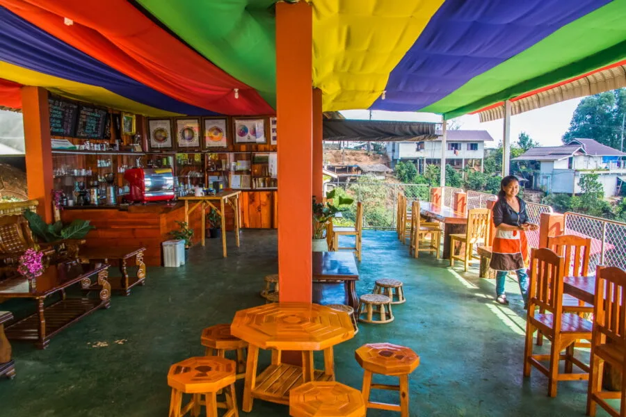
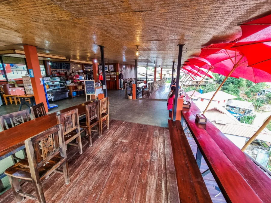
I had gone to the one I consider to be "the original", the Pha Hee Coffee (so yes, even if the village is called Ban Pha Hi, the coffee shop chose the spelling Hey).
Installed in the courtyard of a family home, it was at the time a simple open terrace overlooking an incredible panorama, between two mountain peaks. It was expressly this view, spotted on Google Maps, which had pushed me to take this road 1149.
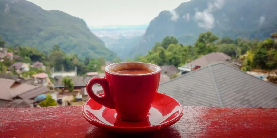
And since I love coffee, I might as well taste it directly from the source! The barista at Pha Hee Coffee has typical Akha features, and even back then, they provided a traditional headdress and clothes for souvenir photos.
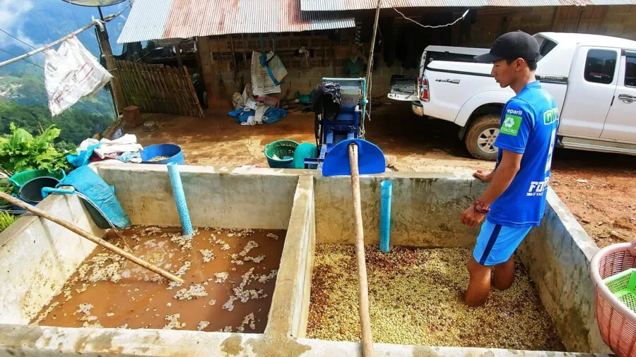
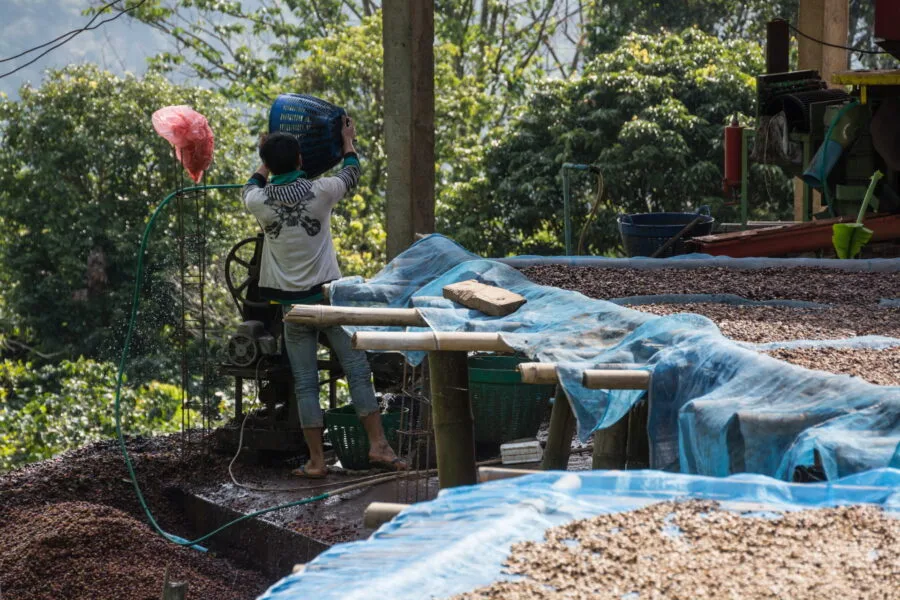
All over the village, there were stalls of drying coffee beans and coffee plants near the cooperative, which was then freely accessible.
The rise of the village and the explosion of tourism
Every time I pass by, I see Ban Pha Hi evolve. First, the Pha Hee Coffee has doubled its surface area, then they added photo platforms with the possibility of drinking your coffee with your feet in the air. See the evolution of the latter between 2017 and 2022:
At that time, there were already more visitors, but the village still maintained a certain balance. Then one day, shock.
The parking lot was full (well, it was a weekend, that also plays a role), panoramic platforms had been added everywhere, but above all, two large buildings had sprung up above the original café: hotels! Worse! An imposing hotel had actually been embedded in the middle of the village's main plantation!

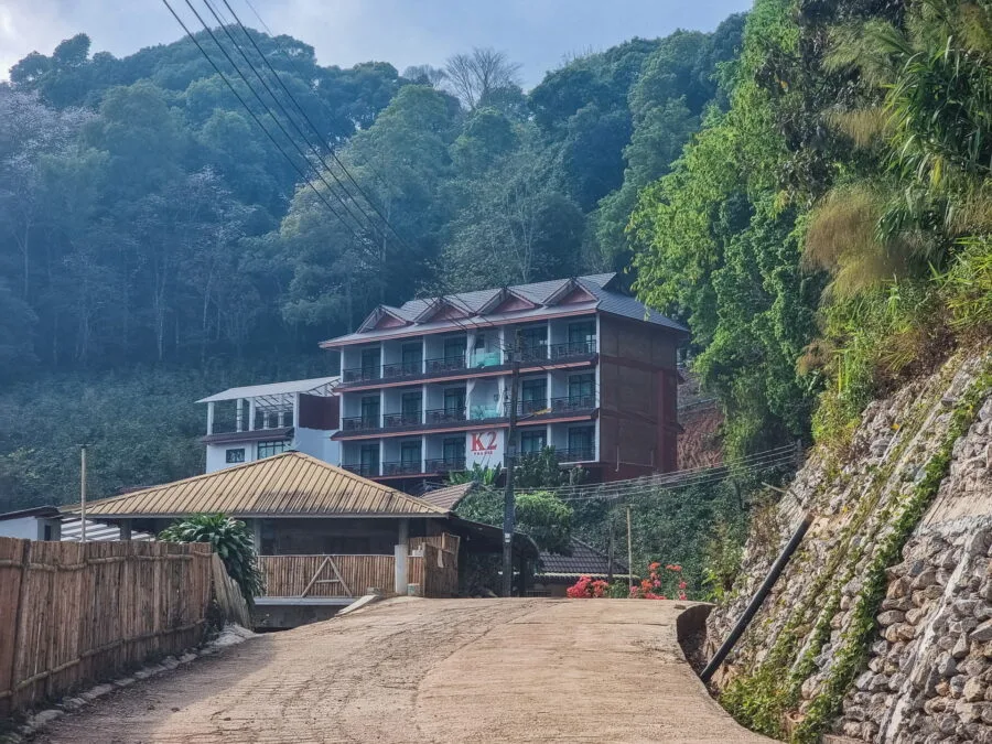
Today, Ban Pha Hi has more than ten homestays and at least five or six more coffees. In addition, the cooperative is no longer accessible. Gone is the calm of the beginning, even if the village remains very popular with Thais rather than foreign tourists.
So, Is it still worth the detour? Yes, still, The view remains incredible. But seeing a place change so quickly is always frustrating.
Passing through the military base: a strategic area at altitude
Less than 3 km after Ban Pha Hi, continuing on the 1149 route, you will come across an area on your right delimited by a bamboo barrier. If you pay attention, you should see a yellow, green and red flag floating on a mast. You will have understood, This is Burma. More precisely, it is a Burmese military outpost !
A few meters further, you will arrive at a thai checkpoint. The barrier is closed by default, so you have to stop. You will just be asked where you are coming from and where you are going, just say you are going to "Doi Tung" and you will be let through without any problem.
Just after this passage, you will come across Thai military outpost (spotted by Chang Moob Military Outpost on Google Maps), which, is accessible to the public. You can park nearby, and after a simple sign in a register, a zigzagging bamboo corridor leads to the top of the base.
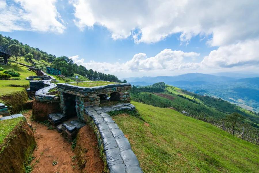
From up there, the view is breathtaking view of the Burmese mountains, With a vvillage visible below. The base is so peaceful that apart from a few shelters to protect against hypothetical explosions, there are… a little coffee, installed directly within the military outpost! Typically Thai.
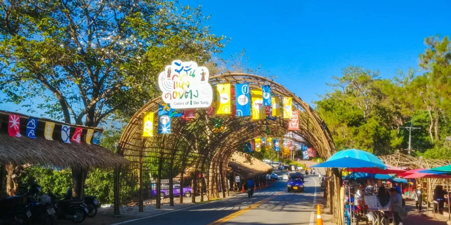
Doi Tung and surroundings
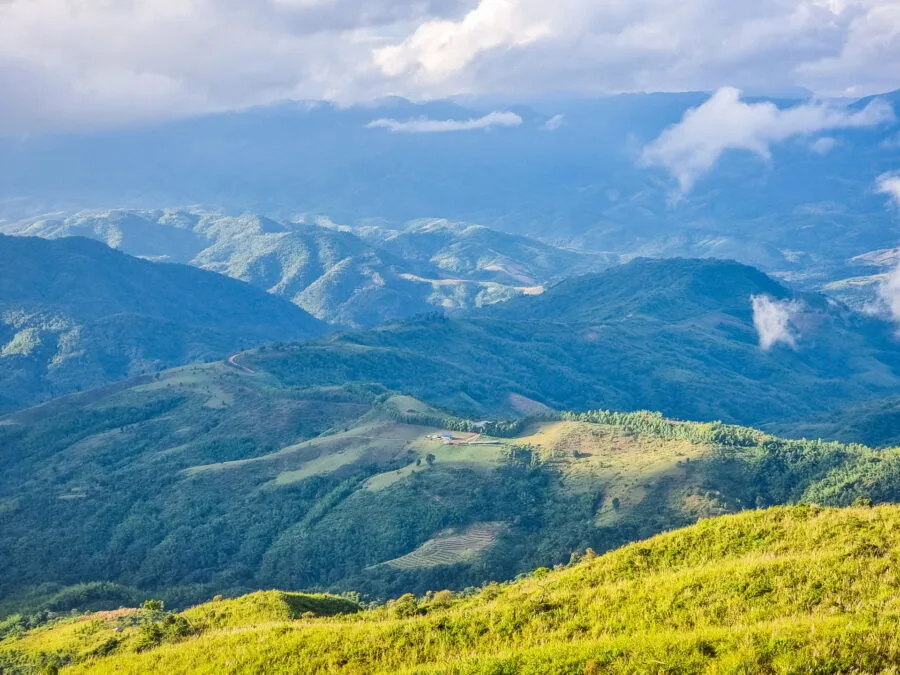
Less than a kilometer after the military outposts, we finally arrive in Doi Tung area. Continuing on the 1149 route, we cross a small, wide area, with a parking lot on the left and a kind of local market, with a line of merchants on the right, mainly selling fruit and vegetables.
The parking lot allows you to visit Mae Fah Luang Arboretum, not to be confused with the gardens of the royal villa, located further away. Not being a fan of flowers, I never stopped there, but for botany lovers, this site houses a collection of rare plants and colorful flower beds, accessible via shaded paths.
Right next to it, a panoramic platform allows you to admire the valley. A pedestrian tunnel passes under the road to access another platform, this time offering a view of the surrounding mountains.
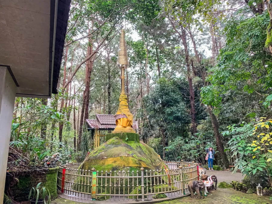
Near the arboretum, a path part of the market and leads to the Doi Chang Mub stupa, a small pagoda perched on a rock that, seen from the side, resembles a prostrate elephant. The place is surrounded by majestic pines and banyan with tangled roots.
The turnoff to Doi Tung
Shortly after the arboretum, we come to a fork in the road. Whichever direction you choose, the road remains 1149 et the two routes meet further down. However, attractions vary according to the choice:
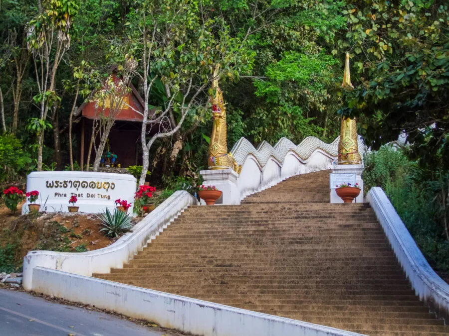
Left: Towards Wat Phra That Doi Tung
One kilometer after the junction, you will come to another fork. Continuing to the right, you continue the descent of route 1149, while going to left, you go up towards the temple.
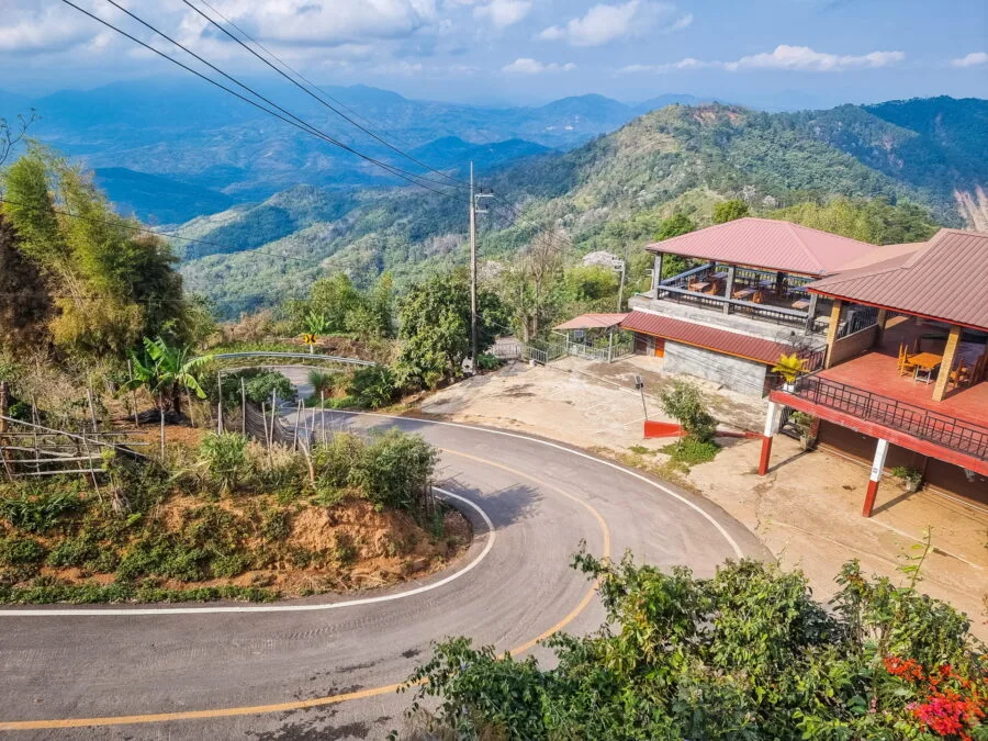
Just to the right, on the side of the road, there is a small restaurant. If you haven't eaten yet, this is a nice option, although I usually prefer to stop at Ban Pha Hi. But I have tried this restaurant before and it is very good.
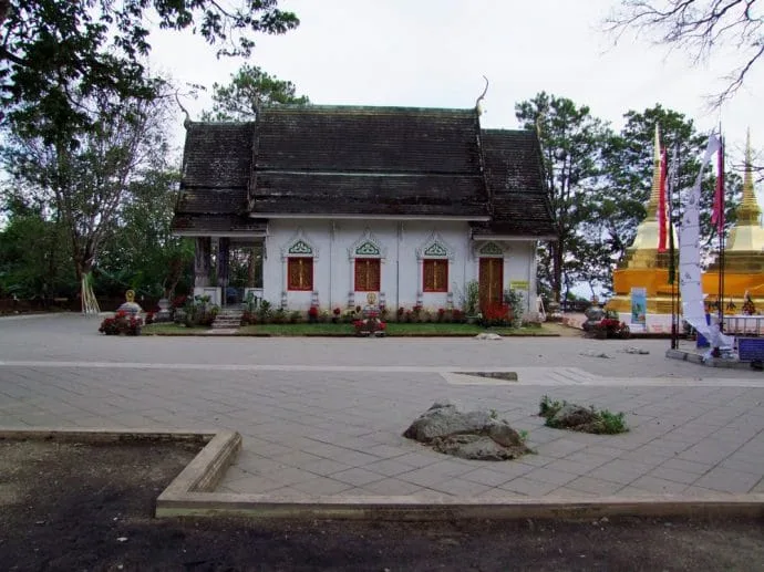
Next to it, stairs lead to a first part of the temple. Here you will find a modern viharn and a golden chedi, but the place is not very interesting, so you can skip it and continue opposite. A sign then indicates Phra That Doi Tung 1 km away.
The climb to the temple
When I first visited, the road leading to the temple was narrow, just wide enough for two vehicles to pass each other. At that time, it was even still possible to park directly within the temple grounds.
Since, the road has been completely redone. At one point, we enjoy a clear view of the valley and even of Ban Pha Hi, visible in the distance.
For the car park, two possible options:
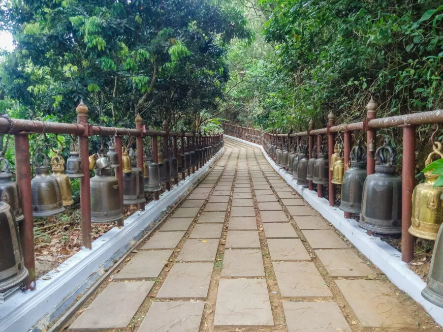
- Le premier (small), shortly after the viewpoint, with a few shops, snacks and toilets. From there, a staircase lined with Nagas leads to the temple.
- The second (larger), located higher, provides direct access to the temple entrance for the least motivated to climb on foot.
If you opt for the stairs, a paved and shaded path awaits you, bordered on both sides by an impressive alignment of bells. It remains easy to access because apart from the beginning, it is essentially flat and there are less than 300 meters to go through before to reach the temple terrace.
An important temple undergoing a metamorphosis
From what I could find as information, the Wat Phra That Doi Tung is mentioned in some sources as an ancient temple almost 1 years. In its current version, it is best known for its two twin golden chedis, built in Lanna style. He is also a important pilgrimage site for Buddhists.
Because this temple, although modest, is part of the 12 main temples of the country, each associated with a sign of the Chinese zodiac. All are located in the north (including four in Chiang Mai province alone), except Wat Phra That Phanom, located not far from the Mekong in Issan (northeast region).
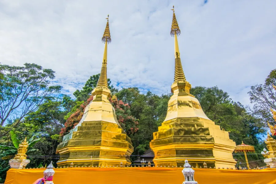
In this case, the Wat Phra That Doi Tung is associated with the sign of the Pig, which matches my sign!
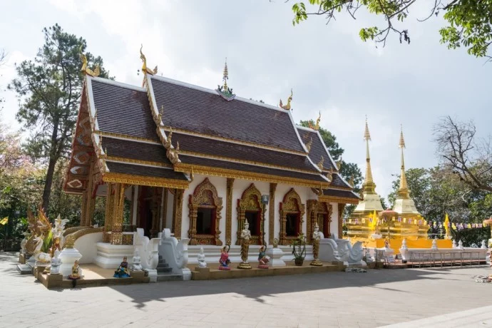
Again, I saw this temple evolve over time. Already after a few years, it has undergone a serious facelift. This again is normal and nothing shocking. But it was by seeing recent photos that I noticed other changes:
- The floor has been completely redone
- Added new structure to side of temple
- Extension of the platform around the temple
The most annoying thing about all this? Is that The site once offered real serenity, surrounded by vegetation. But to privilege the view, the extension led to the felling of trees… However, a point of view already existed à only 300 meters from the temple!
Indeed, you will find a staircase on the left side leading to a small path leading to a panoramic platform. Why cut down the trees when there was already a dedicated belvedere?
Right: Towards the village of Ban Musoe Laba
Let's start from the fork. Let's say you've seen enough temples and you choose the Route 1149 on the right. After 3 km, you will arrive at the entrance to a village: Ban Musoe Laba.
This is a Lahu village, an ethnic group originating from Yunnan, China. The Lahu are one of six major ethnic groups considered hill tribes in Thailand.
In the image of Ban Pha Hi, nothing particularly distinguishes Ban Musoe Laba architecturally, at least not enough to clearly identify its ethnicity. But then again, the interest lies in a combination of the view and… coffee, of course!
This is what pushed me one day, already knowing the Phra That Doi Tung, to take this route and stop here. Unfortunately, as of the date of this update (2025), the Laba Cafe and Bistro Doi Tung, the only cafe in the village, seems closed.
Too bad, because the view was really nice, just like the welcome from the family who ran the establishment. Afterwards, it is indicated as "temporarily closed", so we'll see if this evolves...
On principle: Note that this route makes the journey slightly longer. In fact, going via Route 1149 on the Wat Phra That Doi Tung side is only 3,7 km to the junction where the two descents meet, compared to 7 km via this village.
The Royal Villa and Gardens of Mae Fah Luang
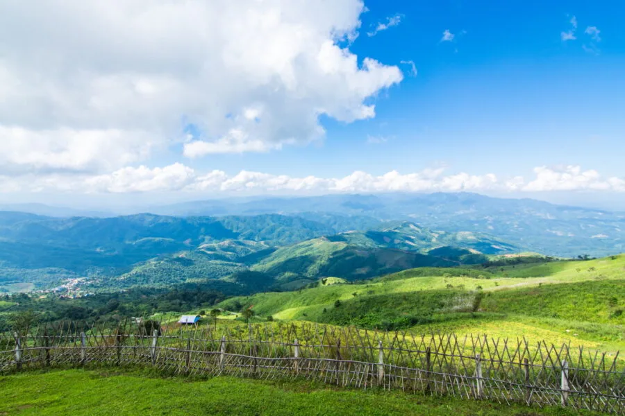
Shortly after the junction of the two 1149 roads, the road becomes flatter. You will pass a bend with a water retention basin below and just after a discreet village on your right, you will have a widened area with parking spaces visible on each side.
Opposite this area there is a junction. If you go left, it takes you on route 1149 which in this direction ends up going back down into the valley and back towards “civilization”.
By taking a right, it is indicated, the road leads to the Doi Tung Royal VillaThe climb is 1,5 km long and, along the way, there are parking spaces on the left side, proof that it can be busy on certain days.
At the top, there is a parking lot on each side of the road, at the level of the Doi Tung Bazaar, a local market run mainly by members of the Akha ethnic group, living in the neighboring village. It is also in this village that there is a guest house, the Ruea Phu Mok Homestay. As parking spaces are limited at the bazaar level, the car parks below allow for better distribution of vehicles.
It should be noted that the gardens and the royal villa can be visited independently of each other, the garden being on one side of the road and the villa on the other.
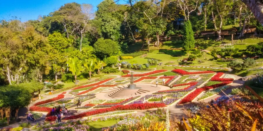
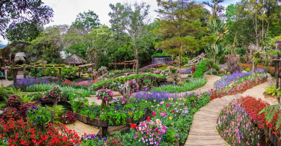
Mae Fah Luang Garden
The name Mae Fah Luang often returns to the region (as for the university Mae Fah Luang) and directly refers to the princess mother, who worked hard to improve the living conditions of the northern hill tribes. As she flew over these mountains in helicopters on her royal missions, she eventually earned the nickname "Royal Mother of Heaven" ou "Heavenly Royal Mother".
Le Mae Fah Luang Garden is a superb botanical garden of 10 hectares : , created on her initiative to offer Thais an experience similar to the European gardens that she had admired during her stays abroad, and more particularly in Switzerland.
The project also aimed to create jobs and improve living conditions for local communities, while combating deforestation and the poppy cultivation, once widespread in the region.
The garden is renowned for its wide variety of plants and flowers, which change with the seasons. Paths allow you to stroll among the flowerbeds, decorated with a few artistic sculptures.
In the past, you could also go tree climbing at Doi Tung Tree Top Walk, but this attraction has closed. Before accessing the gardens, it is also possible to visit the Hall of Inspiration, an interactive exhibition dedicated to the royal family, in particular the Mahidol branch, currently reigning.
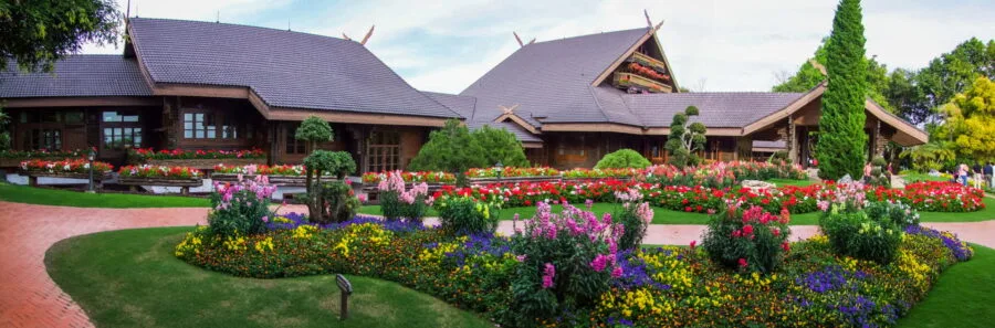
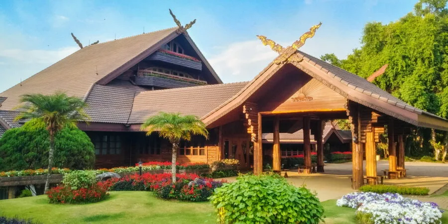
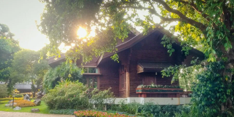
 Doi Tung Royal Villa
The history of this villa is closely linked to the Princess Mother's efforts to improve the living conditions of the mountain populations of northern Thailand. From the 1960s, she became actively involved in the region and, during her visits, she noted the extent of deforestation due to slash-and-burn agriculture and poppy production.
Faced with this situation, she initiated projects to restore forests and offer economic alternatives to residents, promoting sustainable crops such as coffee, tea and flowers.
Inspired by these initiatives, the Thai government launched in 1988 the Doi Tung Development Project, a program aimed at reforesting the region, combating poverty and improving access to education and health care. To allow him to oversee these efforts more closely and avoid his long annual trips to Switzerland, it was decided to build a residence on site.
The choice of Doi Tung was not random : located more than 1 meters above sea level, there is a milder climate all year round, and this mountainous landscape (even if objectively different) reminded him of the surroundings of Villa Vadhana where she stayed in Lausanne. She settled there even before the end of the work in November 1988 and resided there regularly until the end of her life in 1995, continuing to supervise the development of the region.
The architecture of the villa, with its wooden chalet style, is inspired by Swiss chalets, while integrating Thai elements. The house is composed of two floors :
- The upper floor includes his private quarters, those of his daughter Princess Galyani Vadhana, as well as a reception room and a kitchen.
- The lower floor is reserved for living areas and work spaces.
In front of the villa, a large flowery lawn offers a clear view of the surrounding mountains. At the back, a long balcony lined with planters recalls her love of flowers: it was here that she spent long hours gardening.
Inside, Photos are prohibited, but there are several elements reflecting the passions of the princess mother, notably for astronomy, with a ceiling representing the solar system as it was on the date of her birth (the October 21th 1900).
Today, the Doi Tung Royal Villa is open to the public, offering an insight into the Princess Mother's lifestyle and commitment to sustainable development and the preservation of natural resources.

How to get there
Being a destination off the beaten track, there is no no direct public transport to travel the entire route 1149.
If you only want to visit the Doi tung, it is possible to take a cab from Chiang Rai or to reach the entrance of the site by songthaew purple, which start from the Chiang Rai Central Bus Station at fixed times.
In any case, these options do not allow exploring the villages and panoramic points along the road.
The best solution therefore remains renting a vehicle :
- By scooter : I have already come across some on this road, but This is not an option I particularly recommend.. Mountain roads are sometimes steep, and driving in Thailand can be full of surprises. (I refer you to my article on the driving in thailand for more details.)
- By car : More comfortable, especially if you plan to make a lot of stops. A 4×4 is recommended, although not essential. Some portions are very stiff, and in the rainy season the road can become slippery.
Organized excursions
For those who prefer do not drive but want to fully explore this part of the province, tours from Chiang Rai offer tours of Doi Tung and surroundings. Some also include ethnic villages or in panoramic stops.
In summary, Doi Tung and its surroundings offer a walk that combines mountainous landscapes, local history and traditions. Apart from the gardens and the royal villa, it is a getaway that offers an experience a little off the beaten track.
To complete this visit, it is possible to make a detour via the tea plantations of Choui Fong, located approximately 20 km from the gardens, nestled in the valley slightly off the main road to Chiang Rai.
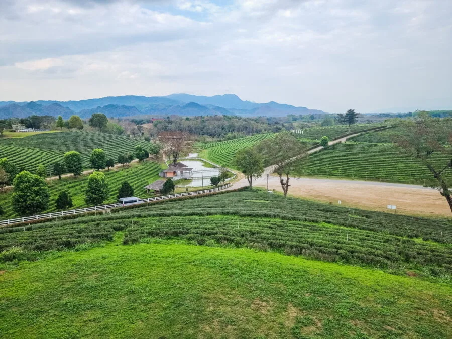
From its plantations, you have a view of Doi Tung, clearly visible in the background, perfect for ending this day in the north of Chiang Rai province.
_(October_2021)_-_img_08.jpg)