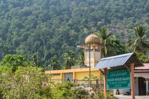
Langkawi is an island located just in the north of MalaysiaLangkawi is located on the Andaman Sea side of the island. It's also an archipelago made up of more than 90 islands, neighboring the Tarutao archipelago, which includes the popular island of Ko Lipe, in Thailand. Langkawi is a developed island, but not overly so. It boasts lovely beaches, beautiful natural areas, and abundant wildlife.
Bigger than Penang Island, which I had revisited during my previous stay in Malaysia, it is an ideal size for a stay of a few days without getting bored or going around in circles.
Visit Langkawi in 3 days
I covered the essentials of Langkawi in 3 days, although an extra day or even two would not be too much. And if I have to summarize Langkawi, here is how my program was divided over these three days:
- Day 1: North West Coast and Langkawi Sky Bridge
- 2nd Day: Tour of the island, between beaches and mangroves in the north
- Day 3: Gunung Raya and the central plains
Breaking down a bit, I focused my visits like this:
Day 1: North West Coast and Langkawi Sky Bridge
I wanted to see one of the island's main attractions first, the suspension bridge over the mountain bordering the island on the west coast, I'm of course talking about the Langkawi Sky Bridge.
Before that, I had gone to see the few beaches on this coast like that of Pasir Tengkorak. I also went to see the waterfalls in the area, starting with Air Terjun Temurun Waterfall then the most famous on the island, Telaga Tujuh waterfalls, nicknamed in English “seven wells”.

2nd Day: Tour of the island, between beaches and mangroves
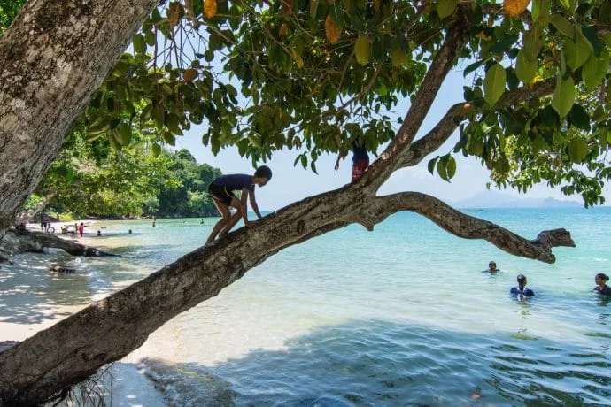
For my second day, I wanted to focus on the rest of the different beaches surrounding the island. So I set off for a complete loop of the island (which is 30 km long all the same, for an average of 10 km wide) stopping along the coasts, until reaching in particular one of the most beautiful beaches on the island, Tanjung Rhu.
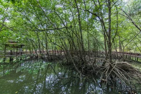
The entire east coast is essentially lined with mangroves, which made the visit easier. My plan was to go to the Kilim Geoforest Park, but the price for a single person was too high (I also think it was a price for a private tour, not a shared one), so I had to skip this sea trip...
At the beach I was going to a secondary waterfall, Durian Perangin Waterfall, and I still went to see the mangrove located next to the main departure dock for the Geopark.

Day 3: Gunung Raya and the central plains
Finally, for my last day, I wanted to complete my visits with an exploration inland. Starting by climbing the mountain that dominates the island, the Gunung Raya, which still reaches an altitude of 881 m. But it is easy since there is a road.
The rest of the day, I spent in a park located at the foot of Mount Raya (Tangga Helang Seribu Kenangan) before discovering a mainly agricultural island, walking on small roads crossing the Langkawi countryside. I ended this beautiful day by strolling in a local market, a perfect way to conclude this stay on this island which has a lot to offer.

This summary is here to help you plan your stay on the island, but I will now go into detail about what there is to see and do in Langkawi.
Langkawi in 3 days on a map
As usual, here is a small personal map, grouping the stopping points of the 3 days. You can also display the routes corresponding to each day (via the menu at the top left), I did not put them by default to avoid visually overloading the map.
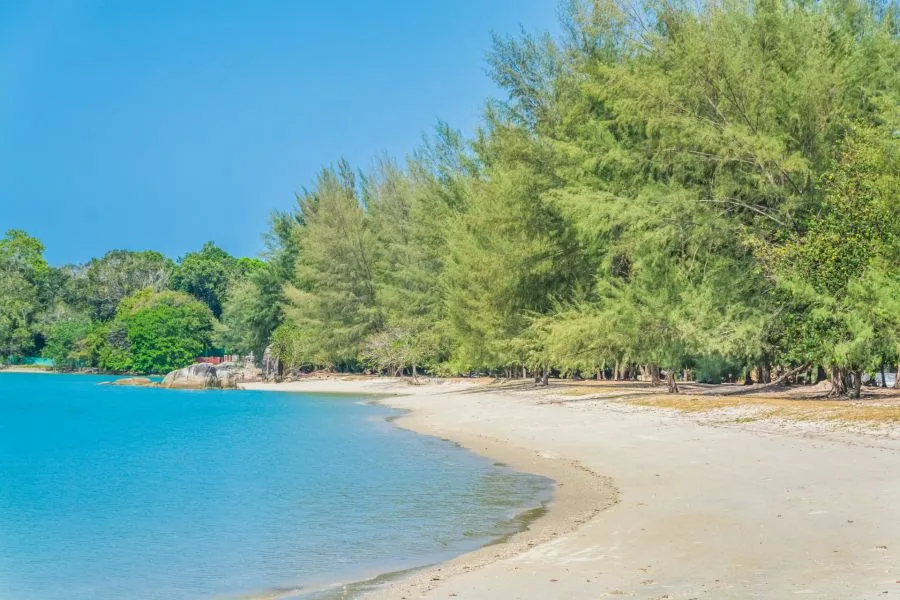
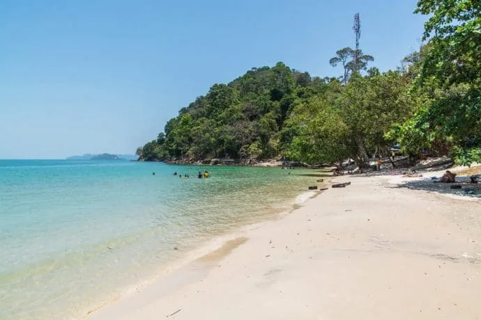
Langkawi Beaches
I confirm what I mentioned in the intro, while touring the island, I saw some pretty beaches. And the styles vary greatly, white sand, black sand, large, small, lively, deserted. I enjoyed touring the island and discovering as many of the possibilities that the island offered in terms of places to relax.
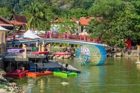
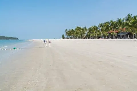
Pantai Cenang
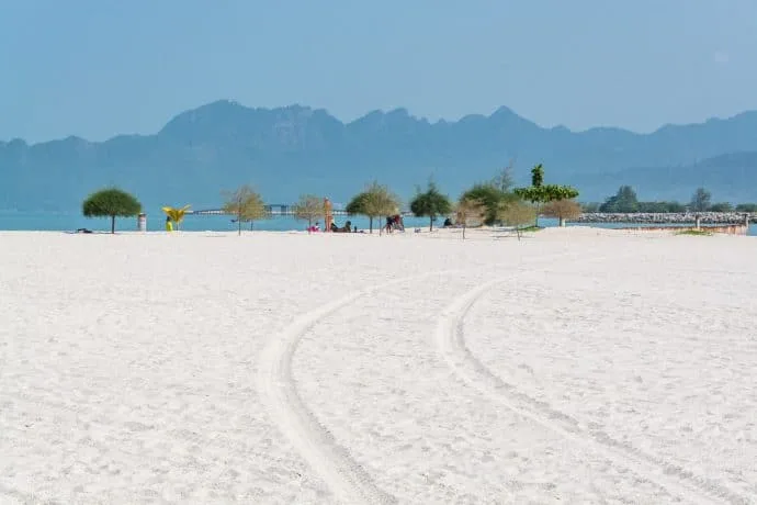
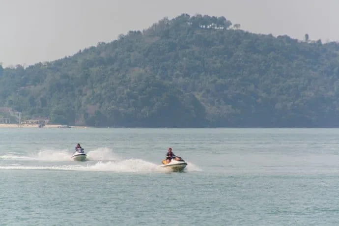
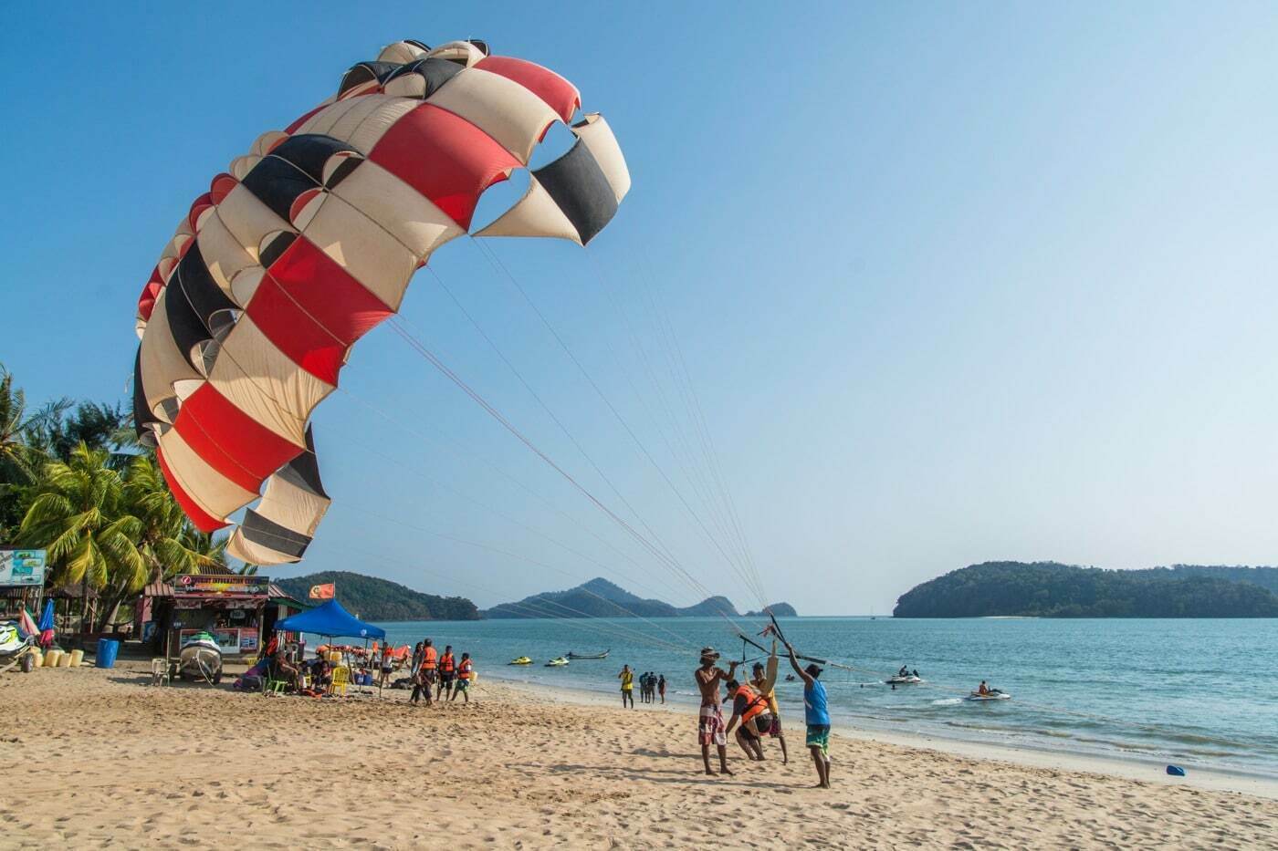
Among the lively beaches, including the one I stayed at, there is Pantai Cenang (Pantai meaning "beach"). It is the largest, but also the one that stands out as one of the most beautiful. It is not for nothing that Cenang Beach is the busiest on the island. This is where you will find the main village of the island, with its share of hotels, including the one where I stayed (see below), restaurants, souvenir shops, scooter rentals and classic water activities such as jet skis, parasailing, etc.
However, it is not as crowded as on some Thai beaches and I have already said it, the beach is large. So I have never seen it packed with people, which left this beautiful and wide strip of white sand visible, pleasant under the toes.
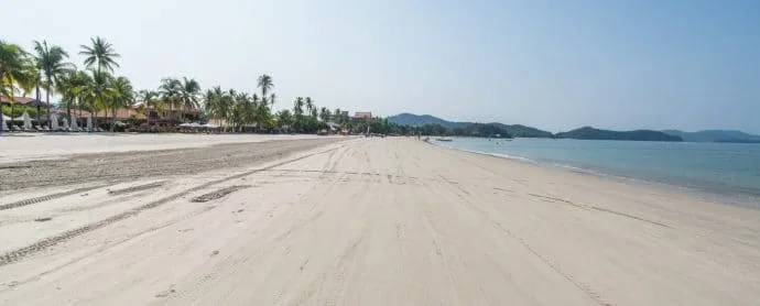
You will find public access via a path north of the beach, practically opposite the path leading to my hotel and next to the Casa Del Mar hotel.

Pantai Tengah
This is the neighboring beach south of Cenang, with a similar atmosphere, but calmer. I had the opportunity to go there at the end of the day, so as not to miss any of the different beaches surrounding Lankgawi.

Pantai Kok
This is the beach next to Telaga Marina (which is why I called it by that name before seeing its official name on Maps). It's a beach I passed on my way to the Sky Bridge cable car.
It was deserted when I visited, with a nice, tree-lined setting. But given its proximity to the marina, it's not really the kind of place I'd want to swim.
Phone Data
It is a bay with a beautiful isolated beach, in the northwest corner of the island. However, it has a big drawback, it is that there is a road passing through the area, but the access to said beach is completely private… Only guests of the luxury hotel complexes built in this area can enjoy the beach, unless they pay an apparently exorbitant entrance fee.
Shortly before, we also pass Datai Bay, which is now occupied by a golf course, which also caused the road to be moved, which used to run along the seafront but now cuts the land in two, running further inland.
However, it was while I was in this area that I came across a nice little beach with public access, Pantai Pasir Tengkorak.
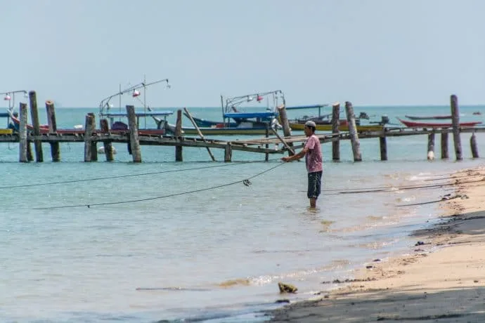
Fisherman's Beach
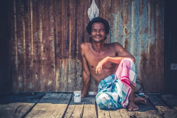
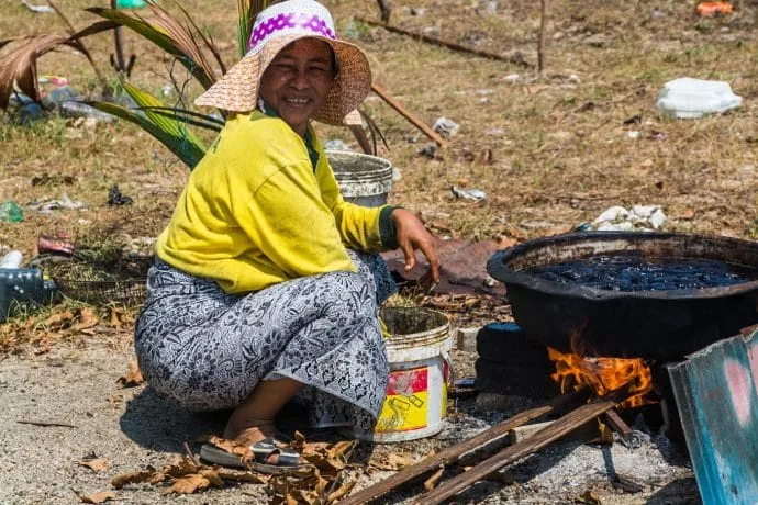
Because I don't see an official name on this beach in the north of the island, I call it that since that's where I came across a quiet beach, bordered by fairly simple wooden huts. The latter being inhabited by fishermen, well there you go, "fishermen's beach".
It was shortly after passing the large cement factory (hard to miss given how it stood out from the landscape) that we arrived at this stretch of beach. Since I'm never against taking a look at a seemingly deserted place, I put my foot down and walked around the area a bit.


Not speaking Malay, I still try to ask, in English, what they are fishing for, just to have a contact. Except that I understand his answer… Which was not in English… nor in Malay. It was Thai!
They came from the neighboring province, from the south of Thailand, to fish for the abundant sea cucumbers here. Cucumbers that they were just boiling. I stayed for about 20 minutes in total, time to chat a little and take a few photos, before continuing on my way.
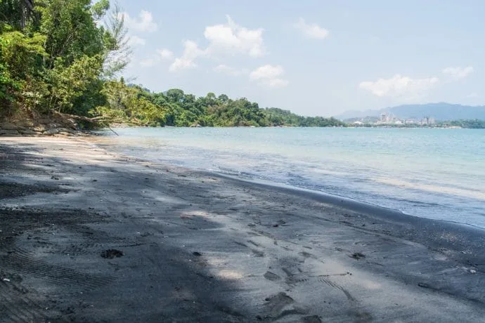
Black Sand Beach
Continuing my journey to the north of the island, I reached the “black sand beach”, literally, the black sand beach (Pantai Pasir Hitam in Malay).
Often this type of beach is the result of volcanic rock, which gives this particular shade to the sand. The point here is that it is not "black black" but a mix of blackened sand and normal colored sand. But there is no volcano nearby...

So why black sand?
The reason why the sand is black here is given on the information boards at the beach. There is a huge amount of minerals called "tourmaline" and "ilmenite" in the granites of Gunung Raya (the mountain that dominates the centre of the island). These minerals are brought by spring water flowing from the mountain further south and mix with the sand which turns black.
As I am curious, I wanted to know more about these minerals by writing this article. And a curious element comes out of it. Because this phenomenon of black tinting seems to be an exception in Langkawi. Usually, the minerals in question do not particularly modify the color by pulling towards black… It would even be the opposite given its usefulness!
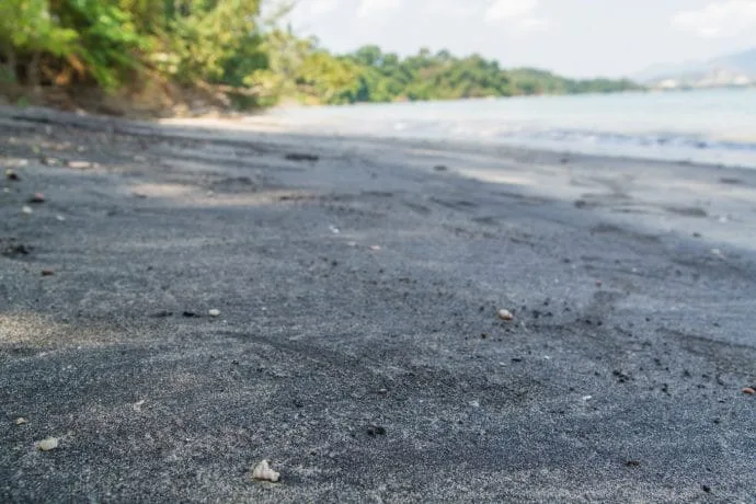
Ilmenite being a basic mineral used to produce titanium dioxide which when finely ground into a powder becomes a very white substance… It is used as a base in a number of products including paint and paper. So why does the sand turn black here and not white? There is no real answer…
Bonus info, did you know that ilmenite is found on the moon?
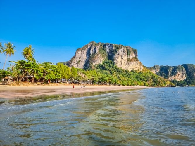
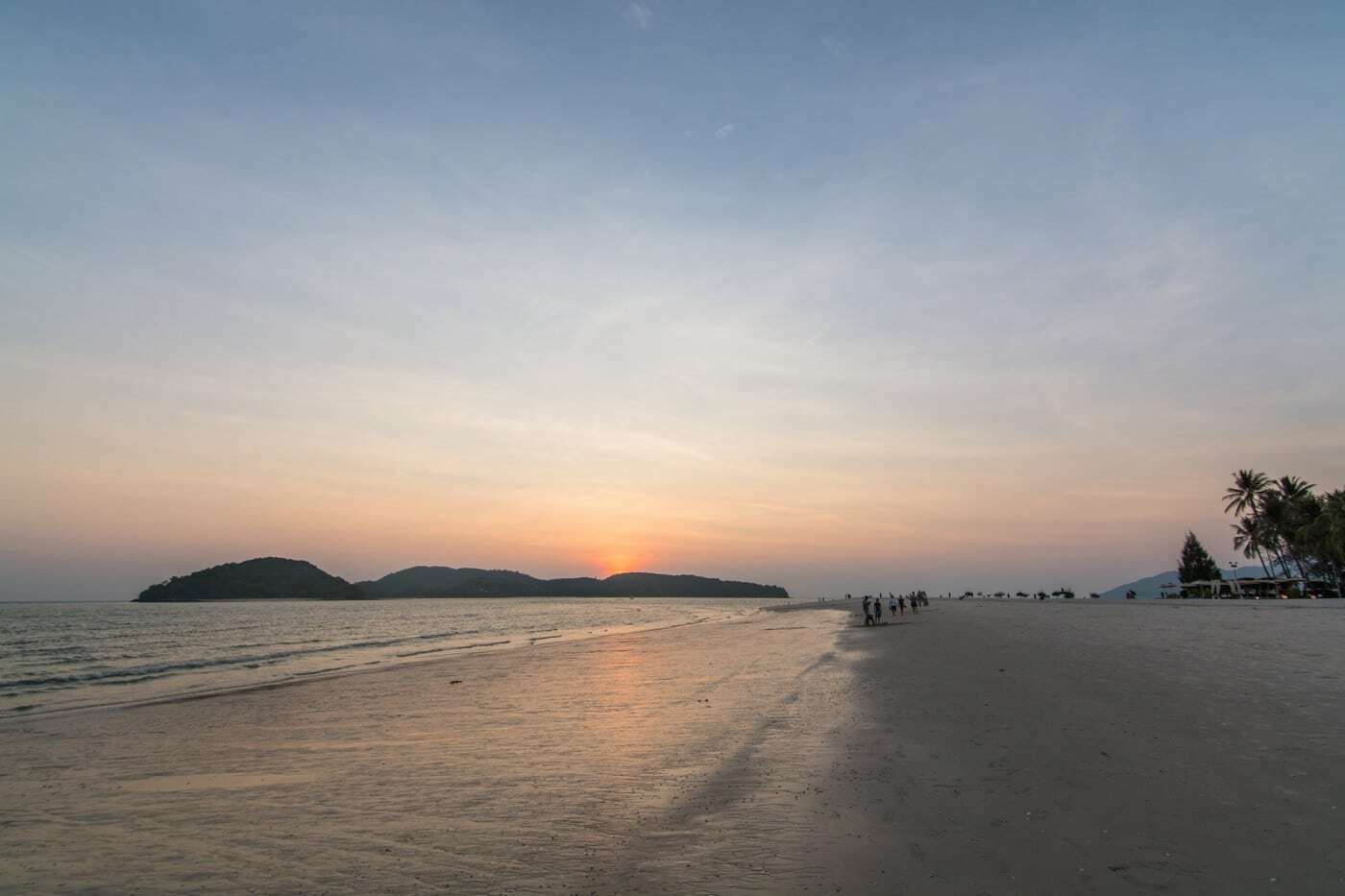
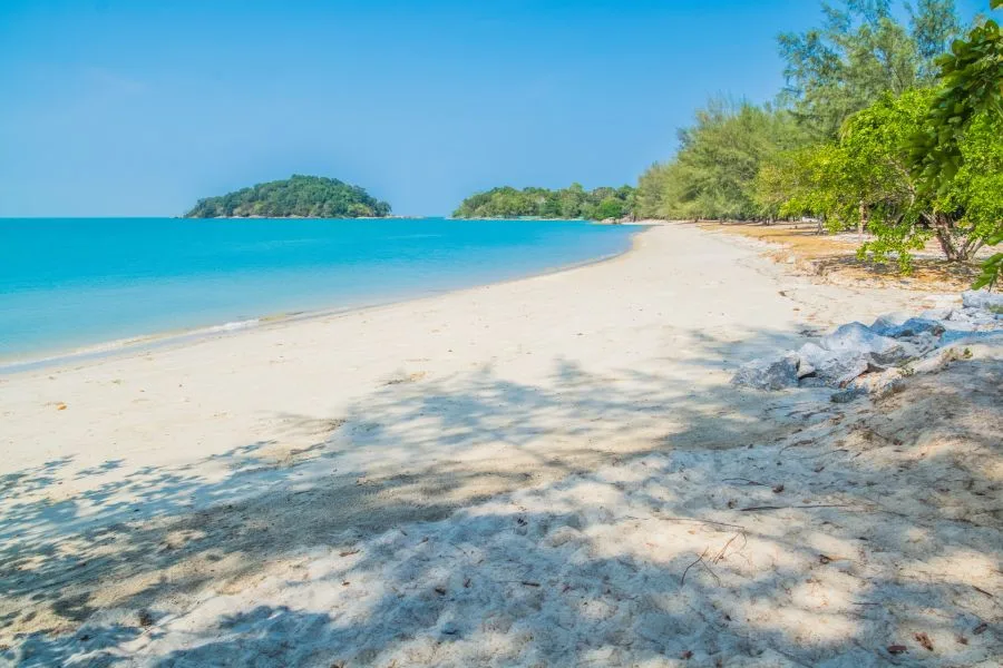
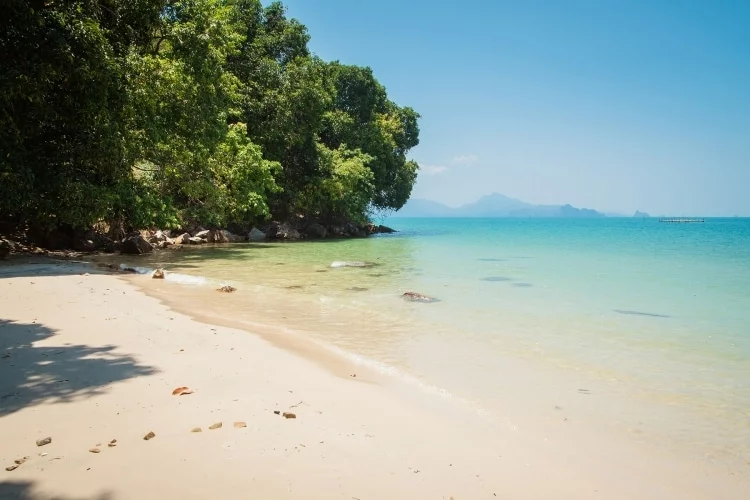
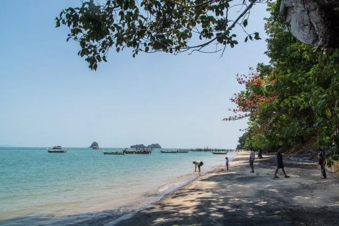
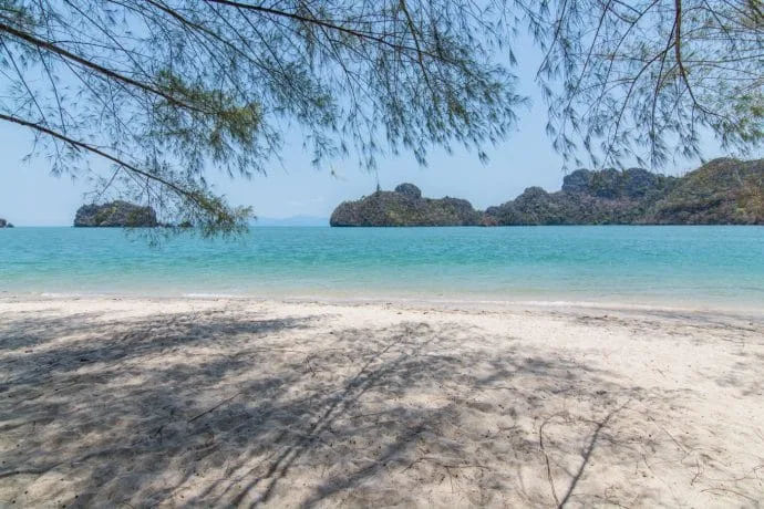
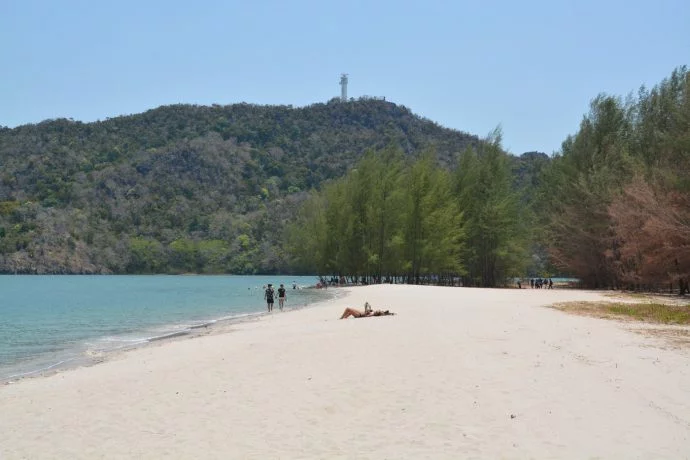
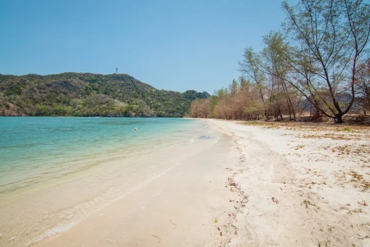
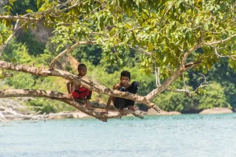
Pantai Tanjung Rhu
The next stop was what is considered to be the most beautiful beach in Langkawi, Tanjang Rhu. It must be said that it has a few arguments for it. Very white sand, the turquoise sea bordered by fir trees at the end, and a few rocky peaks emerging from the water to perfect this decor, which quickly makes one think of Krabi.

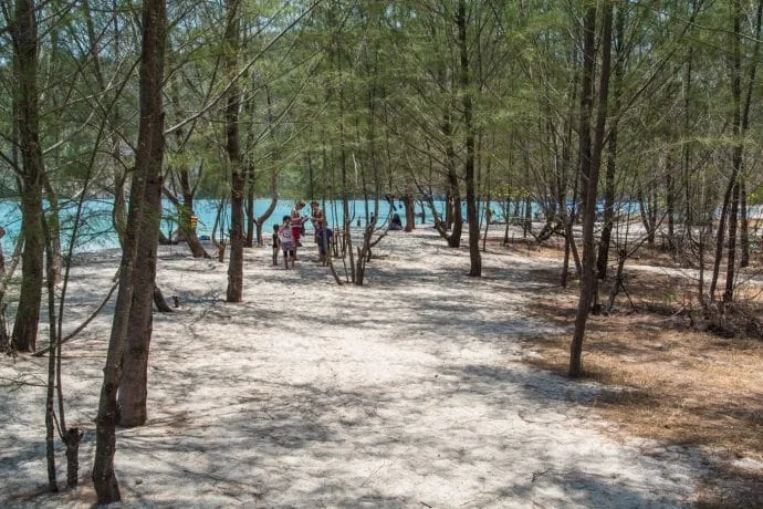
This is the beach on the very northern tip of the island, which is next to the departure dock to see the Geopark and the mangroves of northern Langakwi. When I was there, it was relatively deserted, which was very appreciable. The fault of the season, with a fairly high heat that day. At the end of the beach, there were a few fir trees, providing welcome shade, where most of the people present were sitting, and a few monkeys too…
Viewpoints on the island
Langkawi is a mountainous island, so there are at least two interesting viewpoints from which to overlook this popular Malaysian island.
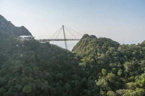
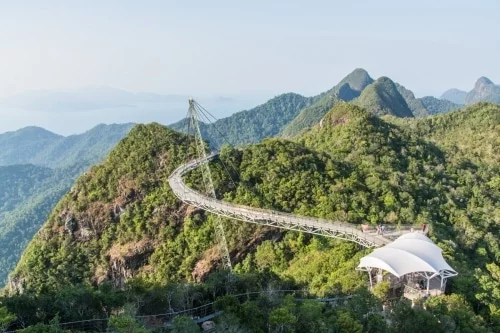
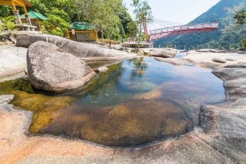
Langkawi Sky Bridge
You may have seen these pictures of a suspension bridge above the canopy, with the sea in the background? Well, it's in Langkawi, and it's probably one of the places that made me want to visit this island.
It can't be called a cheap activity, but I didn't find the price abusive either, knowing that it includes two other attractions in addition to the cable car access. And it must be said that the Sky Bridge offers an incredible view of a good part of the island. The Sky Bridge is, as its name suggests, the aerial bridge, built on top of Cincang Mountain, which covers the entire northwestern part of Langkawi.

The cable-stayed footbridge has been open to the public since 2005. Curved and with a total length of 125 m, it dominates the mountain and provides this superb view from more than 700 m above sea level.
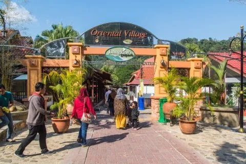
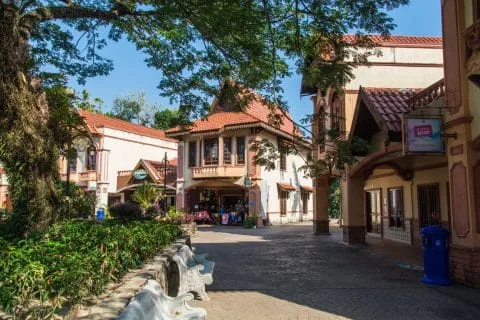
It is accessed from the “Oriental Village”, a sort of mini amusement park with souvenir shops, a few water games and image-based attractions (it’s a long way from Futuroscope, let’s be clear).
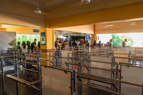
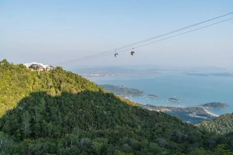
I was taking a basic ticket for SkyCab (the cable car), which cost me 45 MYR. Unfortunately the price has since gone up considerably (see on their official website to see all their offers and updated prices).
Fortunately, there was not much of a queue. Basically, the departure time is indicated on the ticket, there are some every 15 minutes from what I remember. After a visit to the SkyDome, which is more used to delay the queue for the cable car than to provide a memorable experience, I got into a "normal" cabin that accommodates up to 6 passengers (knowing that there are other types of cabins, such as the one with a transparent glass floor, the VIP one for 3, etc.).
The journey takes about ten minutes. This leaves time to observe the mountain, from where I can clearly see the "seven wells" waterfall below. You are then taken down to the intermediate station, which is already at an altitude of 650 meters. A platform already allows you to take lots of photos and selfies.


Arriving at the station at the top, the bad surprise, I who naively thought that the ticket also included the bridge and well no! I had to pay on the spot another ticket of 5 MYR just to access the bridge! And once you are there, it is hard to say no… Well with the readjustment of the price that has since taken place, it is included in your SkyCab ticket normally.
If you are not daring enough to cross the bridge, you can always enjoy the view from the café terraces, accessible by the stairs on the left directly after exiting the cabin. Otherwise, you have two options to reach the bridge from the cable car station. Either take a path cutting through the woods, which is a bit chaotic (but being redeveloped at the time of my visit), or pay again and take a kind of elevator on rails called SkyGlide (10 MYR extra). You can guess my choice…


The short walk through the woods lasts just 10 minutes and I finally arrived at the bridge. I have to admit that the panoramic view is just fantastic. Over 360 degrees, you will be surrounded by the mountain, all covered in dense tropical forest, with the sea in the distance and small islands visible to the south of Langkawi.
Crossing the bridge gives a strange feeling. Its curved configuration and its very high suspension give an impression of floating. This impression of being in the void is all the more accentuated by the fact that they have put windows at regular intervals at ground level! It is better not to be too sensitive to vertigo!
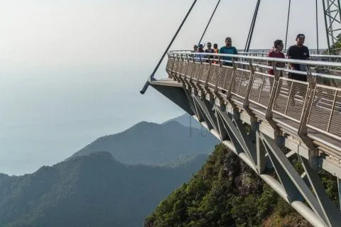
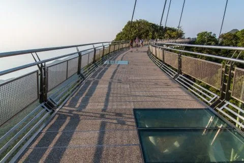
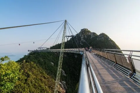
The bridge crosses a hollow in the mountain, as if you were floating above it, and the fact that this technical feat is ultimately held together by a single support pole is not reassuring. I could see that some people were having a much harder time moving across the bridge than I was.
I still took a minimum of time to appreciate the views offered, knowing that by looking at the horizon in the distance, one has less of the feeling of vertigo (obviously). Without realizing it, time passes quickly, because if I went up around 16 p.m., I only came down at 18 p.m., taking advantage of the setting sun to take a few more photos.

Back down, I didn't have time to see the little attraction included with my ticket, the SkyRex (a sort of TRex attack simulation), as it was already closed, too bad, 10 minutes later, it was good...
The evening of my visit, I didn't have far to go back to "my" beach (for your information, the Cottage Langkawi, my guesthouse during this stay, is close to Cenang beach). After the sunset, I sat on the terrace of the Red Tomato Restaurant & Lounge, which has a rather chill atmosphere and a menu that suited me (more international than Asian on the other hand).

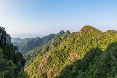
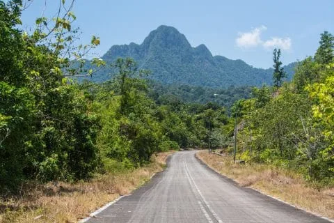
Gunung Raya
Another interesting walk to gain height, and in this case towards the highest point of Langkawi, the mountain (Gunung) Raya, which peaks at 881 m and offers a 360 degree view of the entire island.
Although I found the view less impressive than from the mountains surrounding the Sky Bridge (which peaks at 660 m), Gunung Raya remains a good alternative to enjoy a good view of the island. It is also a much more economical version of accessing the Mount observation tower, essential to really see something from the summit, costs only 10 RM, tea offered.
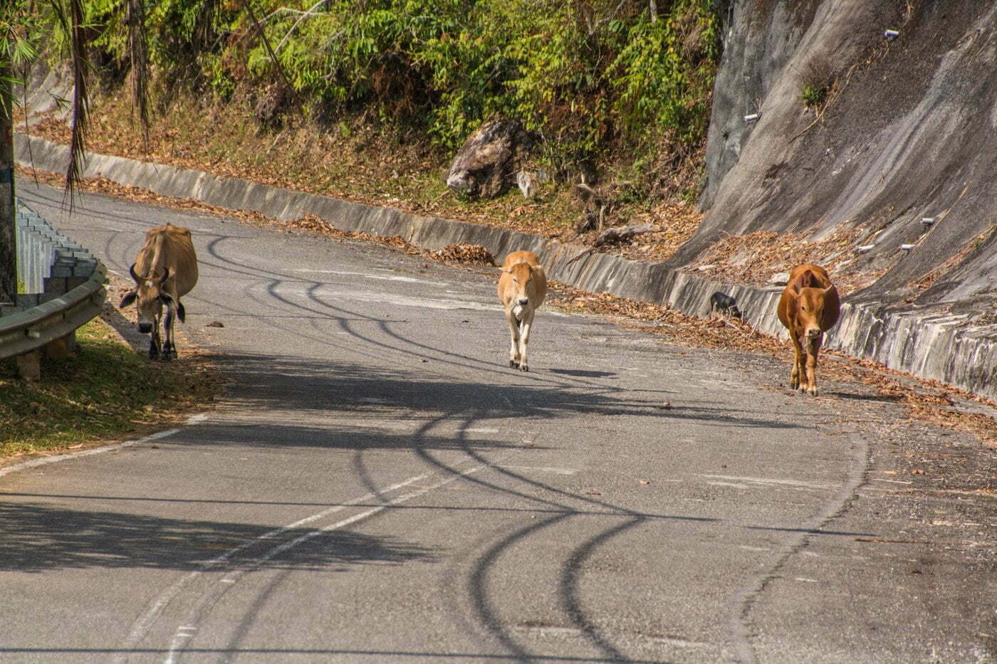
Even taking my time, it didn't take more than an hour to climb up to the station that sits above my beach. On the road, I didn't come across many people except for a few cows hanging around on the side of the road or even walking in the middle of the road (and I really wondered what the hell they were doing there...)


The view is a little hazy from the heat that day. I stopped at a parking lot along the way, and I was lucky enough to be able to observe (and hear) toucans perched on their tree.
From this spot, a staircase goes down, yes, yes! For the most motivated, it is possible to do this climb, on foot! If you embark on this madness adventure, it's no less than 4 steps to climb! The start is at 287m above sea level, and this arrival point, which is not yet at the summit, is at 55 m altitude. This difference in altitude of 788 m is done via a route representing “only” 733 km, the estimated time to do it, 3h2. Volunteers?


I hadn't originally planned on paying anything when I got up here, but since I was there and didn't have much else planned that day, I dropped my tickets and took the elevator up to the top of the tower. We were now at an altitude of 900 m.
A few people were there, sipping their tea, not being a fan, I tasted it on principle, but I didn't linger either.

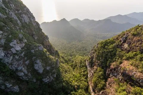
Waterfalls and nature spots in Langkawi
As the island is mountainous, it has its share of waterfalls and a few parks allowing you to immerse yourself in this generous nature, a quick overview.
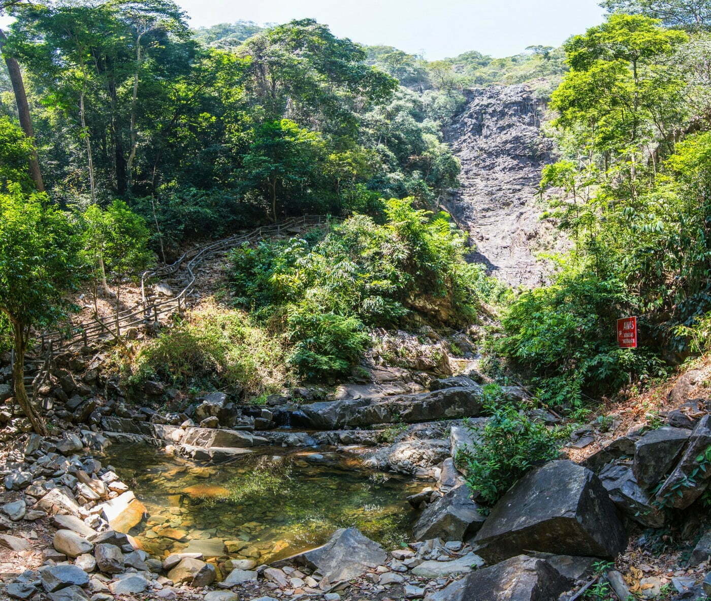
Air Terjun Temurun Waterfall
This is the first waterfall on the island that I visited, while I was traveling in the northwest area of the island, on my way to Datai Bay. Located at the foot of the Mat Cincang mountain (also spelled Chinchang), the whole place is part of a natural park, the Mat Cincang Nature Park. The Temurun waterfall falls on 3 floors for a total drop of 200 meters.
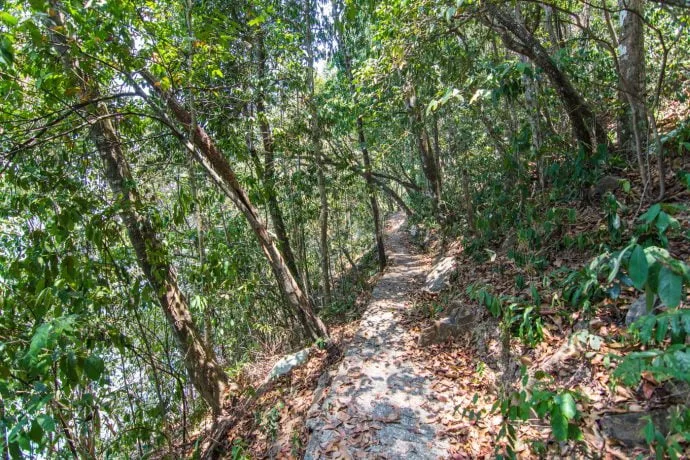
The least we can say is that it seems impressive, if there was water… Because here is a disadvantage to seeing waterfalls during the dry season, there was no water apart from the natural pool at the foot of it. The walk is nonetheless devoid of charm. Access is via a paved path through the tropical forest, just 5 minutes from the parking lot.

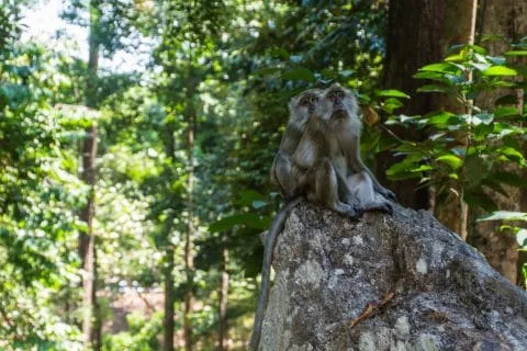
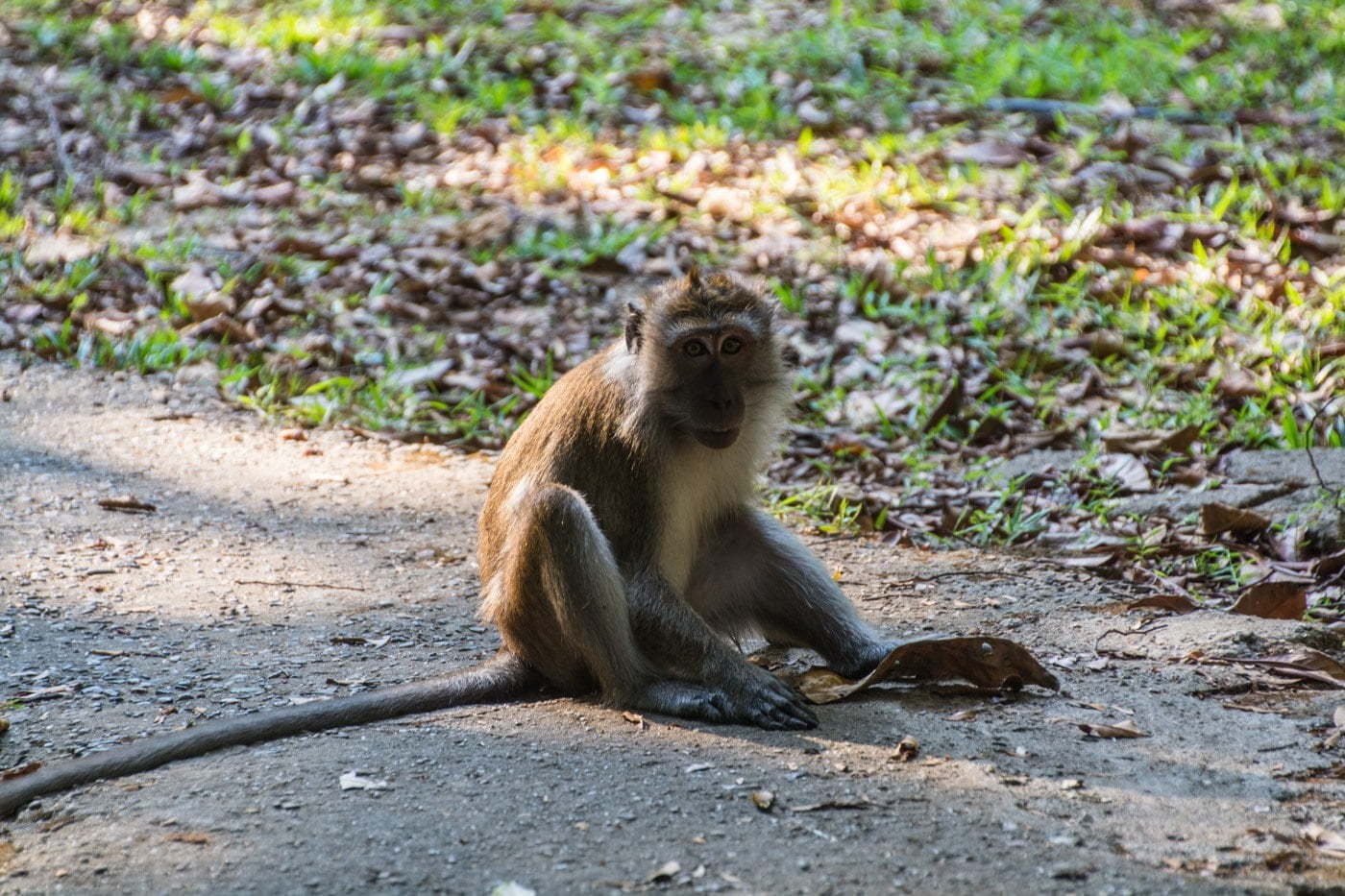
In addition to the appreciable shade of the large trees, you can come across many monkeys, not really frightened by human presence. As I was all alone at the time of my visit, I had the impression of playing the explorer, with the primates to accompany me. Although I was not entirely reassured, the latter being easily susceptible…
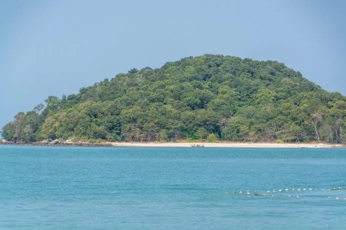
Back at the car park, on the other side of the road, there is a small beach below. Well, it is a pebble beach and apart from an old rotten hammock, there was nothing to get excited about… But the attraction here is this view of Tarutao Island, which we can see very well, while the latter is on the Thailand side! Tarutao is the main island of the archipelago of the same name, which mainly includes Ko Lipe Island, better known.

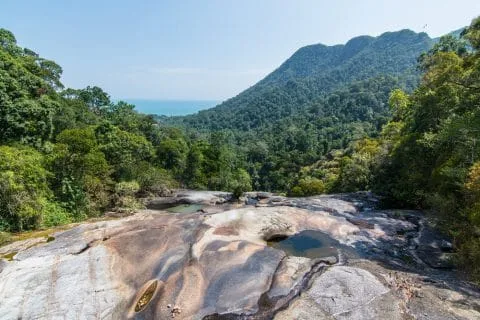
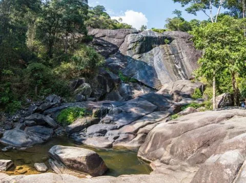
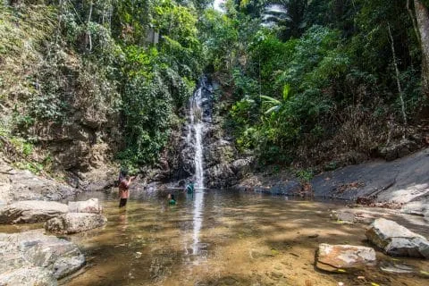
Telaga Tujuh waterfalls
Telega Tujuh means in English, “seven wells”, which could be translated as “7 wells”, in the sense that it is a waterfall on 7 drops with a natural pool formed there at each one.
From the main car park, it is possible to eat, which is what I did in order to gain some strength (well, and especially because I was hungry). After a good fifteen-minute climb, I arrived at the main spot.
I climbed the footbridge that overlooks the waterfall and gives a view down to the sea below. You can also see the cable car that goes up to the Sky Bridge.


He's possible to do a trek in the forest to observe the local flora and fauna. Allow at least 2-3 hours to complete.
For my part, I didn't really have time. After seeing the signs, it's better not to be too scared, because you're likely to come across scorpions and tarantulas there.
As for the waterfall itself, unfortunately the same story as the previous one. The site is almost dry except for the small pools filled with clear water. But the atmosphere is peaceful at least because there is almost no one.

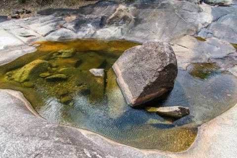
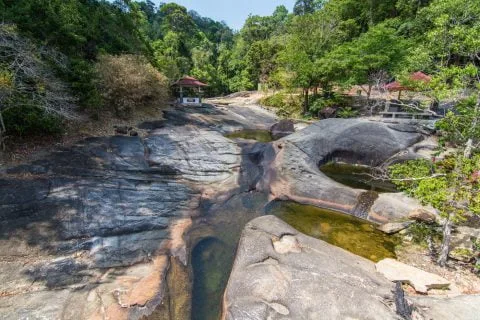
On the way back down, I stopped at the last level, which is again a wall, with a drop of 90 m, a wall whose surface has been polished over the years. There was just a trickle of water, but still no one except for a small group arriving when I was leaving.
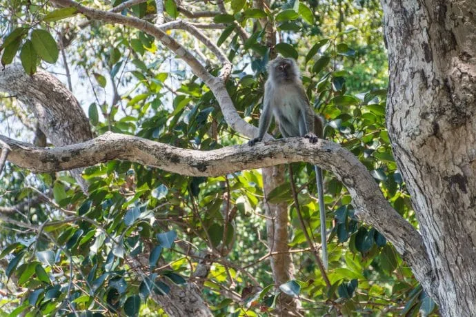
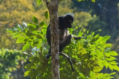
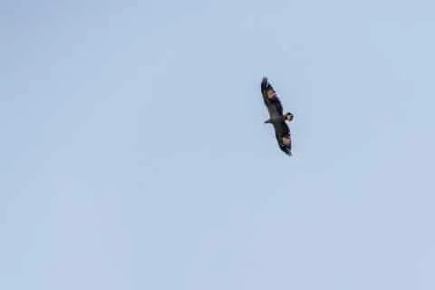
I had time to observe monkeys, much more shy than macaques, it was a Dusky Semnopithecus, not a simple name… but a rare observation, because this species is threatened. Double luck by the way, because in the process, I was able to observe an Asian fish eagle or White-bellied eagle, flying in the sky. One of the species of eagle that can be found on the island.
And that's a good thing, since the name of the island, Langkawi, means "brown eagle" in Malay, hence the symbol of this animal which sits proudly not far from the ferry arrival quay and illustrates this article.

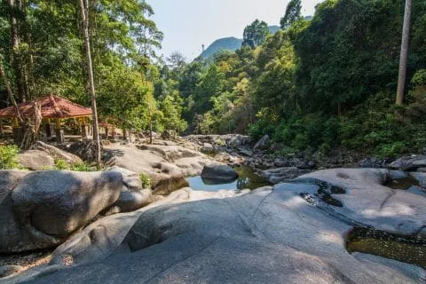
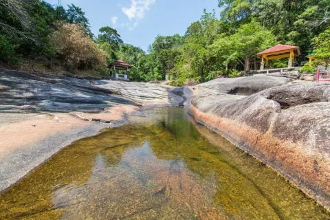
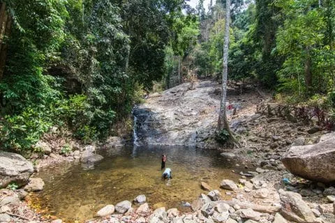
Durian Perangin Waterfall
Passing by this waterfall, I thought it would be stupid not to go. I had time anyway (it was not the same day as the waterfall above). Hurtling down the slope of Mount Raya, this waterfall is divided into no less than 14 floors.
A marked path with a railing makes it easy to reach the main drop-off point. If this time it wasn't dry, it wasn't crazy in terms of water flow either.
The forest surrounding the waterfall and the few people present meant that I didn't really regret this little walk on this hot day. A little freshness wouldn't hurt and a few Malaysians present here had understood this well. Finally, and it's important to note, this waterfall still had water flowing, and that still makes a difference.
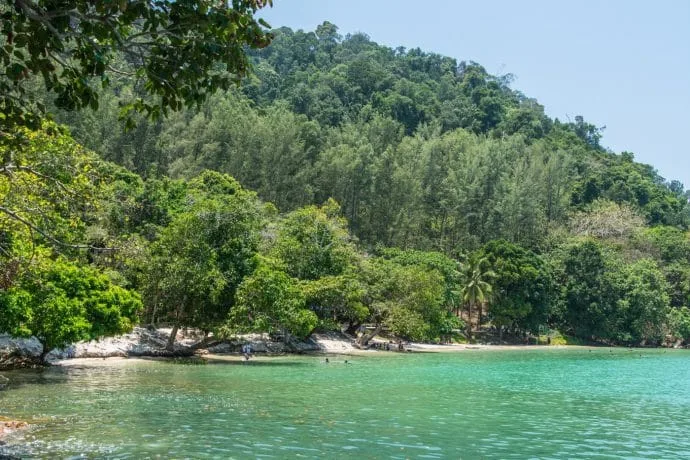
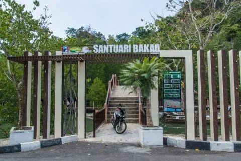
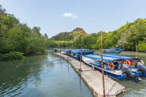
Kilim Geoforest Park
This is one of Langkawi's top attractions. The park covers a large part of the north and east of the island and includes a mangrove, karst rock cliffs several million years old where some caves filled with bats are nestled. The area being preserved, it is home to a large fauna of monkeys, eagles, and even dolphins to name a few.
There are actually two access points to enjoy the nature of the park, by boat, traveling in the natural canals and at sea.
The first access is next to Tanjung Rhu beach. This is also where I had planned to visit, which includes among other things the mangrove and at least one cave. But when I inquired about the price, I quickly became disillusioned… The cheapest being around 120 RM but the fact is that this is a price per boat, so if you are with family or a group of friends, it is clearly worth it.
As I was alone, I had to decline the offer and continue on my way because it was out of my budget. Afterwards I admit, it only came to €25, but at the time, maybe I had made a mistake in the conversion, it seemed expensive to me, knowing that it represented more than double the budget used for the Sky Bridge, which already seemed a lot to me…

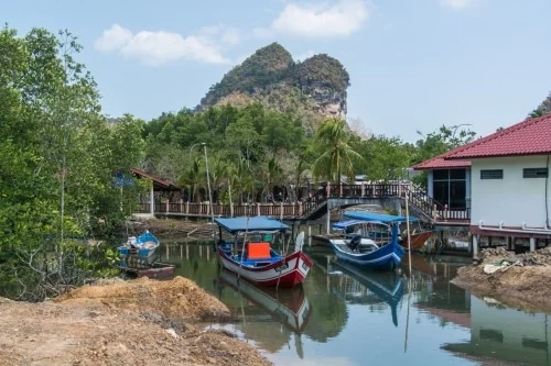
We come to the second access point. Just to be sure about the prices, and to see what it looks like, I went to the other starting point, Tanjung Rhu being a beach rather oriented “luxury”, given the hotels in the area, I hoped to find more reasonable prices at the main quay for the “mangrove tour”.
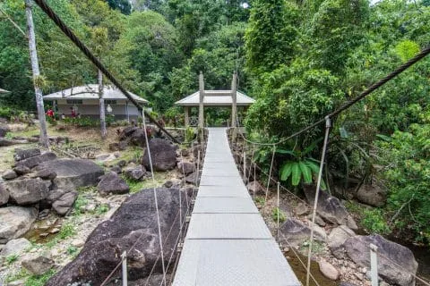
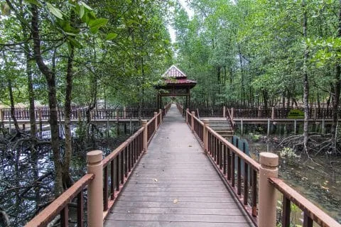
If the basic rate was confirmed to me (count between 200 and 500 RM for longer trips, up to 4 hours), and I therefore dropped the boat tour, I did not leave without visiting the part of the mangrove accessible on foot, via footbridges built in the forest. Here again, monkeys were going about their business (like, lazing around) and apart from me, not a single human in sight...
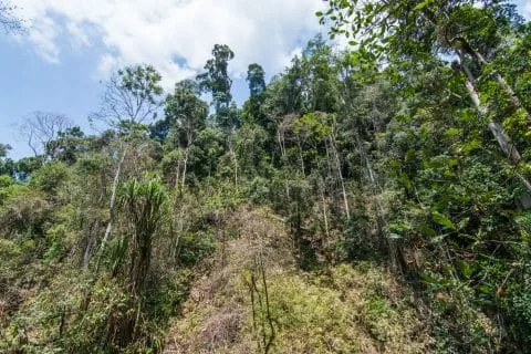
Tangga Helang Series of Figures
Another park with a somewhat convoluted name, this one is located at the foot of Mount Raya, which I had just visited. It wasn't particularly on my itinerary, but passing nearby, I decided to take a look. Here again, it was exceptionally quiet. I hardly saw anyone there, apart from two guys lounging in the water, and some more monkeys going about their business.
Water which was also particularly lacking, the river usually flowing through here looking more like a field of stones. For the record, the crazy stairs I mentioned above, leading to Gunung Raya? It turns out that this is the starting point!


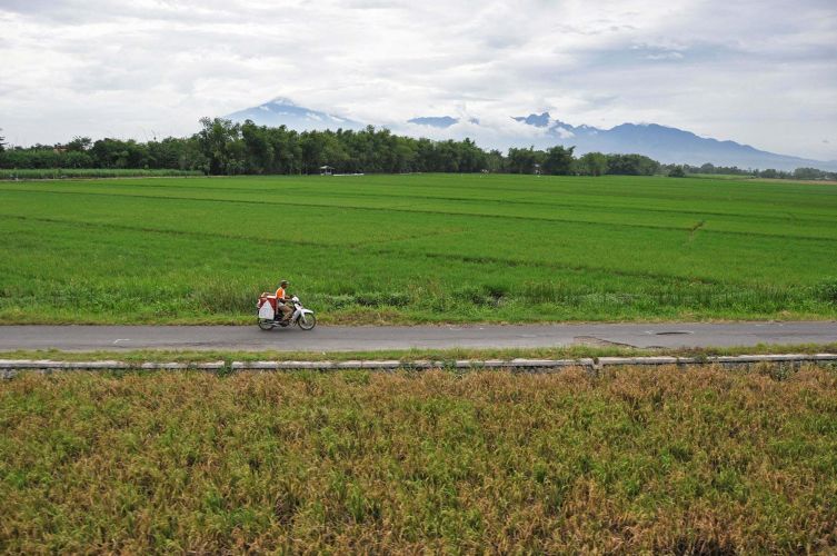
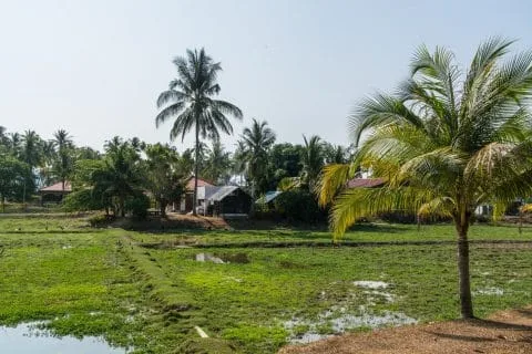
Langawi Rice Fields and Countryside
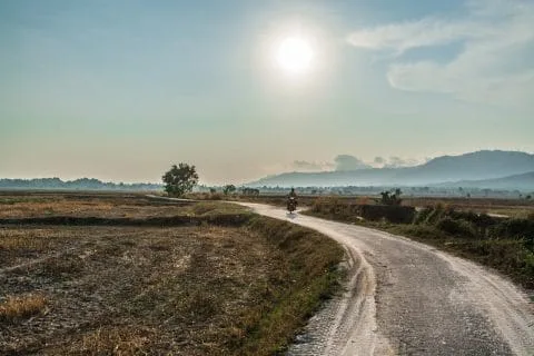
After this previous visit, I had nothing special planned, except that I still had to return to the beach of my guesthouse. But looking at the map, I decided, so to speak, to cut across the fields, rather than returning directly by road.
Taking advantage of being on a scooter, I could afford a bit of easy off-roading. I found myself walking through the rice fields, empty at this time of year (too bad), but with a beautiful late afternoon light, a nice walk and a good decision.
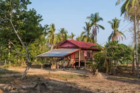
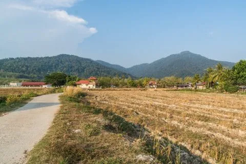
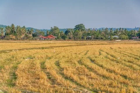
With the mountain in the background, a heat haze in the distance and cows in front of me adding to this idyllic scene, it gives an image of Langkawi that I would not have particularly suspected, the rural, country side.
A few locals passing by usually look at me with a smile, as if to say to themselves what the hell is he doing here. Luckily, I have a good sense of direction, and the setting sun gave me a good indication of direction.
But I still had my map (with GPS positioning…) which was very useful for finding an exit from this maze of paths and joining the main road further south.

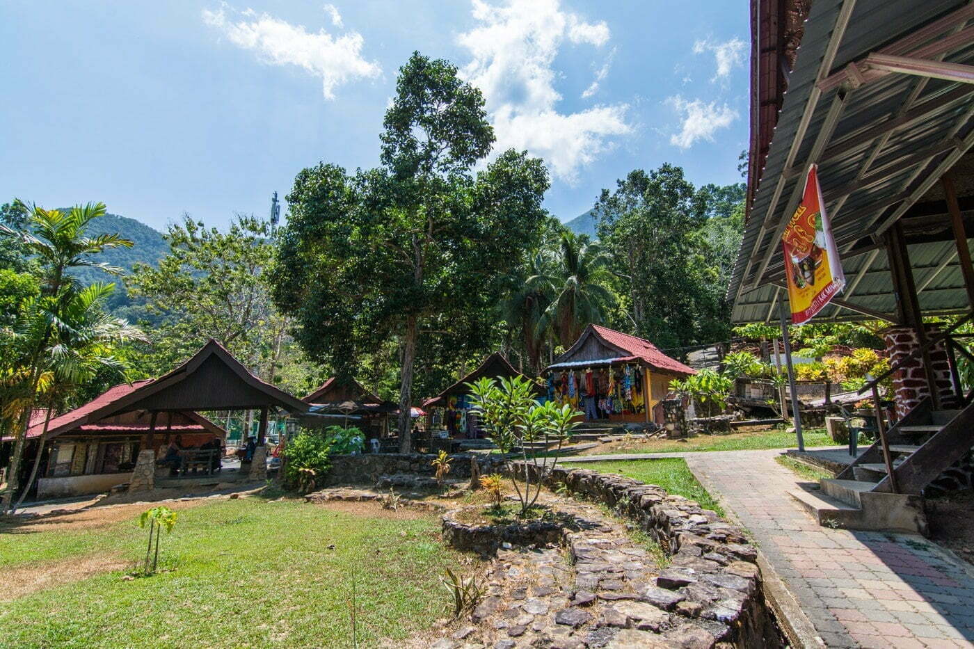
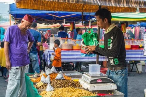
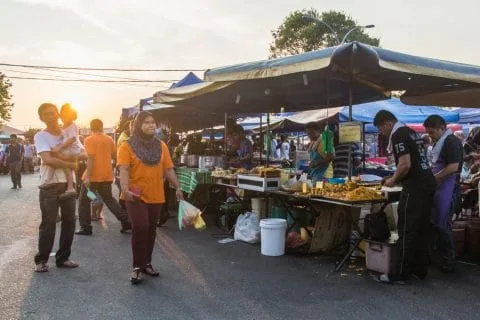
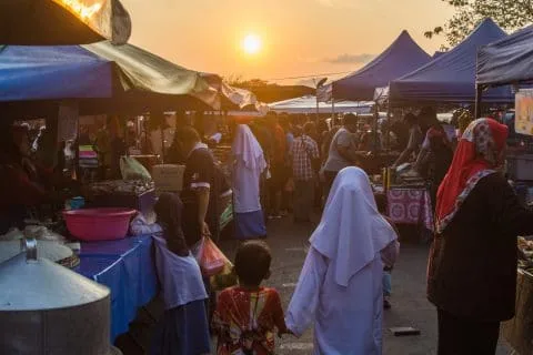
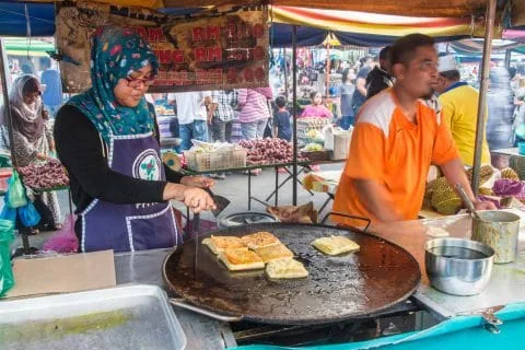
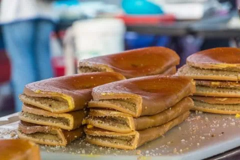
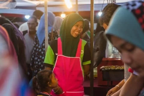
A market in Langkawi
And as luck would have it, as I was leaving these little country roads, I came across an open-air market, shortly before Mr. Sun's bow. It's apparently a night market that only takes place on Sundays, so I was lucky, since that was the day of the week we were there.
I had my last dinner on the island there, grabbing a few snacks here and there. Ideal to end a day and a stay on this island which definitely brought me some nice surprises and a good general impression.


Langkawi seduced me!
If I have to summarize my impressions of Langkawi, it is very positive and a beautiful discovery. It contains preserved fauna and flora, coupled with an island atmosphere that is not too touristy, beautiful arguments to choose Langkawi as a rest spot in Malaysia.
The fauna and the flora
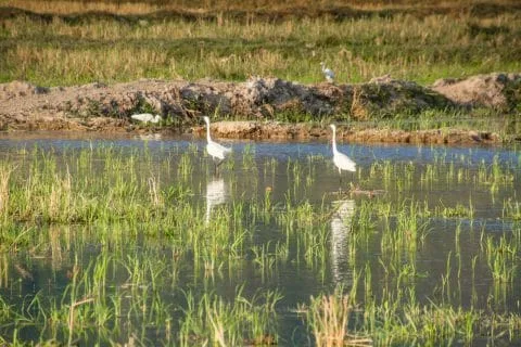
It is a mixture of mountains with karst rocks, mangroves, many animals that can be encountered in the wild, monkeys, of different species, but also many birds, including toucans and eagles. A good part of the island is still well covered by its tropical forest, there are several waterfalls (it was dry at the time of my visit), but given the size of the "walls" that faced me, I have no doubt about their beauty at the end of the wet season.
Almost at every waterfall, it is also possible to swim there since there are good natural pools at the foot of them. And finally, of course, let's not forget its beaches, some of which have an undeniable charm.
A multicultural island
A bit like Penang, Langkawi is a multi-ethnic island, and I'm not talking about tourists obviously, but you come across a lot of Chinese, Thais, since it's nearby, but also Malays, Indians. A good melting pot which therefore offers a wide variety of restaurants.
Afterwards, it is a Muslim island above all, Malaysia obliges. I felt the welcome was generally warm and not at all commercial as one can sometimes feel on certain islands in Thailand.
If I have to define at least one flaw to the island, it is the cost on site, especially for activities. Whether it is visits like the one to the mangrove at Kilim Geoforest Park, massages which are really expensive compared to its Thai neighbor or even motorbike rental (which was still reasonable since I paid 330 baht per day).
On the other hand, a small peculiarity of the island, it is in a duty free zone! As a result, many Chinese (among others) come to do their shopping in one of the stores offering various souvenirs (especially the classics, food, perfumes).
How to get to Langkawi
There are quite a few options for getting to Lankgawi Island, which is fairly well served, including from Thailand.
Getting to Langkawi by plane
The easiest way is to fly, since Langkawi has its own airport. You will have the following airlines to choose from:
- Tigerair, SilkAir from Singapore
- Air Asia from Singapore, Penang or Kuala Lumpur
- Malaysia Airlines
- Malindo Airlines from Kuala Lumpur (whose logo matches that of Lion Air, that's normal, it's the parent company)
- Firefly from Penang (and KL secondary airport)
To my knowledge, there is no direct flight between Thailand and Langkawi. However, it is still easy to get there from Thailand by stopping over in one of the nearby cities. There are at least 2 drop-off points to do so, Hat Yai and Trang, which can be reached by plane from Bangkok via Nok Air or Air Asia in particular.

Getting to Langkawi by ferry
In my case, I first took a flight from Bangkok to Hat Yai, which was cheaper than Trang and with more choice of schedules (larger airport). Originally, my goal was to then reach the port of Kuala Perlis, on the Malaysian side to take the ferry.
The goal was then to take a bus to the Padang Besar border (note that it is also possible to go there by train), the other possibility being the Sadao-Dannok border but as it serves as the main border, it is generally longer to cross.
Arriving at Hat Yai airport, I took a mini van to the bus station via the official counter (not knowing that there are actually several in Hat Yai, I was taken to the default one where most also went).
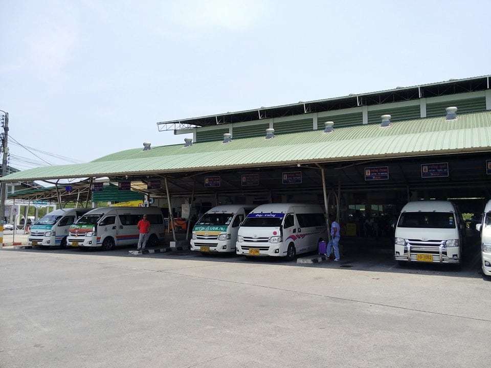
So I arrived at a bus station, but they were only minibuses. Not a problem in itself, except that once I had gone through the possible destinations, I didn't see Padang Besar...
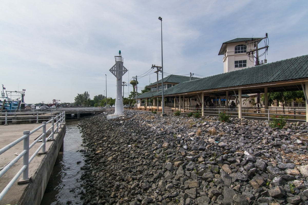
No problem, so I moved on to plan B and decided to head towards Satun, in order to reach the Tammalang quay. In the end, it turns out to be rather quick and effective and probably one of the least expensive and practical solutions!


Getting to Langkawi from Satun, Thailand
If I summarize the steps, and the different costs, here is how this trip was broken down from leaving Hat Yai airport:
- Hat Yai Airport to Bus Station (Mini Van) = 100 Baht
- Minibus Hat Yai to Satun = 80 Baht (96 km for approximately 1h30)
- Satun Station to Tammalang Pier = 30 Baht (local pick-up = songthaew)
- Ferry to Langkawi from Tammalang = from 550 Baht

From Langkawi, it's also easy to get to or from Ko Lipe in Thailand, so if you're in the area and have a few days before continuing on to the rest of Malaysia, think about it, it's worth a look!
Getting around Langkawi
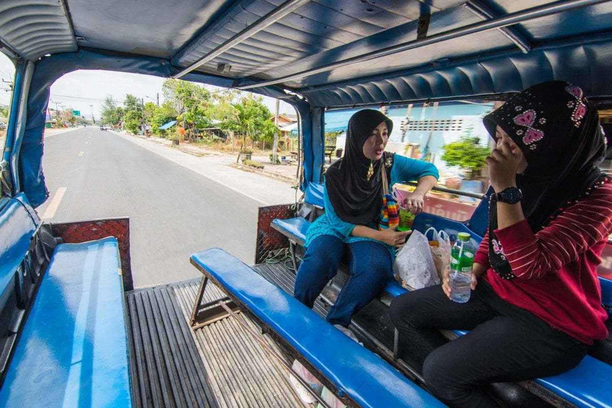
As for me, who says island, says scooter, my preferred means of transport, in order to maintain my freedom of movement, for a very reasonable budget. This was easy since I found a rental company on the main road not far from my guesthouse. The rate was slightly more expensive than what you can find in Thailand, as I had paid 114 RM for the 3 days of rental (plus 50 RM deposit), which made 38 RM per day.
At the time (2016), it was clearly at an unfavorable rate because it represented around 350 Baht. At the current rate, it represents less than 300 Baht per day, so more reasonable (even if I suspect that they have surely increased their rate since then).

The roads are generally in good condition and the directions are pretty well indicated so I don't see any particular difficulty. However, if you've never ridden a two-wheeler, I would never recommend taking this first trip in Asia... So there are taxis, for which I spotted a price list displayed on the main street.

Where to stay in Langkawi
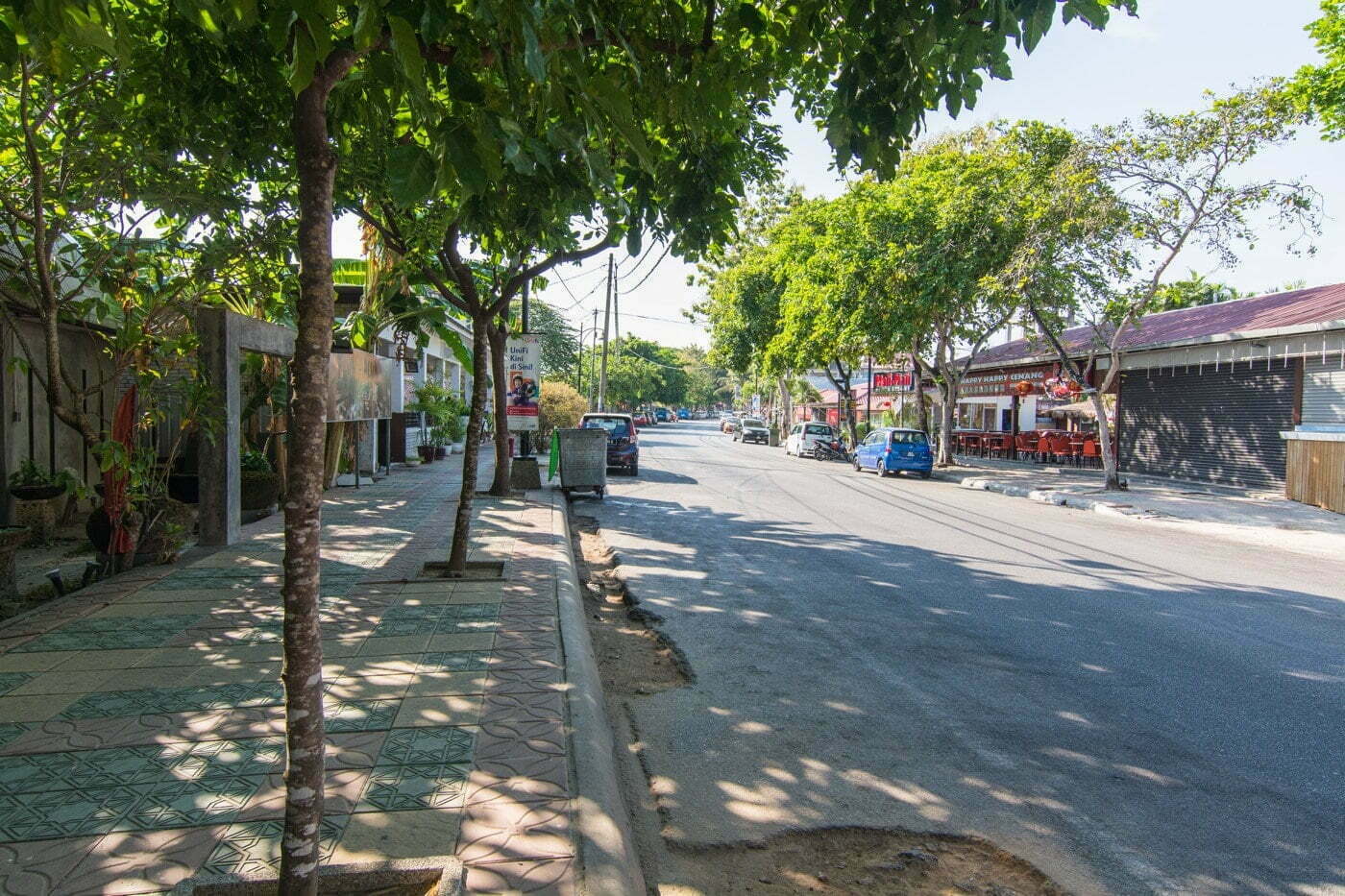
As for the location, I wasn't sure where to base myself. I initially thought I'd stay close to the port, where the main "town" of Langkawi is. But in the end I settled on a hotel on the Cenang beach, one of the main ones on the island. In addition to being a beautiful beach, it offers the widest variety of hotels in terms of style and budget. Not to mention the proximity to restaurants, massage parlors, scooter rentals, etc. it is clearly the best option for independent travelers.

So I stayed at The Cottage Langkawi, a small guesthouse located slightly back from the beach, in the northwest area of the beach.
The Cottage Langkawi
Note: 7,8 / 10
Budget: from €11
This is a small, modest guesthouse, run by a group of friends from what I understand. The reviews are decent and it was one of the cheapest I could find. The air conditioning didn't work too well in my room but at least it was clean and pretty quiet.
Did you like the article? share on Pinterest!