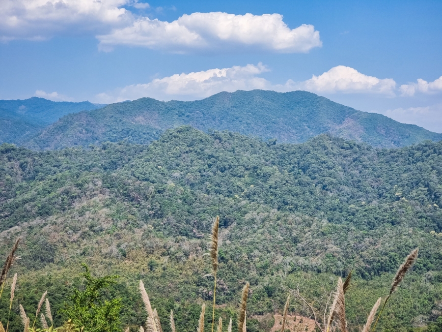
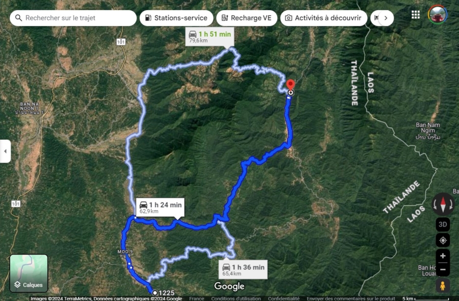
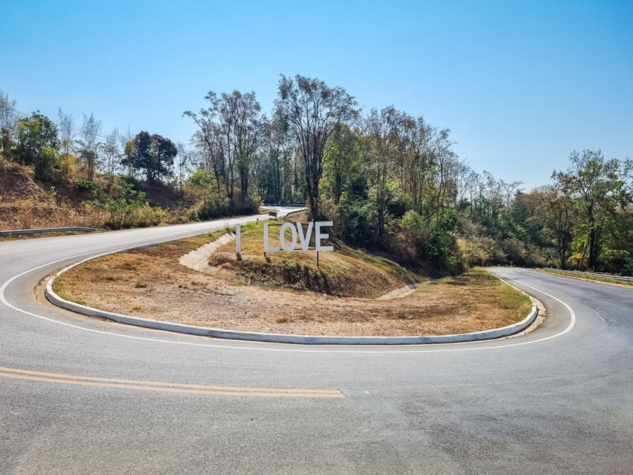
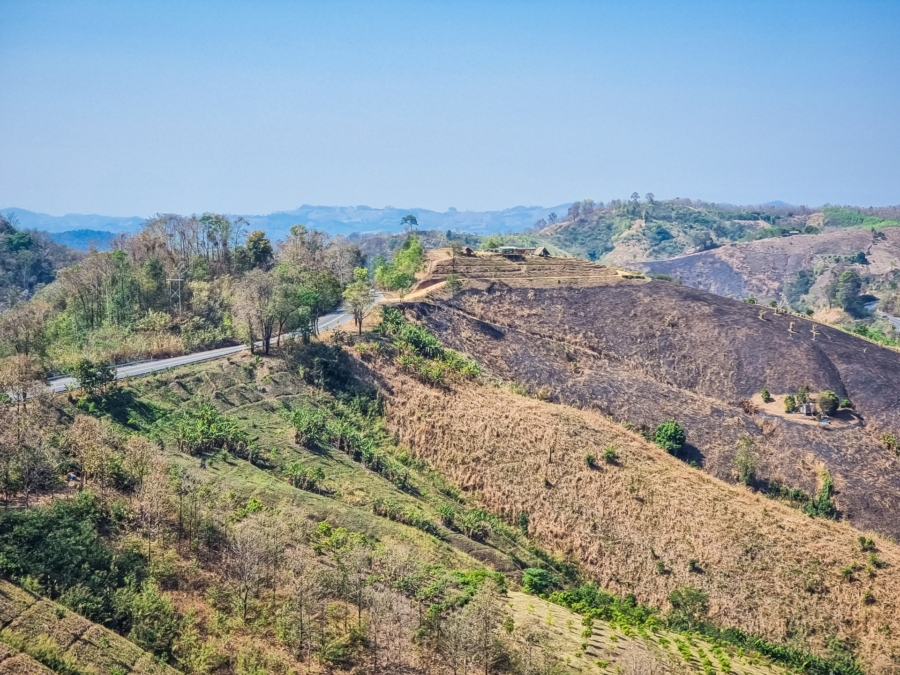
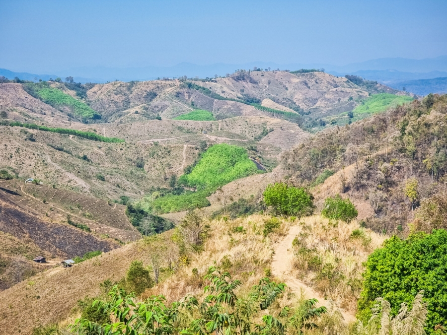
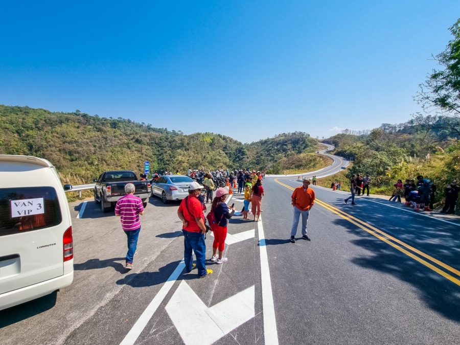
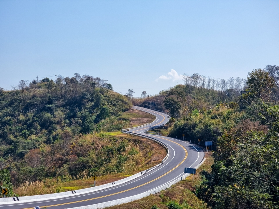
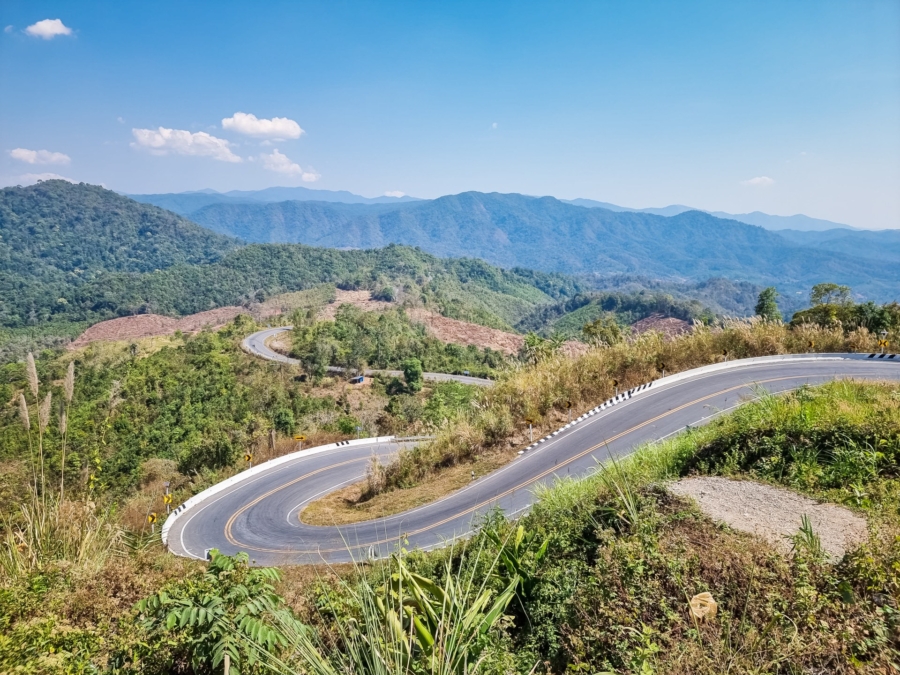
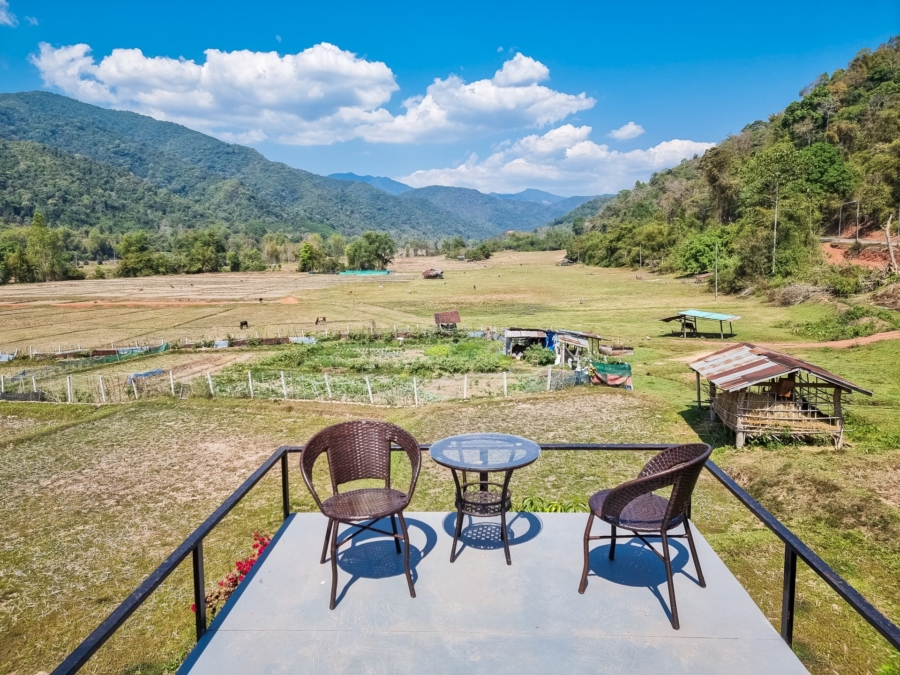
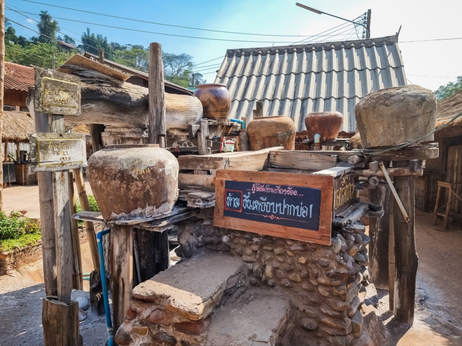
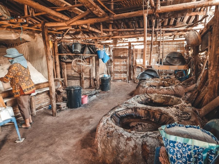
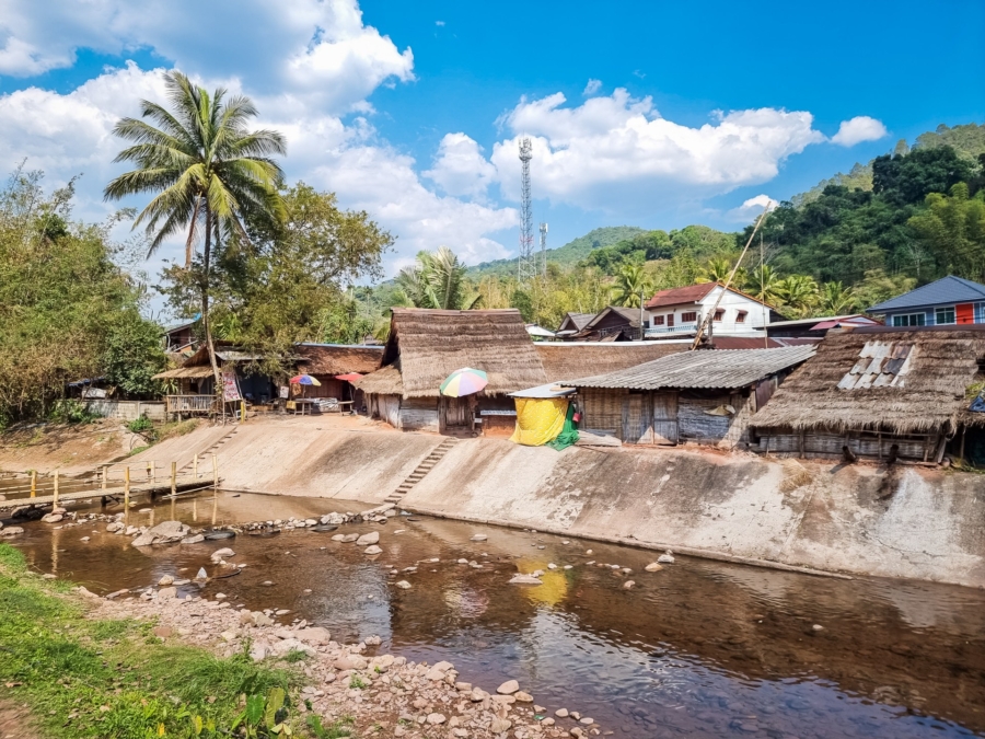
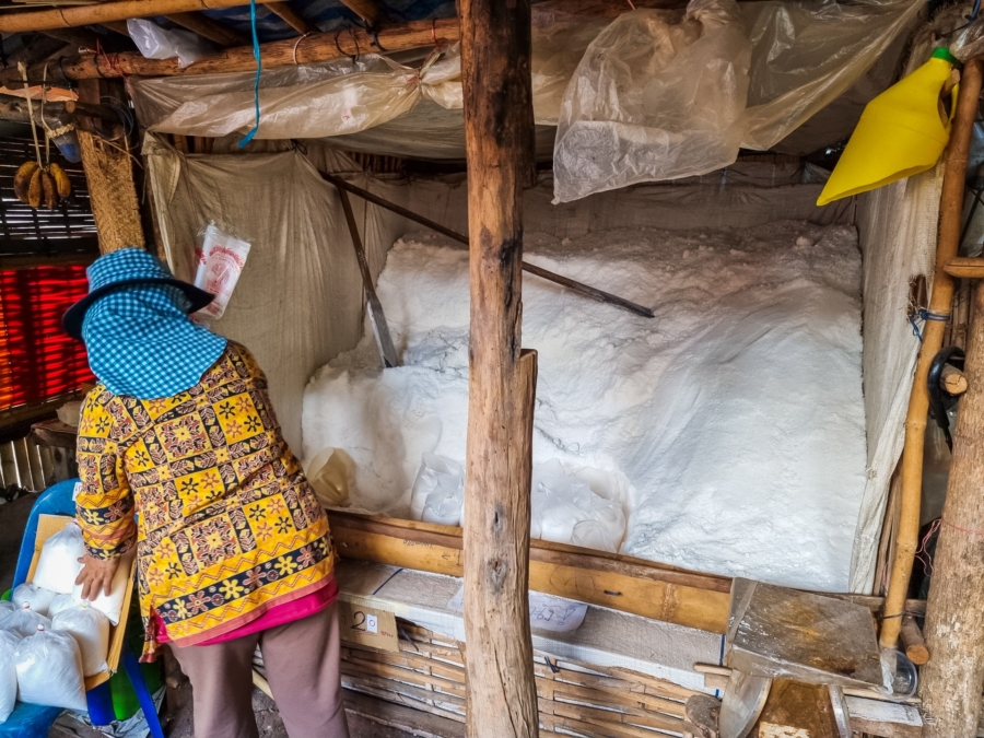
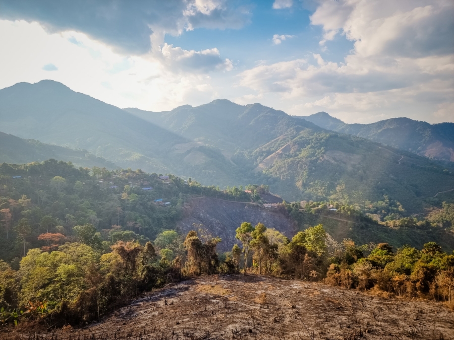
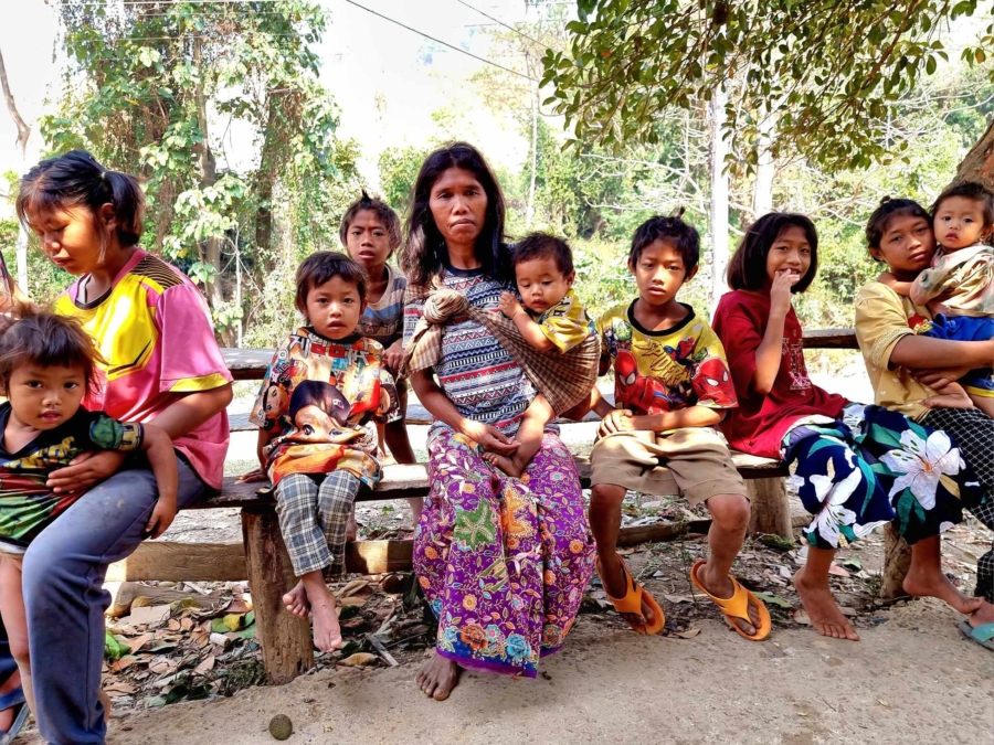
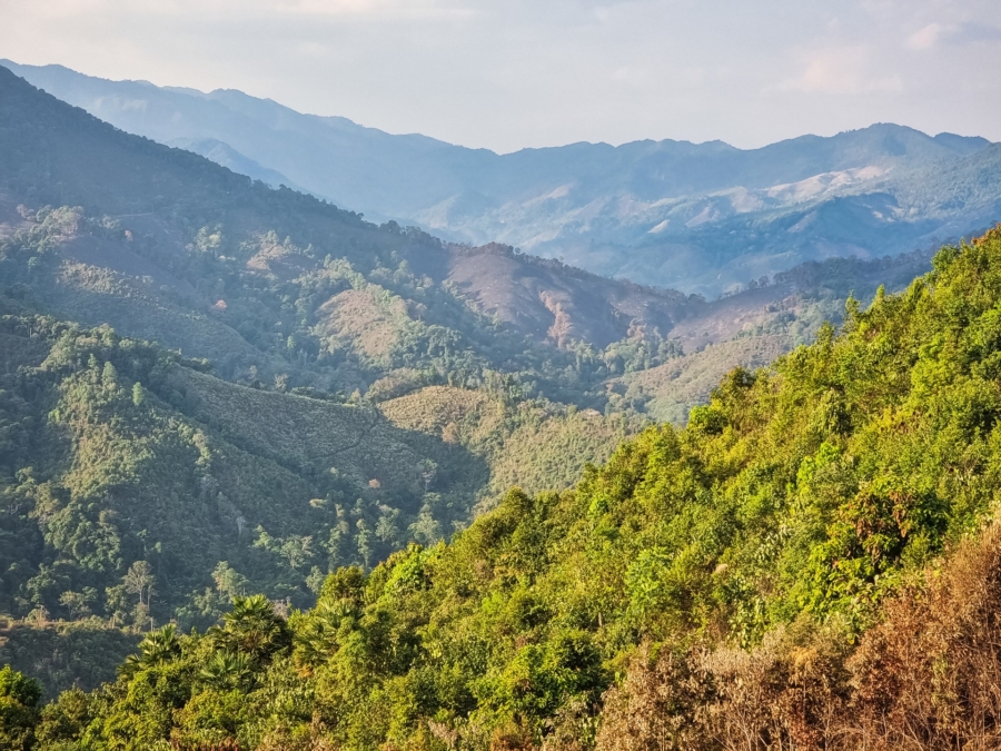
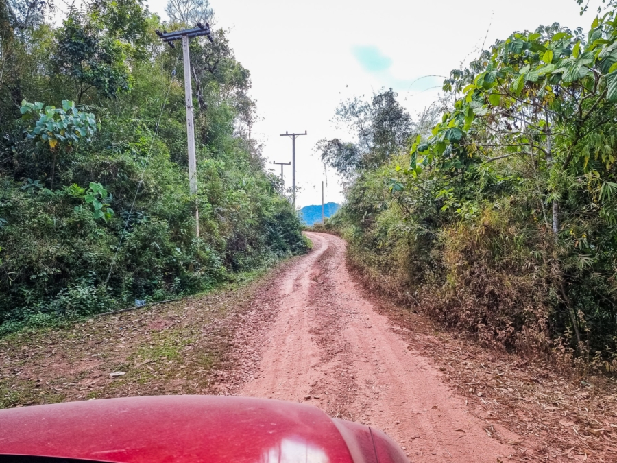
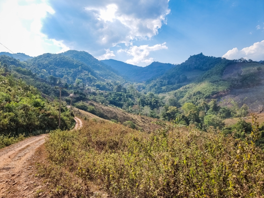
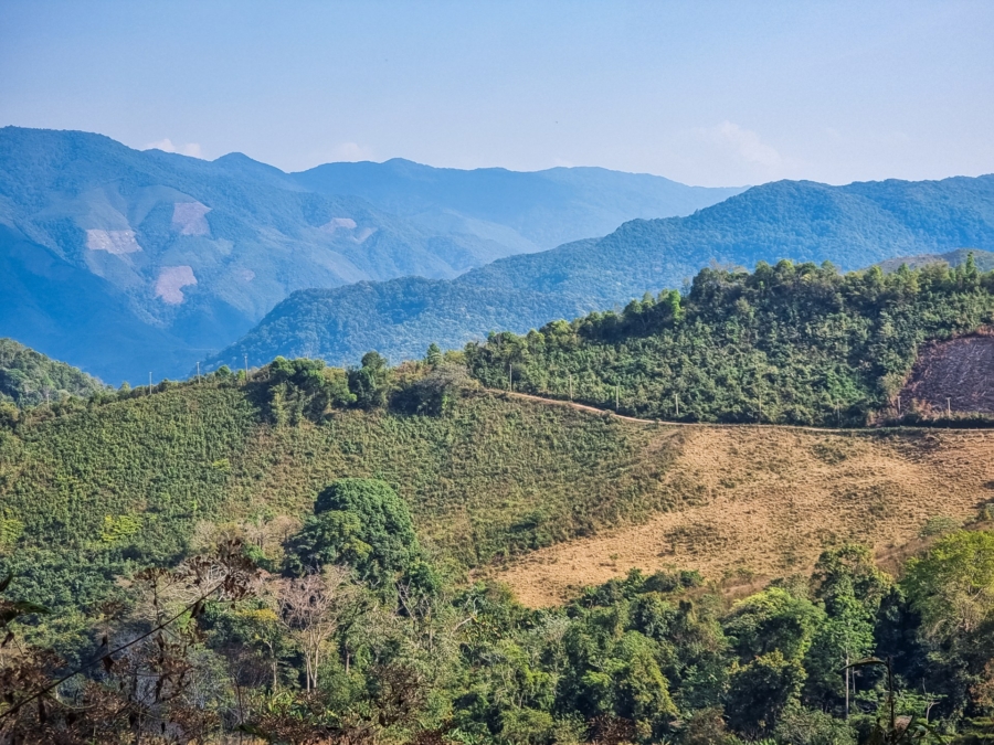
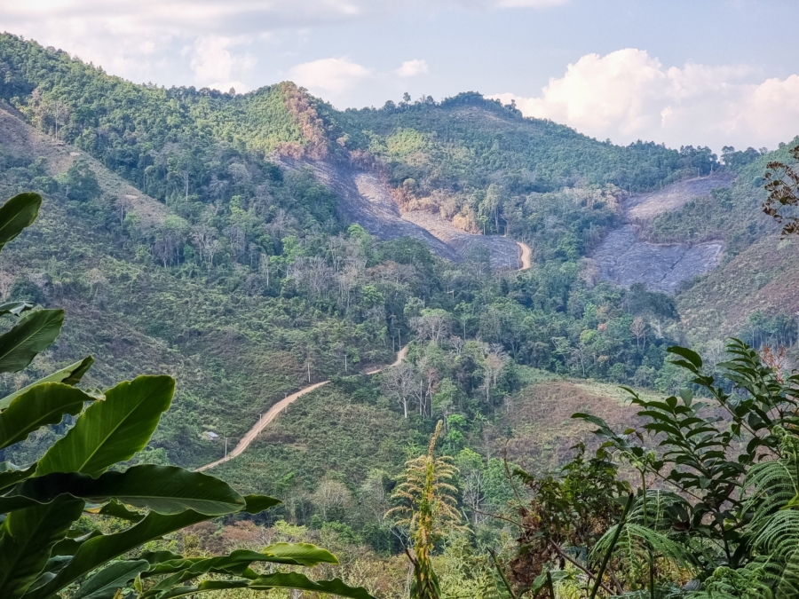
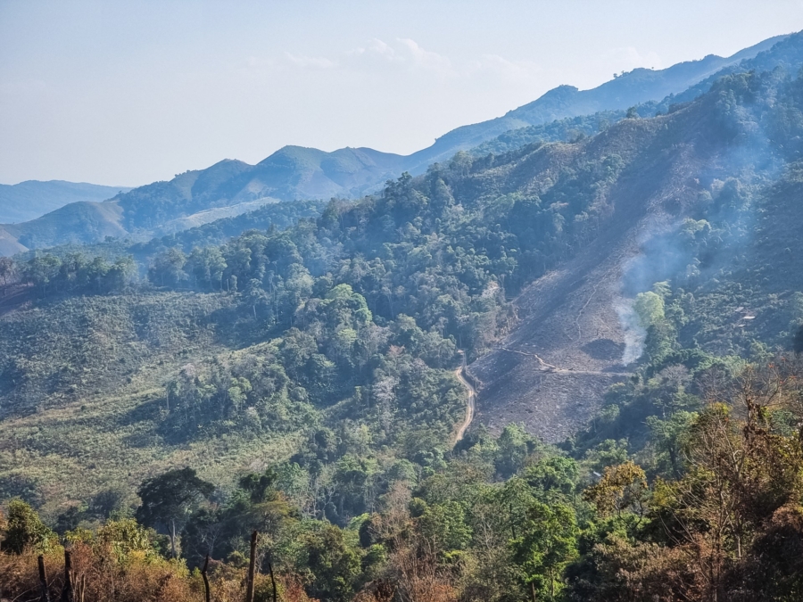
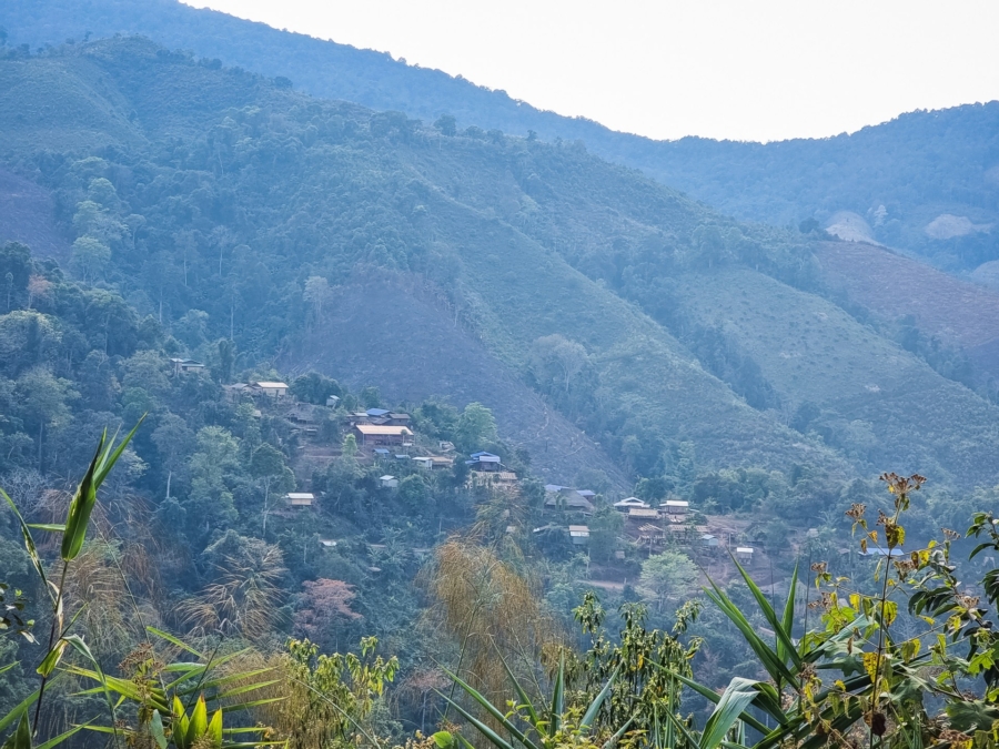
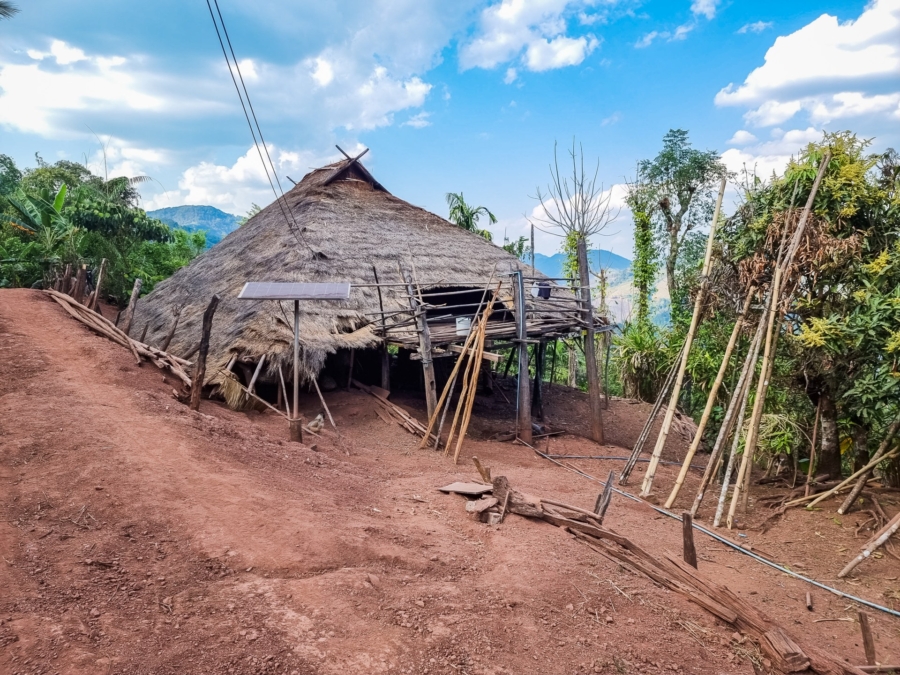
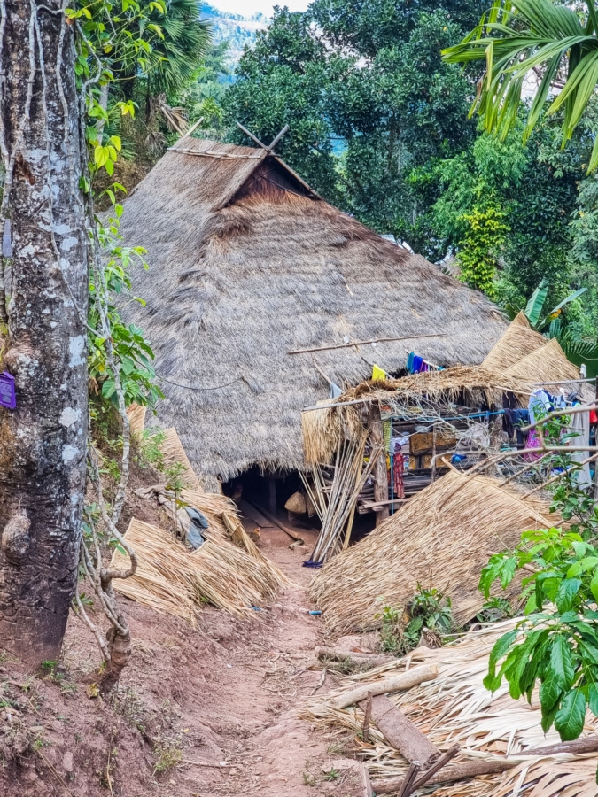
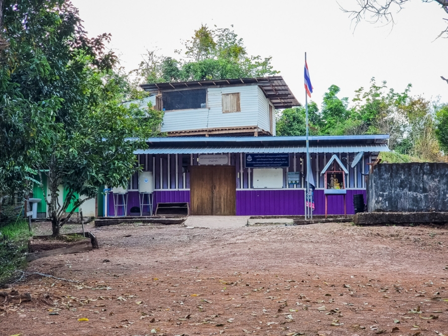
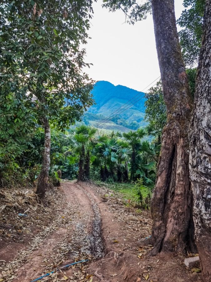
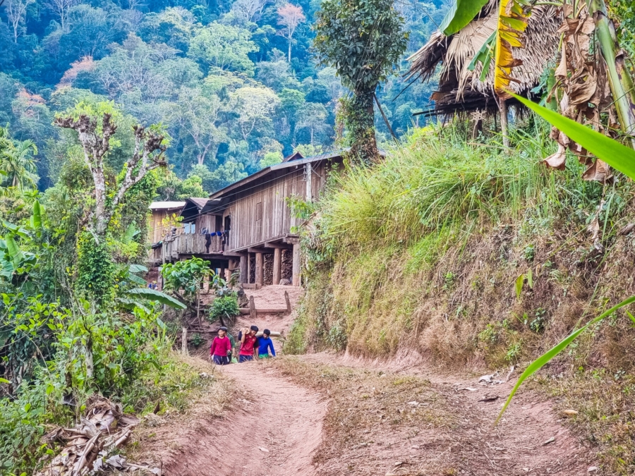
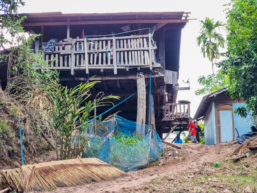
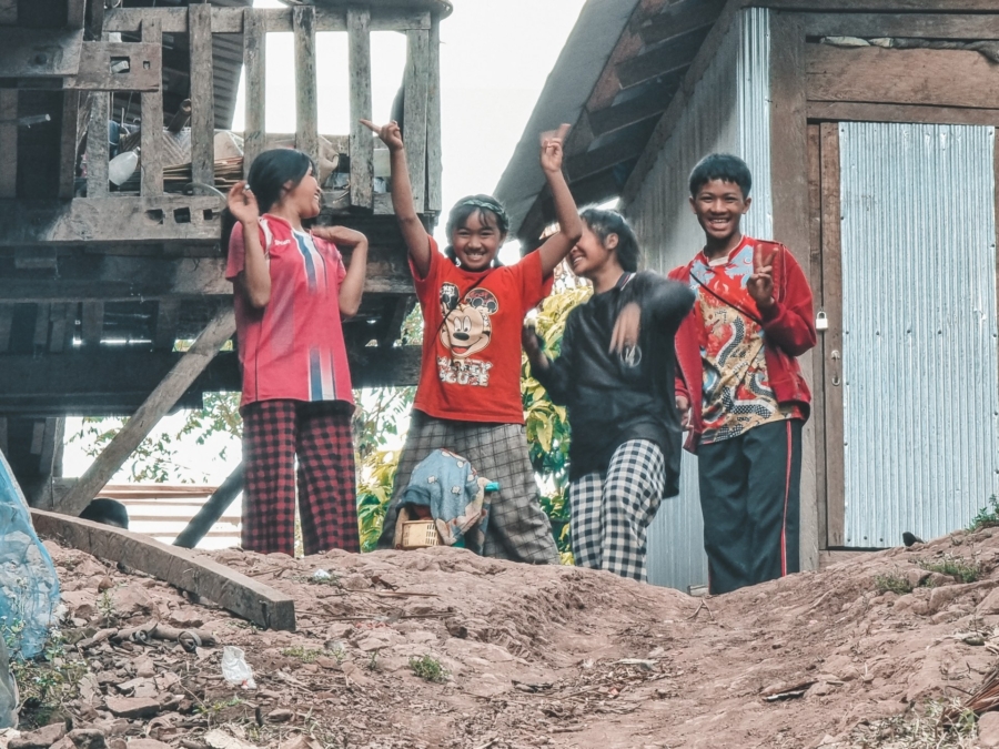
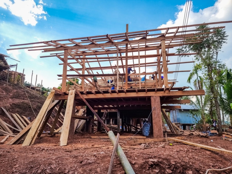
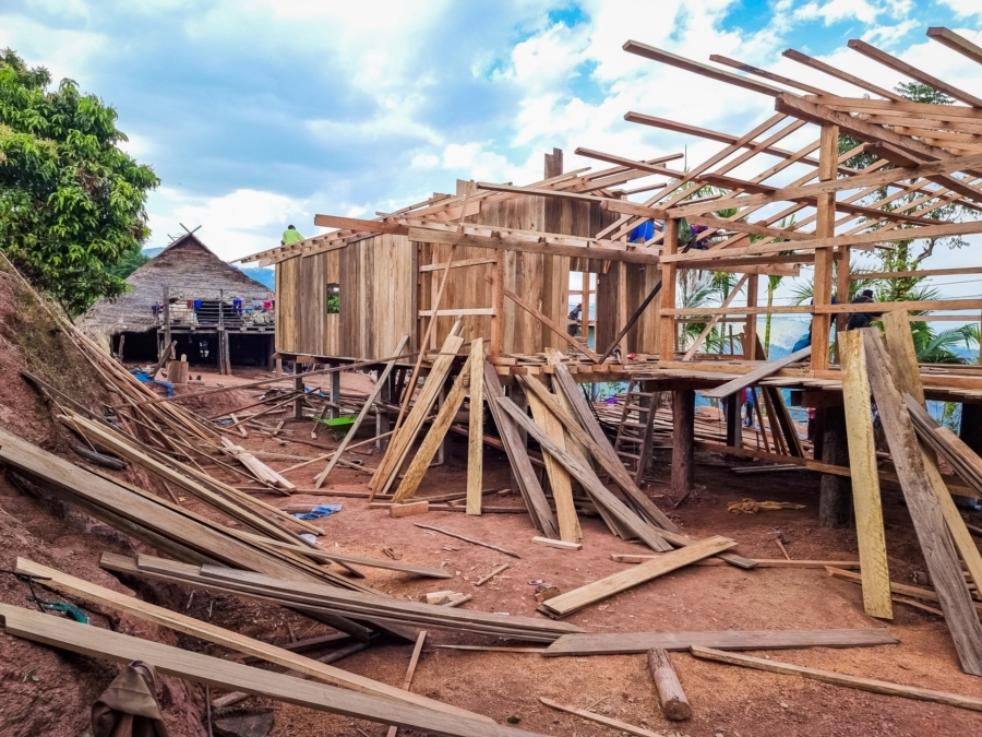
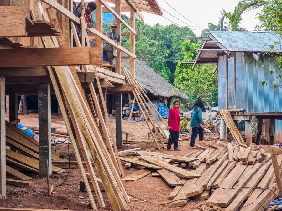
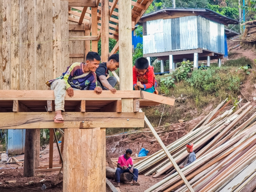
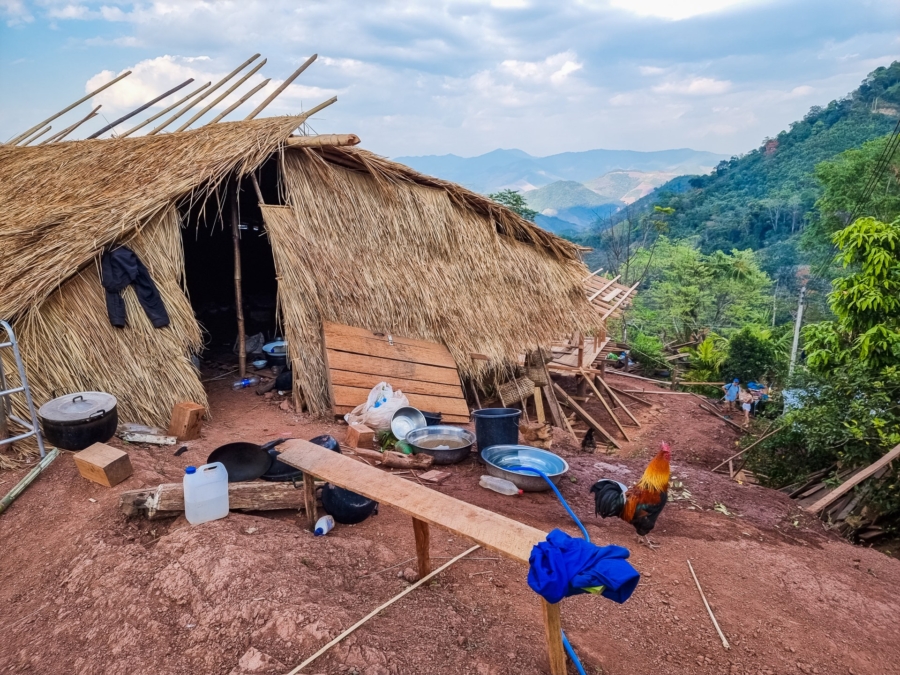
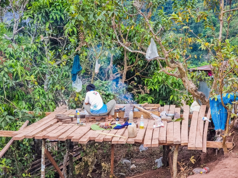
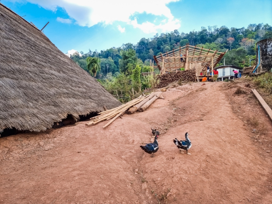
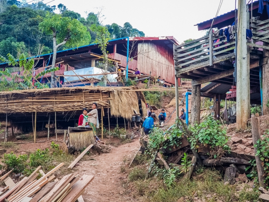
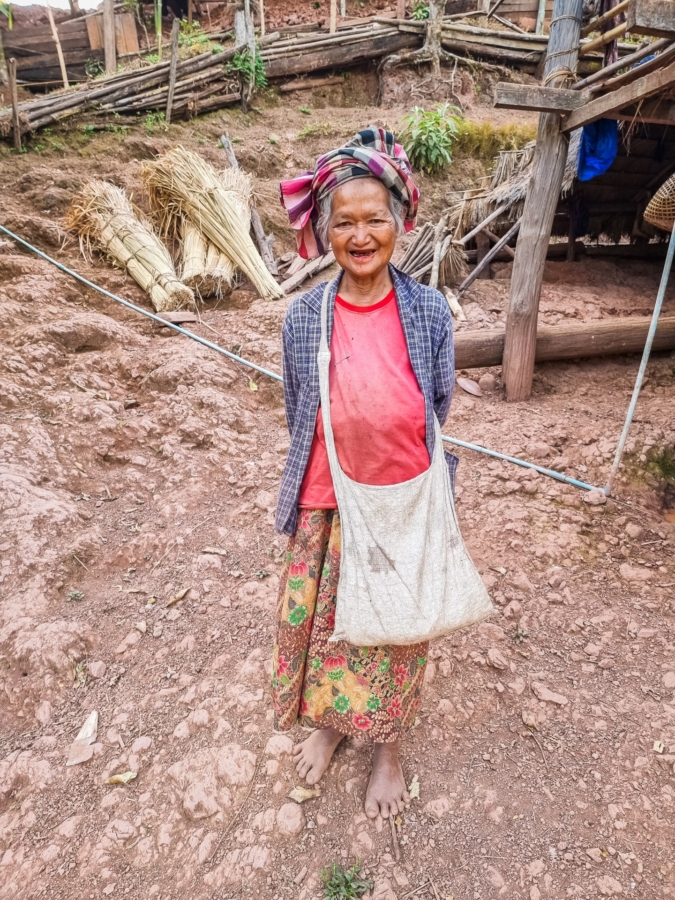
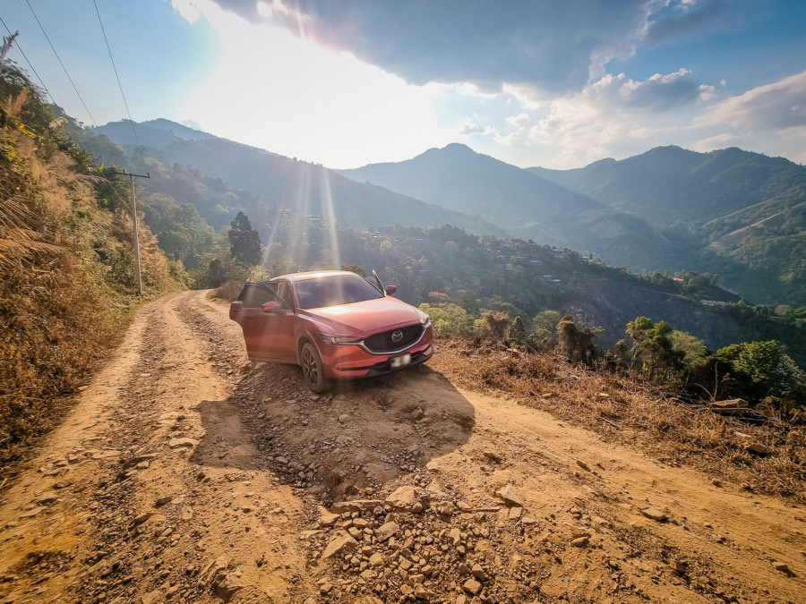
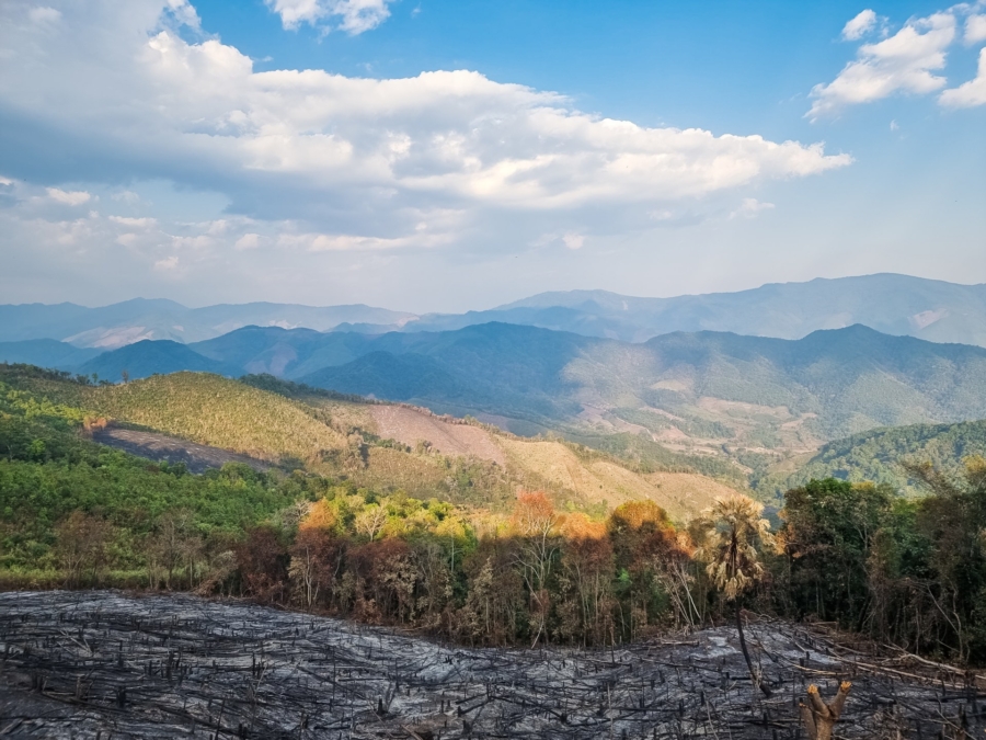
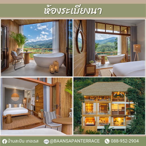
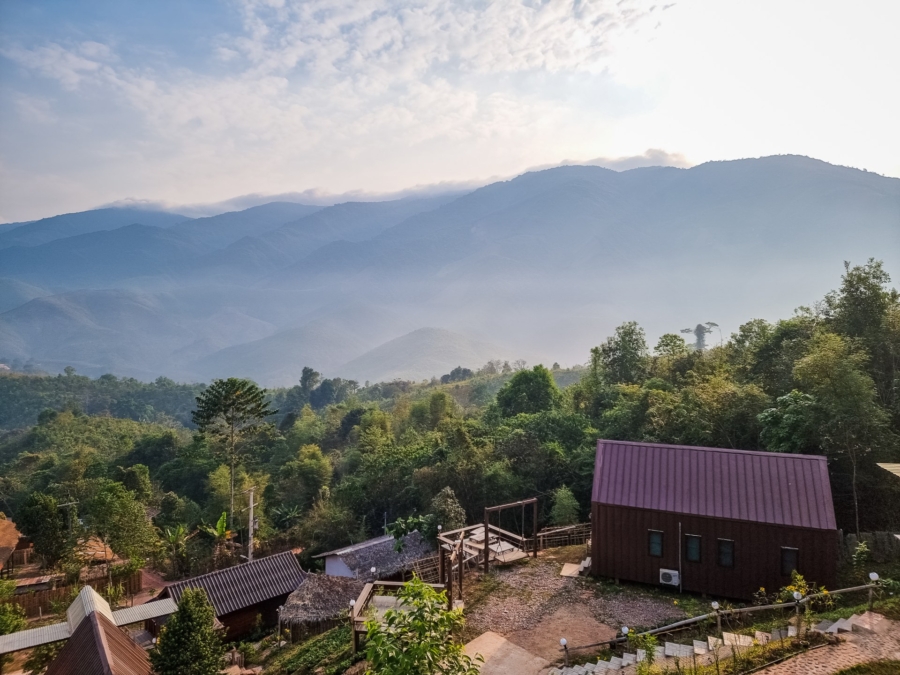
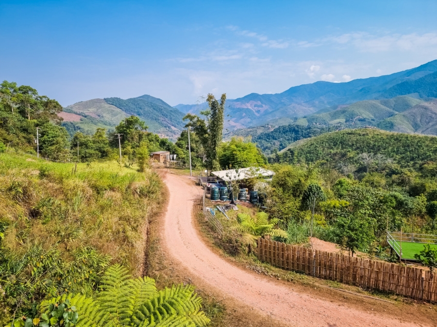
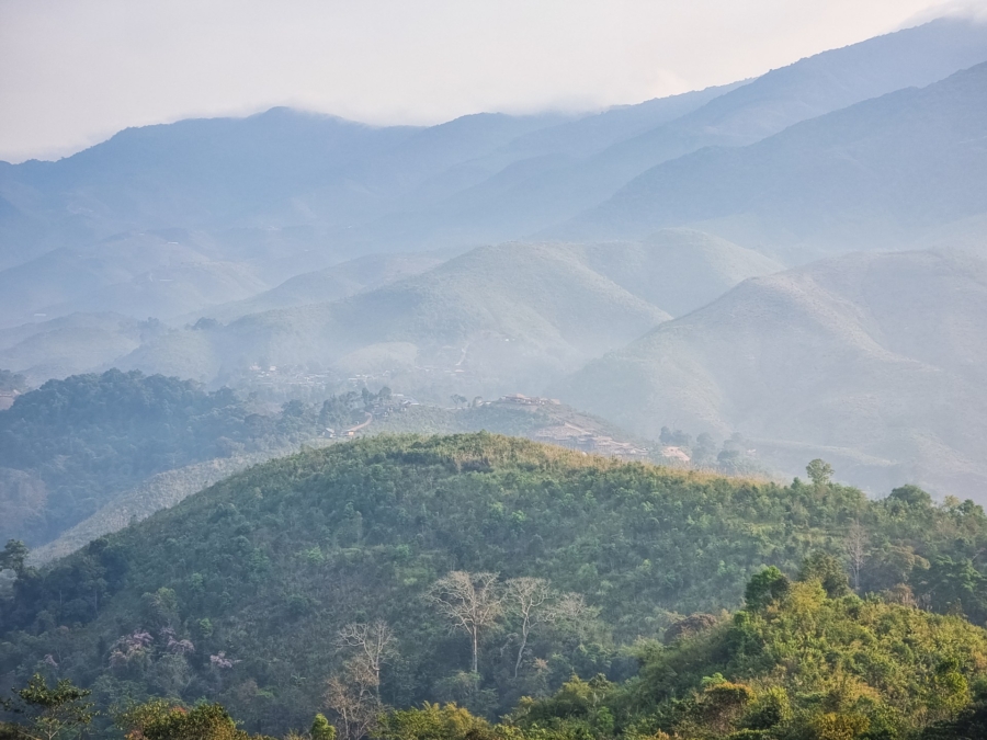
Thailand Sapan and the ethnic villages of Nan: authenticity in northern Thailand Nan, Northern Provinces, Travel to Thailand 4.5 (6)It had been more than 10 years since I had set foot in the region. Nan, a province in the north of Thailand and bordering Laos (of which this part is the only one located east of the Mekong), is a region that remains relatively little visited by foreign visitors, preferring the more classic Chiang Mai, further west, or Chiang Rai, further north.When the opportunity arose, I was delighted to return to this province which had left a good impression on me. during my last visit. After spending a few days in the city with Jitima, rediscovering its main temples — some, like the famous Wat Phumin, were still under renovation — I set off to explore the northern mountains, alone this time, as Jitima had to go back to work.It was in this context that I took the road to the district of Bo Kluea, known for its salt mines, towards the village of Sapan, in the middle of mountains and rice fields, which in recent years has become a popular holiday resort for Thais. Summary hide Roads with photogenic curves Bo Kluea Salt Mines Ban Pa Kam: a lost village of the Lua ethnic group Sapan: peaceful night between mountains and rice fields Roads with photogenic curvesUnfortunately, I wasn't there in the summer, when the greenery and lush vegetation of the rainy season wonderfully embellish its mountainous landscapes - the monsoon being off-putting by default; but tell yourself that going to the north of Thailand in July for example, makes all the difference in terms of colors (I talk about it here).That said, driving the region's winding roads remains an enjoyable experience all year round. And before arriving at my first destination of the day, I had plenty of time to enjoy the scenery.In preparing for this day, I had studied several possible routes to reach the Bo Kluea salt mines (indicated on Google Maps under " Sin Thao Rock Salt Pond"). By default, the main road, which crosses the mountains by the Doi phu kha national park (the best known of the region's national parks) via the 1256, seems like the obvious choice. But on closer inspection, it's quicker to cut through the mountains.There are then two options: take route 1257, the first junction from the main road (the 1225, if you are arriving from Nan like me), then go back up the 1081, or continue on the main road to a junction higher up to join the 1081 directly. As the map below shows, this second option, slightly shorter, was my preference.You can see the online map on Google Maps here.And that's good, because it's the option that interested me the most, it made me go through a famous curve in the shape of a 3, made popular by social networks.So leaving Route 1225, my first stop along Route 1081 was marked on the map as a "U-shaped road", because in fact, the road marks a hairpin bend forming a U characteristic of mountain roads.There is a dirt parking lot on the side, allowing you to stop without obstructing traffic (since I was there, a private individual seems to have exploited the land by adding a small café/restaurant with 3 bungalows next door).I Love “U”.In the middle of the bend, there are big letters, indicating in English 'I Love', 'J'aime'... the bends? nature? And no! You! as it is a U bend, it therefore forms the term "I Love U" ("I love you", I only realized this when adding the photo to my article...)The interest of this stop lies above all in the view offered on the heights, unfortunately very marked at this place by deforestation (an aspect of the region which had particularly struck me during my first visit to the province).I got back on the road, but not for long, because I stopped a few minutes later when I reached the famous curve in the shape of a 3. As soon as I saw the crowd gathered on the verges, with a parking lot overflowing with cars, I knew I was in the right place.I parked hastily, just long enough to take two or three photos, and didn't linger. Being there in the middle of the weekend was clearly not the best plan to hope for a bit of peace and quiet. I noticed that this kind of place is very symptomatic of the search for an Instagrammable spot...We quickly understand that this is where...It illustrates the current phenomenon well: the almost excessive attractiveness of a spot popularized by social networks. Ironically, it is precisely because I had seen many photos of this curve that I wanted to discover it myself… The circle is complete.The famous curve number 3.A few minutes later, I came to a place called “Zero Curve Viewpoint”. Why “zero”? Don’t ask me, I’m still looking for the answer… Here we find another hairpin bend, with a small local café set up in the parking lot.You can enjoy a Pad Ka Phrao (one of my favorite dishes) if you ever get a little hungry. A platform also allows you to admire, once again, the mountains that surround us, with this time, a much more present forest.Before going back down to the valley on the other side, I made one last stop at a named point Tortuous Road Viewpoint (which could be translated as “Viewpoint on the winding road”). A new beautiful view was offered to me, revealing below the S-shaped road that awaited me for the rest of the journey.Note that at each stop, I came across a few tourists – almost exclusively locals – but, apart from the famous curve in 3 (and especially outside of weekends), this road remains generally quite quiet.Tortuous Road ViewpointBo Kluea Salt MinesBefore arriving at the village, true to my habits, I stopped at a local café. While the café itself was not memorable (yes, I admit to being picky about this), the view of the rice fields was a nice touch. However, since it was the dry season, the fields were far less photogenic than in their full green or golden glory.The setting had its charm, however, enough to convince me to have a bite to eat there despite a rather limited menu. That said, there's no point in sharing the address here, because when I checked, I learned that the place has since closed permanently. This is why I often remain cautious before recommending cafes or restaurants: things change quickly!View of the rice fields from the café terrace.Finally, I arrive at Bo Kluea, a village that lives up to its name, since it literally means "salt well". This place has been famous for several centuries for its artisanal salt mining. The naturally salty water is extracted from deep wells before being transformed into edible or medicinal salt.Today, two public wells remain in operation, one located to the south of the village and the other to the north, near the Mang River. It was the latter that I visited. Although extraction only takes place during the dry season (from November to April in theory), there was unfortunately not much to see on the day I visited.The site itself is quite basic, but it bears witness to ancestral know-how. Inside a hut, several ovens lined up are installed to heat stoves similar to giant woks. The process remains simple: brackish water is extracted from the well, often using bamboo pipes, then poured into these immense woks.The water is heated for 4 to 5 hours. Once the salt begins to crystallize, it is removed with a large ladle and placed in wicker baskets suspended above the woks. The excess water then slowly drips off, returning to the pans to continue the cycle until it has completely evaporated.The salt thus collected is then stored in a corner of the shelter, ready to be sold. While some of it is used as classic cooking salt, this rarer mountain salt is also used for its medicinal properties. It is transformed into various products such as flavored bath salts, body scrubs or even soaps. You will find these items in abundance in the stalls around the wells.But why do we find salt in the mountains, you might ask? Although this salt is not iodized like sea salt, its origin is indeed linked to the sea. Geological studies have revealed that this region was a coastal area several million years ago, during the Permian period, between 250 and 299 million years ago. The salt precipitation of this time is the origin of this unique natural resource.Ban Pa Kam: a lost village of the Lua ethnic groupBefore reaching Sapan for the night, I still had some time to spare. Therefore, I left Bo Kluea to go deeper into the mountains. In preparing for this day, I wanted to fit in a visit to an ethnic village between Bo Kluea and Sapan.Obviously, I couldn't choose a village at random once I was there, nor allow myself to go on a trail for hours. So I had anticipated the question by searching on Google Maps (my travel bible).I needed an option that was both reasonably close to the main road and in the direction of Sapan. With my criteria in mind, one village seemed interesting and caught my attention: Ban Pa Kam.General view of the village.By interesting, I mean the presence of houses in a traditional style, visible in the few photos shared by visitors, but also the mention of its belonging to the Lua tribe.From a practical point of view, Ban Pa Kam ticked all the boxes: only a 7-kilometer detour from the main road, and therefore access – at least apparently – easy. And since the name of this hill tribe is unknown to me, I admit that it piques my curiosity. A quick search on Wikipedia (en anglais) taught me that the Lua are originally from Laos, which makes sense given the geographical proximity of Nan province to that country.Moreover, from an ethnic and linguistic point of view, the Lua (called Thin, T'in or Htin by their neighbors) are related to the Mlabri and the Khmu, other tribes that can be found in this same region.Residents of a Mlabri village, located in the province of Phrae, neighboring Nan.I enter the GPS coordinates and off I go. The problem, sometimes, with Google Maps, is that without "Street View", you don't really know what you're getting into... As an anecdote, since my visit, the famous Google Street Car has passed by, and now, you can see half of the journey in Street View ! But at that moment, I was heading into the unknown…So let's be honest, I suspected that it would probably be an unpaved road, but I had no idea of the condition of the road in question...Important point : I remind you that I have an SUV type vehicle with 4-wheel drive, otherwise I would not venture out like this.Knowing that it was the dry season, I told myself that the risk was limited and when the time came, I set off on this mountain road, without really knowing what awaited me...The climb, I would say that it was done in several stages. At first, I was pleasantly surprised to see that it was a concrete road, running here in the countryside and the mountains precisely but I didn't particularly expect it here. My hope was that it would continue as far as possible but after about 1 km, the concrete suddenly disappeared to make way for a dirt road.At first, nothing to worry about. The path, although covered with gravel, did not present any ruts or major difficulties. The first few minutes passed without incident. I followed the hillside until I reached a small hamlet with just a few houses. I was then a little less than halfway already and so far it was easy easy.At first it's easy.It is less visible there but the condition of the road is deteriorating.But it was precisely after this hamlet that things started to get tough. The road became rougher, bumpier and ready to test my car… and my driving skills.Some passages require walking at a walking pace, some climbs even make me doubt, skidding a few times, but finally, it passes and I continue my progression. I change sides and admire the landscape, noting with a certain bitterness the ravages of agriculture, at the same time aware that these people live from this, but raze to make entire sections of mountains (burning everything in the process).As I regularly stop to take photos to document this little adventure, plus the caution linked to the presence of large stones and a few ruts on the road, it will take me no less than a full hour to complete the 7 km!Village on the horizon, phew!I parked as best I could below the main part of the village, ready to continue exploring on foot. I took the main path again, the one I had been following just before by car, and quickly came across my first traditional houses. Easily recognizable, they rest on stilts, mixing wood and bamboo for their structure, and display gently sloping roofs covered with thatch.After about 500 meters of walking, I came across a small solid construction that turned out to be the small local hospital. Well, hospital is a big word: it looks more like a clinic. What remains impressive is that even in such an isolated village, there is basic access to care. Enough to manage the little everyday ailments without having to systematically go back down to the valley.If I had gone a little further, I would have come across the village school. This is almost systematic in Thailand: each village has its own primary school. This saves children from having to travel long distances every day, at least until they start secondary school.After school, I notice on Google Maps that the road continues to wind through the mountains, passing several other small villages before descending another path back into the valley.I then turn back and return to the main part of the village. I take a small path that goes up to the upper part and, there, I meet the first inhabitants. A group of young people will then give me a welcome worthy of the reputation of the country, all smiles!If it can happen that the elders in this kind of ethnic village do not speak Thai, but only their dialect, here, they are young people so no problem to make the usual small discussions when we find ourselves lost in this kind of thing (like what brings you, where you come from, etc.)A few meters further, I witness the construction site of two houses. The latter are more "modern" since, although they are still on stilts, they have a structure and walls made entirely of wood (with even concrete stilts for one).Talking to a young woman from the village, gathered with several women to observe the progress of these new houses, I learn that the latter are assembled in only 4 – 5 days.I myself stayed for a while to admire the men of the village busying themselves with this activity which punctuates local life, noticing that many people were also watching me, probably not used to this unusual visit.Having arrived at exactly 16pm and approaching 17pm, I can't hang around too long, because night falls rather quickly in Thailand.As I was going back down to the car to leave, I saw a little lady of a certain age, with her headdress partially hiding her ash-colored hair, displaying a curious smile, revealing her teeth marked by years of chewing betel (an areca nut, with addictive properties, which damages and causes lasting discoloration of the teeth).After an exchange of courtesies, the opportunity was too good to pass up. Of course, it is good manners in this case to ask for his consent before doing so. After his agreement, I contented myself in a hurry to capture a general photo, without insisting on a close-up portrait. I did not want to abuse his kindness.The descent was faster this time, already knowing the way. And since the village was relatively close to my next destination, it only took me an hour to reach my hotel from Ban Pa Kam.It's time to go again.Landscape near the village.Sapan: peaceful night between mountains and rice fieldsPerfect timing, I arrived just before nightfall. Well perfect… I didn’t have the chance to really linger around Sapan, because by the time I had settled in, the stars were already showing their noses in this clear February sky.Sapan being a fashionable place, hotels do not hold back on prices, it is difficult to find accommodation (at least easy to book) below €60… To give you an idea of the target clientele here (even if it is certainly possible to find simpler and cheaper but still, it gives a general trend), here is an example of a hotel that you will find in this valley popular with Thais:For my part, I opted for the Baan Midao. Besides the not too high price, it is well located, a little set back from the main area so quiet, and high up for a clear view. In addition, it has its own restaurant, a real plus because even if it is not that far, it saved me from going back down to the central area for dinner.They have quite varied rooms in type and size, spread over several levels. I wanted to have a view so I took a room with terrace and private bathroom (type V), not the cheapest but they also have more basic rooms (without toilet and bathroom) from 25 €. If you are a family, they also have large rooms for 3, 4 or even up to 6-8 people.You can see their rooms and rates here if you are interested!After a rather calm night, the next morning, I enjoy the landscape from the restaurant terrace, coffee in hand, facing the mountains. No mist or sea of clouds at this time of year, but the view remains pleasant. Unfortunately, I don't linger too long: a long day awaits me on the roads.No regrets though because to really enjoy Sapan, it is better to come during the rainy season (except possibly in September, October). This may seem counterintuitive to many, if you do not know the monsoon, but you have to understand that it does not rain constantly, it is often rains certainly intense, but short, which generally take place only in the late afternoon or in the evening.However, it is at this time that the rice fields will be very green and the lush nature reveals all its beauty. Otherwise, even if it can be packed with people, you have to come at the beginning of winter, when the nights are cool and the valleys are covered in mist in the morning, this gives character to the panorama.So maybe next time, Sapan! Did you like the article? Vote on the article Note globale 4.5 / 5. Number of votes: 6 No votes yet. Be the first to rate this article! Did you like the article? Follow me on social media Off the beaten track Mountain Local meetings Rice field Road trip Village 0 2 Roman 25/11/2024