If you didn't already know, Singapore is basically made up of one large island, separated from Malaysia to the north by the Johor Strait and from Indonesia to the south by the Singapore Strait. It consists of a main island, called Pulau Ujongbut also by a whole set of islands and islets surrounding it (in total, there are 63).
And among these islands, some are ideal for a relaxing day and a bike ride, mixing beach and forest, a chance to unwind away from the city centre (although the latter is full of parks as I mentioned in my previous article).
Here is a summary of how to get there and what you can do there.
Singapore, a constantly evolving area
Before telling you about the interesting islands, I wanted to show you how they have evolved, to understand what you are going to see and how it could still evolve in the years to come.
As I said in the introduction, the main island is Pulau Ujong. The latter, which means "island at the end (of the peninsula)" in Mandarin, covers 584,8 km², constituting the majority of the territory of this country, and by far, the total area of Singapore in 2017 reaching 724,2 km². This is where the original city and current city center are located.
To put it in context, in 1959, before the country seriously began to expand, it was 581,5 km², already less than the island of Ujong today. Then there were two notable expansions, one between 1973 and 1976, increasing the area from 587,6 km² to 616,3 km² and then between 1997 and 1999, increasing from 648,1 km² to 682,7 km².
To achieve this, Singapore is reclaiming land from the sea through land reclamation projects, connecting islands and extending its coastline. Among these notable expansions, the most famous for its amenities is the Marina, where... Gardens by the Bay.
The evolution is therefore constant, with several more series of extensions on the sea planned by 2030. To date, Singapore has been able to increase its surface area by 24%, which is quite considerable. What is paradoxical if we take into account the very environmental aspect of the country, is this stubbornness in wanting to "cheat" with nature, and undoubtedly expand to cope with the increase in its population and its development.

To understand, on this map you have two distinct colors:
- In pale pink, these are the enlargements that have already been carried out.
- In light red, these are the extensions planned by 2030, so some are already underway.
The very eastern tip of the main island is where it is located Changi International Airport (incidentally, one of the best in the world), Singapore's main airport.
The island above this area corresponds to the islands of Tekong and Tekong Kecil (already joined together according to the satellite image). Pulau Tekong is the largest of the Singaporean islands outside the main one (Pulau Ujong), with an area of 24,43 km².
It is not open to visitors.because it now serves as a training ground for the Singapore Armed Forces, and hosts the Basic Military Training Centre.
Next, we notice the entire area to the southwest, which has been greatly enlarged. This is because that's where the port of singapore, third largest port in the world in terms of tonnage (600 million per year).
To understand this figure, you need to know that the world's largest port is Ningbo-Zhoushan (900 million), followed by Shanghai (650 million; to give you an idea of the scale, its quay is over 5 km long!), located not far from each other in China.
By comparison, the leading port in Europe in terms of tonnage is Rotterdam in the Netherlands (500 million) while the leading French port is Marseille (with just under 100 million).

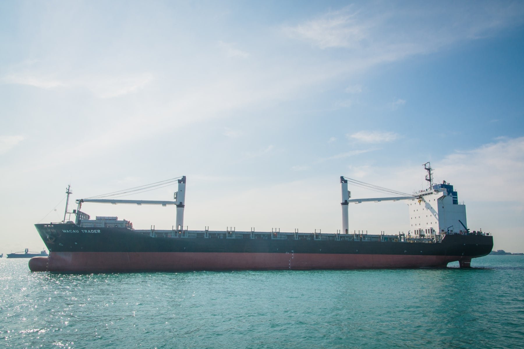
For the record, knowing the name of the boat (on my full-size photo you can easily read it), you can follow its tracks. via a dedicated site (This isn't sponsored at all and is a bit off-topic, but I find it funny).
St John, Lazarus and Seringat Islands
I admit I got a little sidetracked above, but I wanted to clarify the situation in the country to make what follows easier to explain. Namely, that today, if you look at the ferry website (see below), you will only see St. John and Kusu as destinations (at the counter, they also list Lazarus).
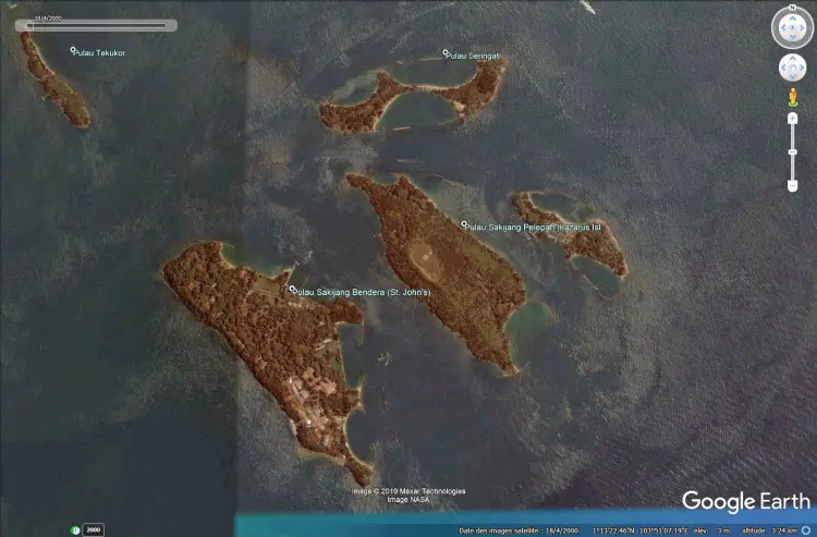
If you hover your mouse over the image below, you will understand the significant changes these islands have undergone. By default, what you see is the state of this group of islands BEFORE the land reclamation work. In this case, there were four distinct islands.
The other image represents the islands today where St John and the Lazarus/Seringat complex are now connected by a bridge, thus forming a single "entity".
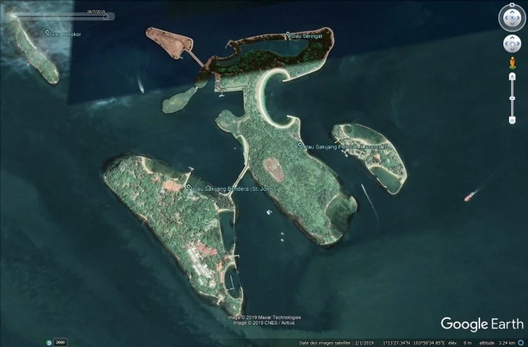
To explain the circumstances of my visit, I went there to see what was going on on these islands, take pictures and get information on how to get there. Basically, it was for my blog and to tell you about it.
I'm mentioning this because, realistically, if you want to see these islands, it's best to dedicate a full day to it. Given the ferry schedule, it's not really possible otherwise unless you do as I did and visit just one island (Kusu, the smallest).


That same day, I also had to go to Pulau Ubin, except, seeing St John AND Kusu AND Pulau Ubin is simply not possible. That being said, that's why I didn't go to St John. The boat docked there for 15 minutes, before continuing on its way to Kusu Island, where I spent more time.
As an aside, in the late 19th century, Saint John Island was used to quarantine immigrants with infectious diseases. By the 20th century, it had also become a prison for political prisoners and a detox center for opium addicts!


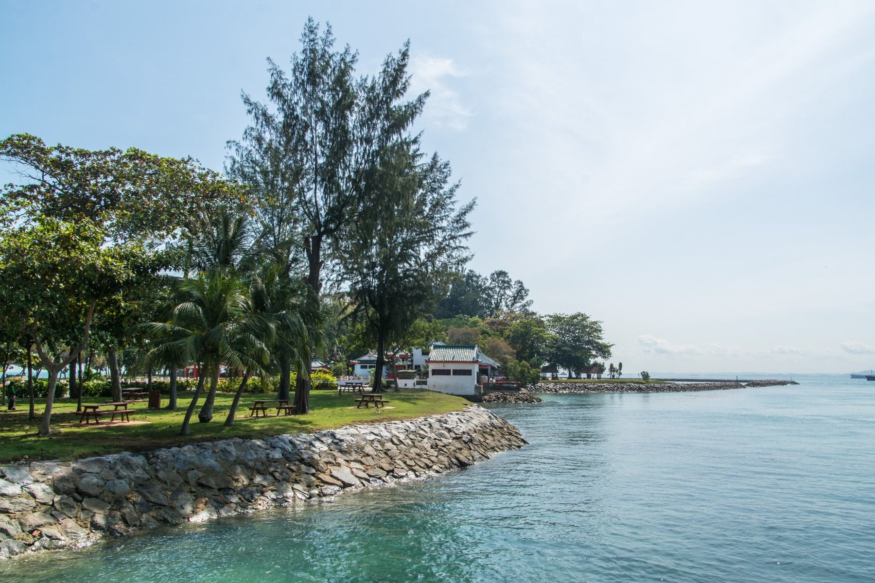
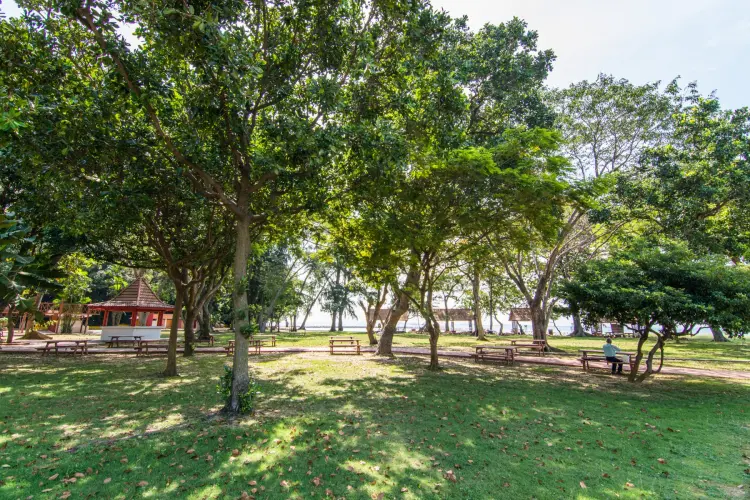
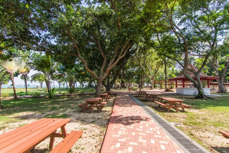
From what I could see, the atmosphere seems similar to Kusu, just bigger. There is a research center for local marine life, paths to walk around, and apparently picnic tables as well. As I mentioned above, there is a bridge connecting Saint John Island and Lazarus, it takes 20 minutes to get from the ferry dock to the main beach of Lazarus.
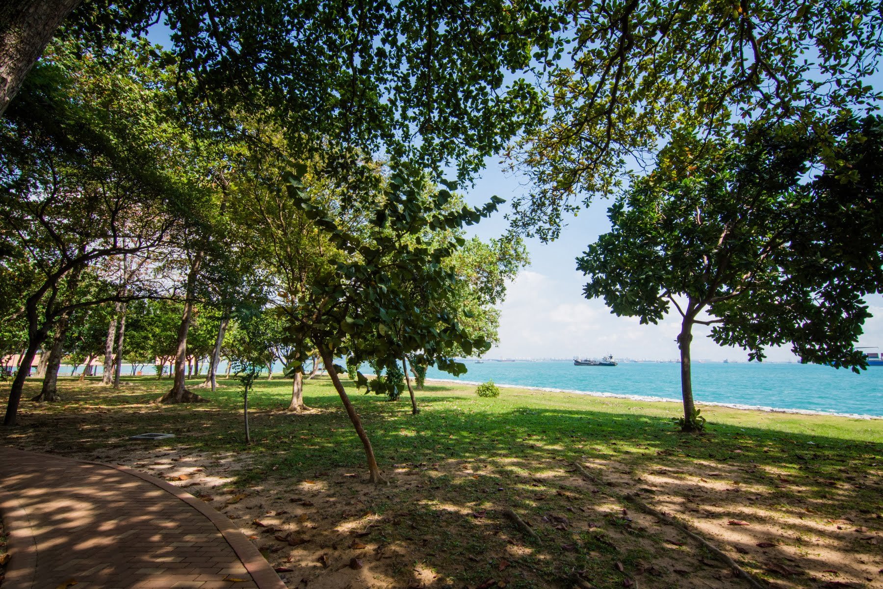
This channel is artificial, created to connect the Lazarus and Seringat islands. Furthermore, given the islands' location near the port and therefore frequented by many ships, the waters, while beautiful turquoise, are quite murky. To illustrate my point, I'll leave you with a photo of one of the ships in the area and a map I made showing the islands' location.

Kusu Island
Past my stop at Saint John Island, the boat was therefore heading towards the neighboring island of Kusu to the north. And this time I went down to discover what is hidden on this little piece of land.
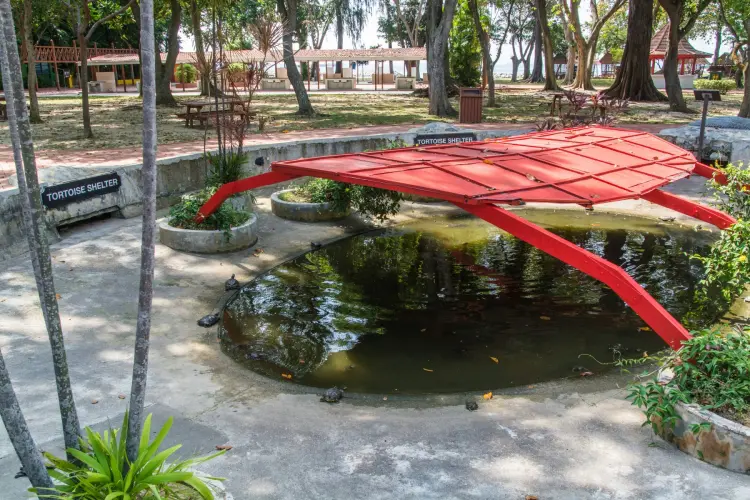
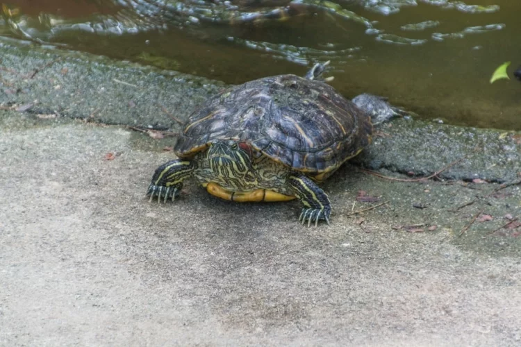
Arrived at the island quay at 11am, the ferry left at noon, leaving me then a little hour to explore this little piece of island. It is also turtle island, local legend has it that a giant turtle transformed itself into an island to save two sailors whose ship had just sunk. One was a Malay Muslim, the other a Chinese Taoist.


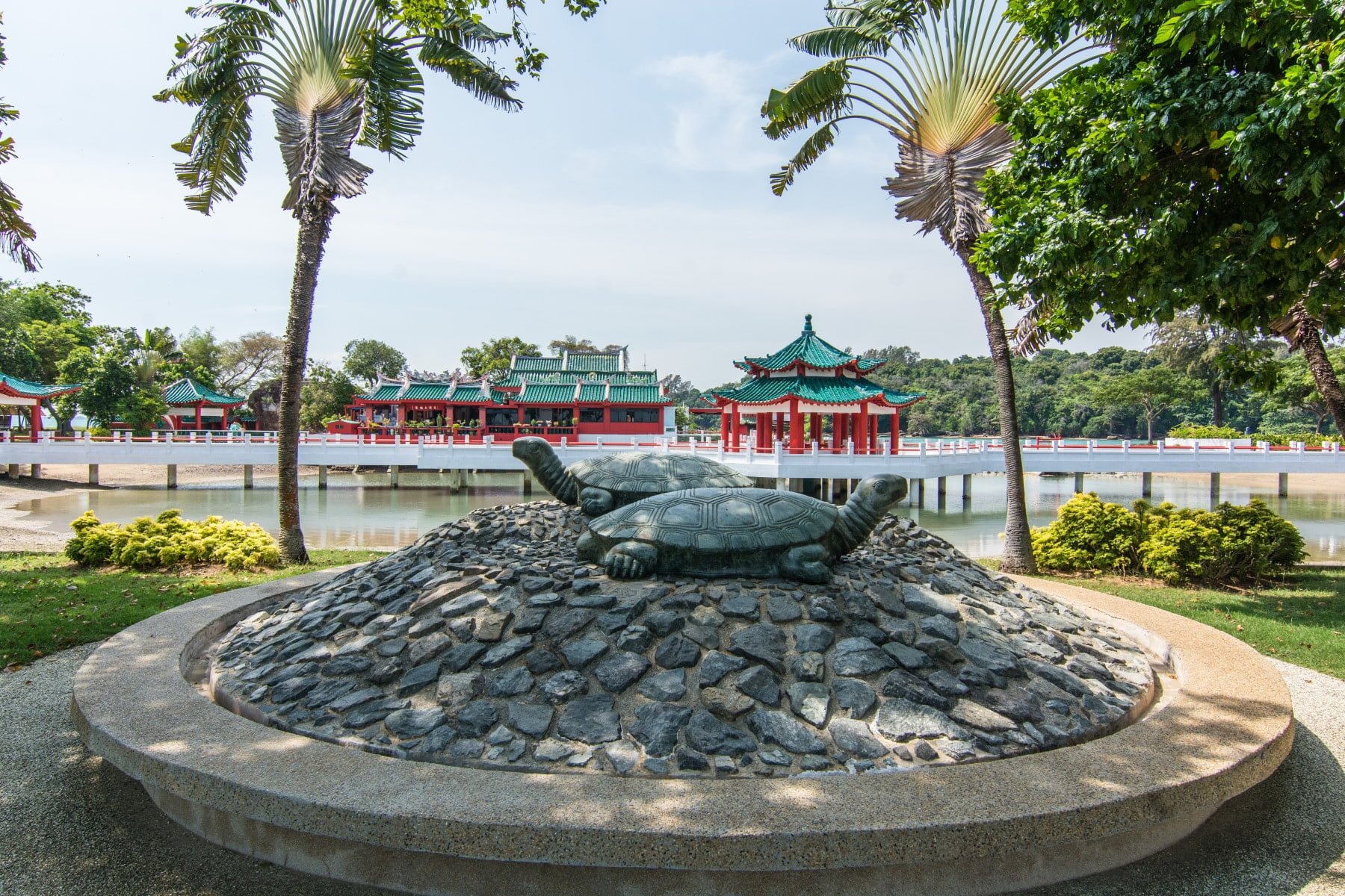
This is why today, on the island there is a statue of two turtles, a sanctuary with a shelter for small turtles and above all two templesOne Chinese, the other Muslim. The latter is located on a small hill that once formed the original island, with another small islet next to it, barely 1,2 hectares in size. With the development work carried out in 1975, intended to transform this piece of land into a holiday resort, the overall area of Kusu has expanded to 8,5 hectares.
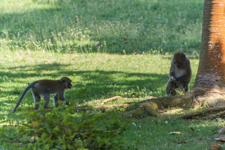
The advantage of this little visit is that it was quiet. Only one person went down to the island at the same time as me, so apart from those present for the maintenance of the island, there were hardly more than 5 people in total, if we ignore the monkeys there.
Because yes, there is even a little local fauna, a few macaques wandering in the trees and on the ground, around the Chinese temple and the Malay sanctuary.
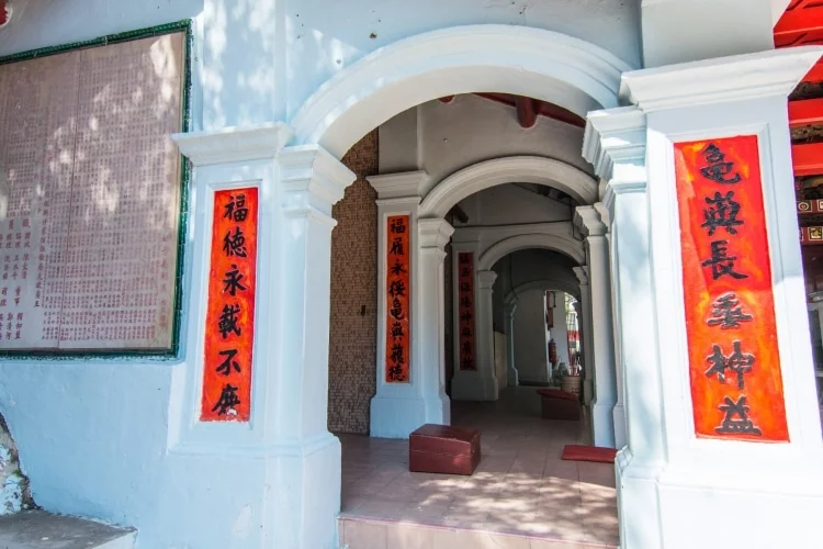
Kusu Island Chinese Temple
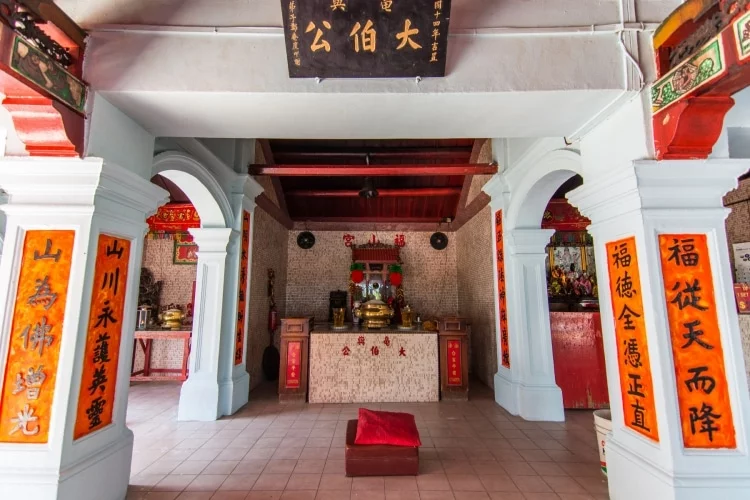
This is a bit of a main attraction on the island. Also called Da Bo Gong 大伯公 or Tua Pek Kong (great-uncle), the temple is built in 1923 by a wealthy businessman. It is dedicated to two main deities – Da Bo Gong and Guan Yin (goddess of mercy).
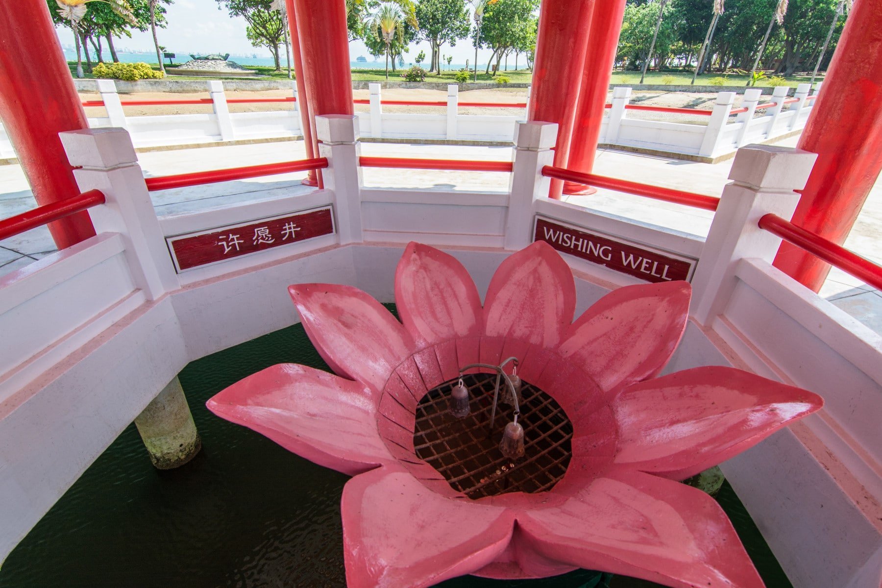
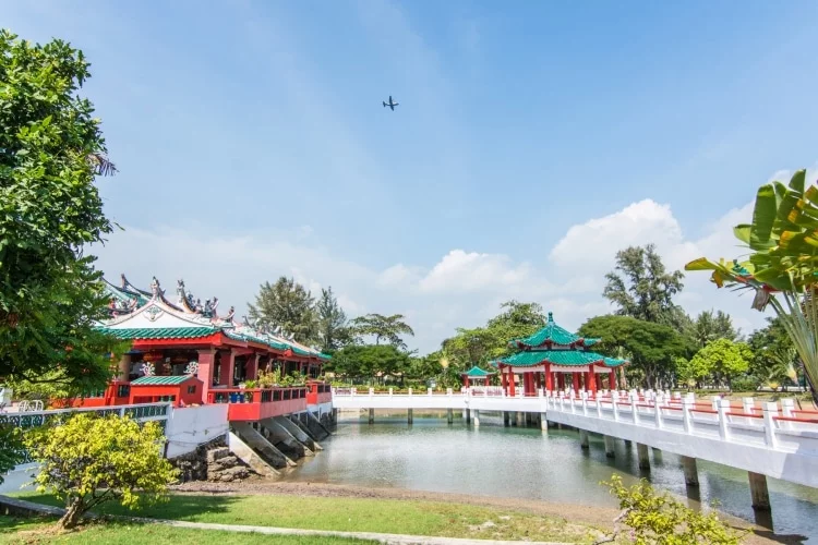
Next to the main building is a basin, which will be filled or empty depending on the tide. This basin is spanned by a walkway with a shelter in its center, where the "wishing well," symbolized by a lotus leaf, is located.
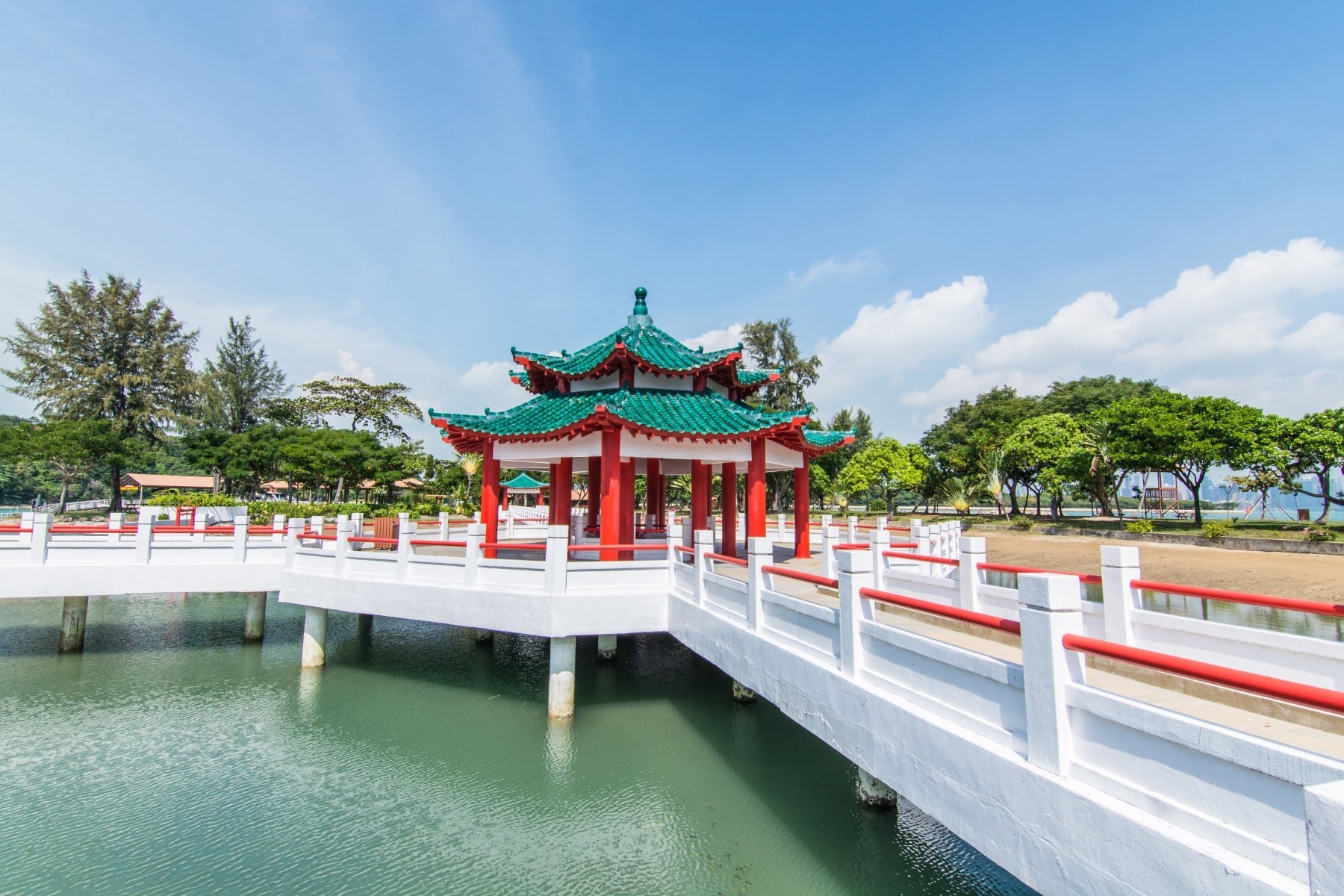
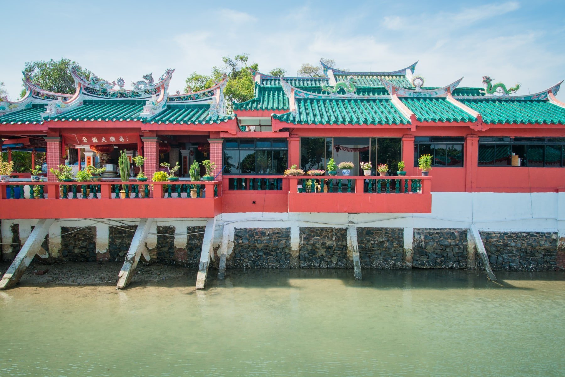

If you are already familiar with Chinese temples, you will find a familiar architecture, where red predominates. Despite its size and modest appearance, The temple is the object of an annual pilgrimage, which takes place between the months of September and November depending on the year (9th month of the lunar calendar and dates spread over 9 days).
This is a period when there can be a lot of people on the island since the pilgrimage attracts up to 100 people!
Kusu Keramat or Datok Kong Keramat
At the top of the only "hill" on Kusu Island, formed by a pile of rocks, are three kramats (sacred shrines of Malay saints). These three kramats commemorate respectively a pious man (Syed Abdul Rahman), his mother (Nenek Ghalib) and his sister (Puteri Fatimah) who lived in the 19th century.
To get there, you have to "climb" the 152 steps which lead to the kramats. Locals come to pray, asking for wealth, marriage, and health. The shrines are also popular with childless couples who would pray here in order to obtain them.
Its particularity for me is that the The sanctuary is all dressed in yellow. When I passed by, I was there absolutely alone. Surrounded by trees, for a moment, I really had this feeling of being at the end of the world.


En one o'clock, I had plenty of time to explore KusuYou have to see that it makes less than 600 m long With a width barely exceeding 100 meters, it feels a bit repetitive. I imagine the atmosphere is radically different on weekends. Personally, I appreciated the calm, the feeling of being on "his own." small quiet island easy, it's not unpleasant.
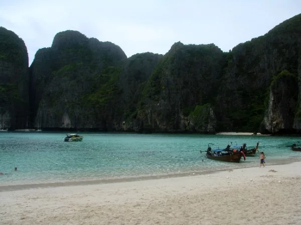
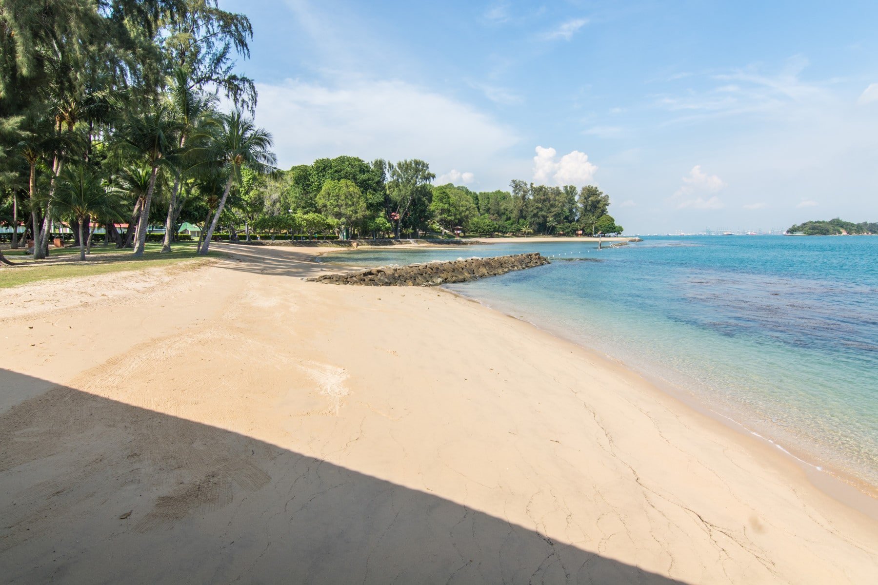
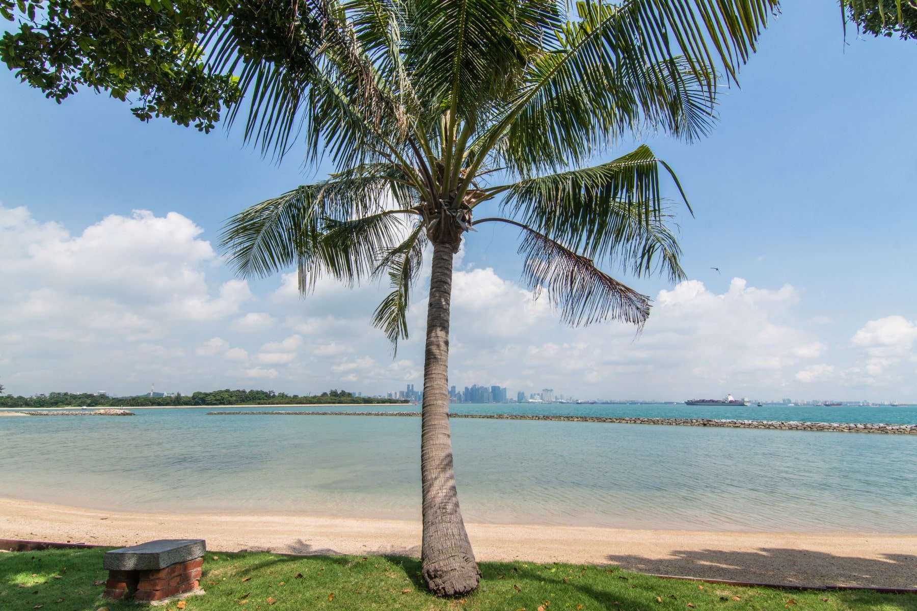
It contrasts quite a bit, even though we can see the buildings protruding from the the city, just 5 km away from there, to see this immaculate beach, with calm turquoise water in which it would be tempting to dip your feet.
And as I take this picture of the beach with its palm tree In front of it, I chuckle to myself, thinking: "Here's a typical beach cliché, and yet, I'm definitely in Singapore!", which really breaks the image of a city that's only good for shopping.


How to get to St John and Kusu Islands
You have a regular ferry to these islands, with limited timetables during the week and a little more flexible at the weekend. People naturally allow themselves a few hours of respite on these islands after a week of work.
From the quay, count 30 minutes to get to Saint John Islandthen 15 minutes from St John to Kusu.


Ferry times to St John and Kusu Islands


Rates and additional information
The other islands
In this same area of southern Singapore, we can find other small islands to spend a relaxing time. You will probably see their names when you arrive at Marina South Quay and they are served by the same ferry company as St John and Kusu.
The only difference is that there are no regular schedules and you have to take a charter boat. You will have a white counter for this, separated from the orange one for the islands of St John and Kusu, with the following islands indicated:
- Sisters Islands : the sister islands, consisting of two islets Subar Darat and Subar Laut, just 1 km southwest of St John.
- Ghost Island : here too, a set of two islets, literally next to the island of Bukom (dedicated to the port and more specifically to the petrochemical industry).
- Semakau Island : an island south of Hantu, mostly artificial (I doubt tourists go there).

Of this group of islands, apart Sisters IslandI seriously doubt the value of stopping at either of the other two. Hantu is practically attached to Bukom Island, completely filled with tanks and cooling towers from the refineries located there. I thought I understood that it was a spot where it was possible to go diving… Failing that, there are picnic tables and The island is well dedicated to tourism.
As for Semakau, I think that in the future it will also serve the interests of the port and does not currently have any facilities for the public.
Did you like the article? share on Pinterest!