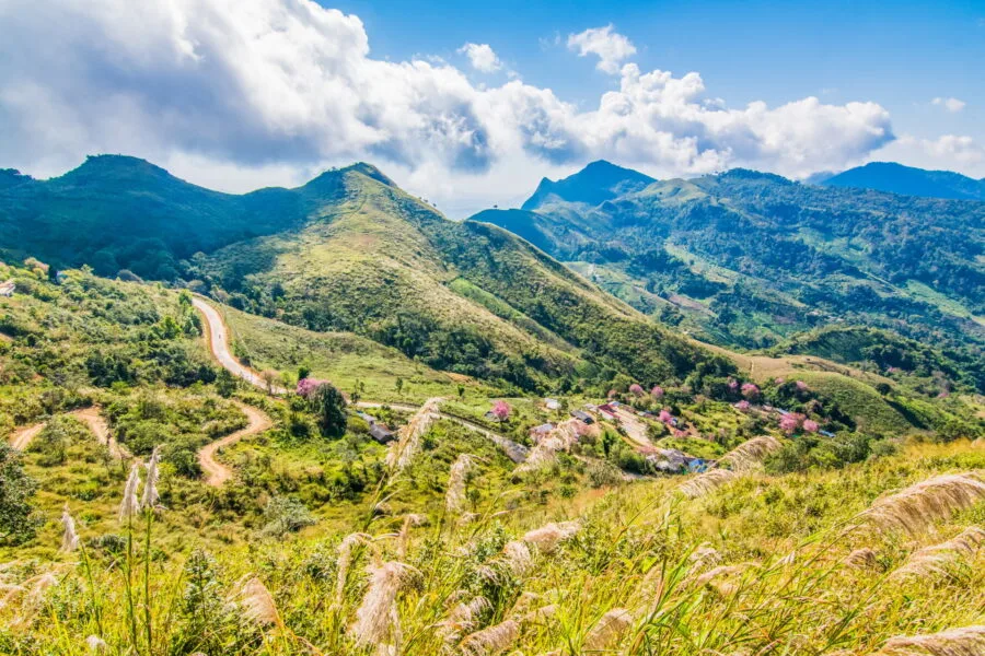
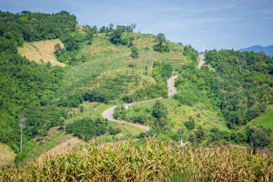
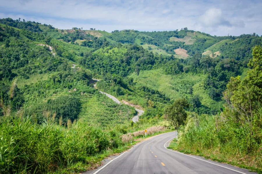
Doi Pha Tang is only 20 km of Phu Chi Fah, and the road that connects the two is a beautiful crossing of mountainous landscapes. This portion of the 1093 route runs along ridges, offering several spectacular viewpoints of the valley below and the mountains stretching to the north and east.
While most visitors come exclusively to Phu Chi Fah before heading back down to Chiang Rai, taking a detour to Doi Pha Tang allows you to extend the experience by exploring another side of the region, less frequented but just as impressive.
A road between cultures and mountains
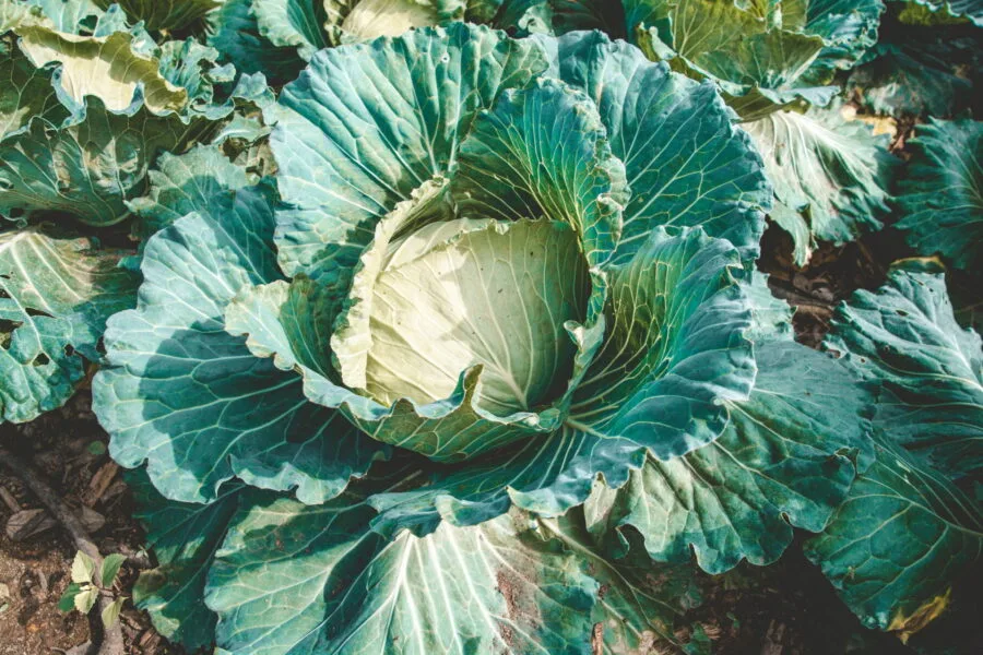
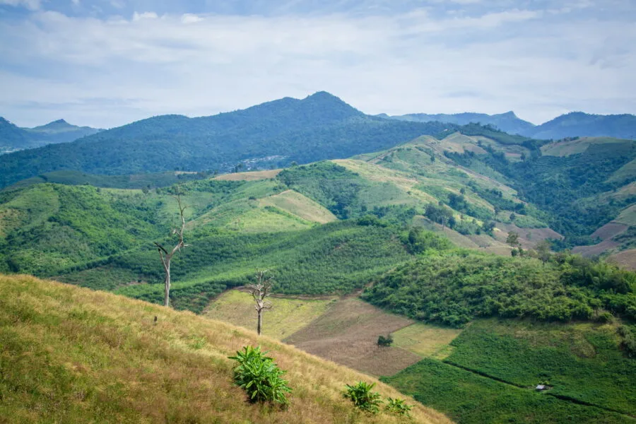
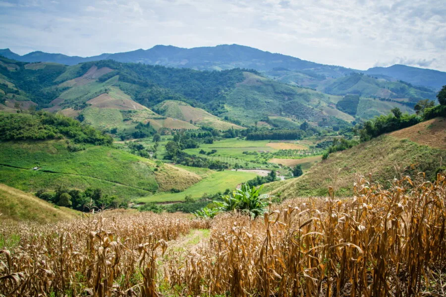
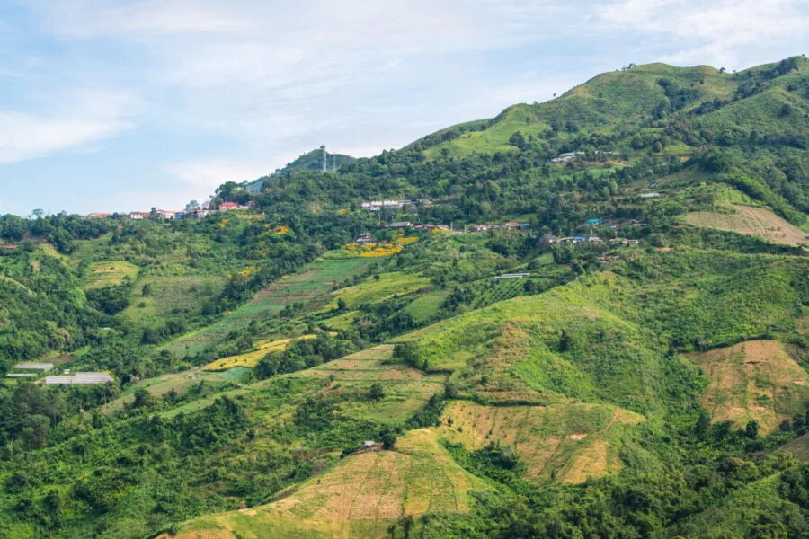
The road winds through agricultural areas where you can come across locals working in the fields. Between cabbage, corn, flowers and rice fields, crops vary according to the season, sometimes with vibrant colors that contrast with the omnipresent green of the hills.
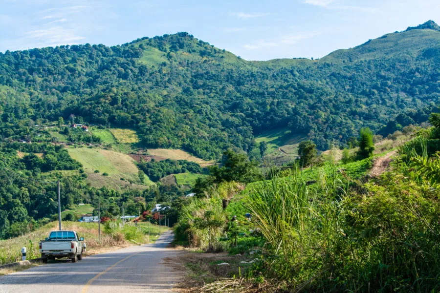
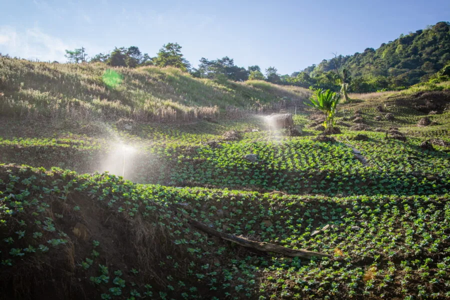
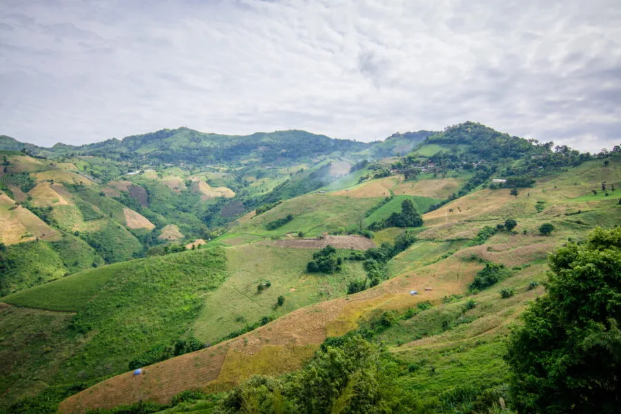
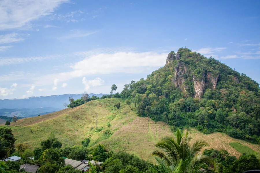
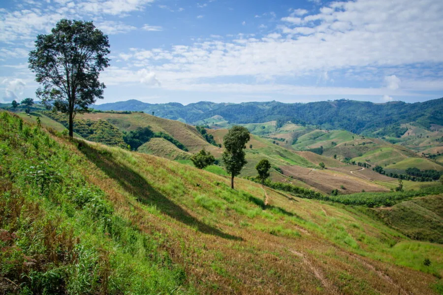
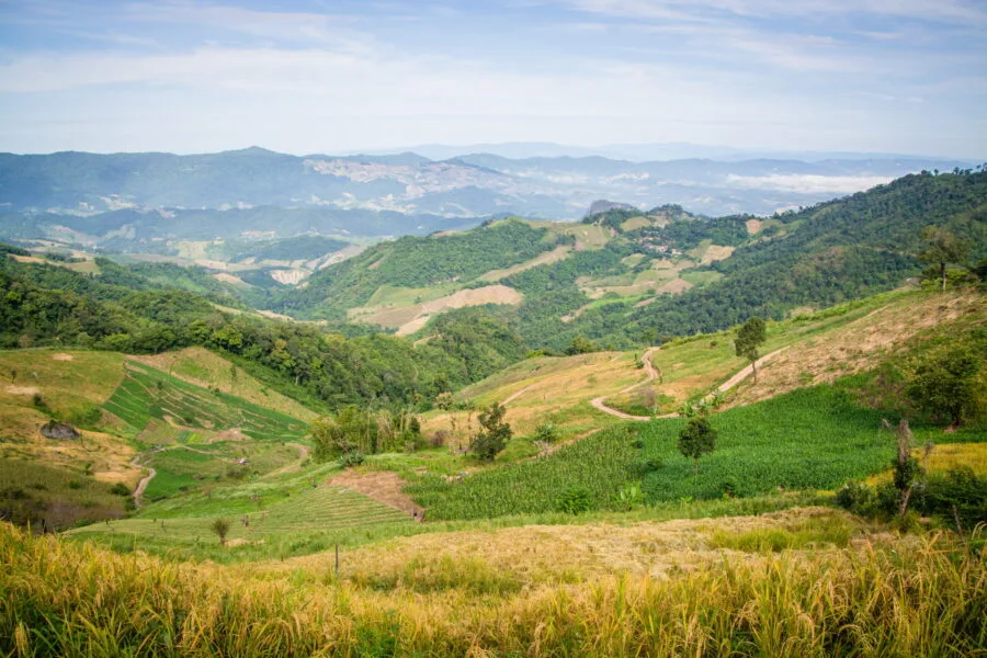
In places, the landscape is marked by excessive clearing, where entire sections of mountain range have been razed for intensive agriculture. Here, forests often remain only on the ridges and summits, leaving the slopes largely exploited.
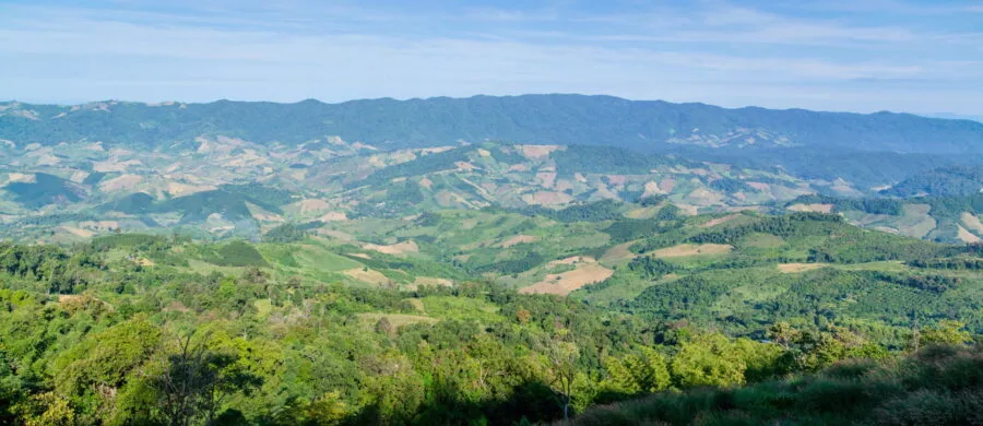
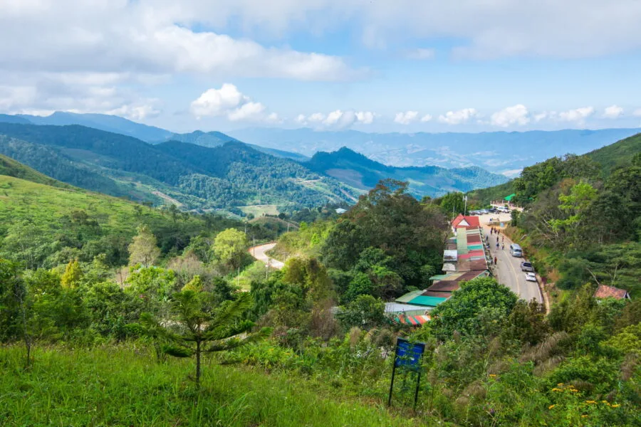
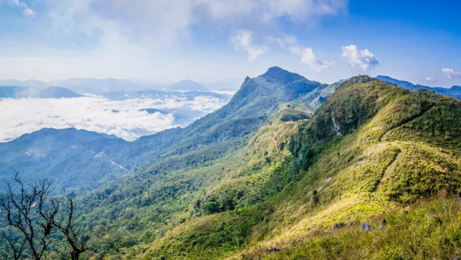
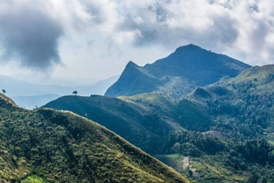
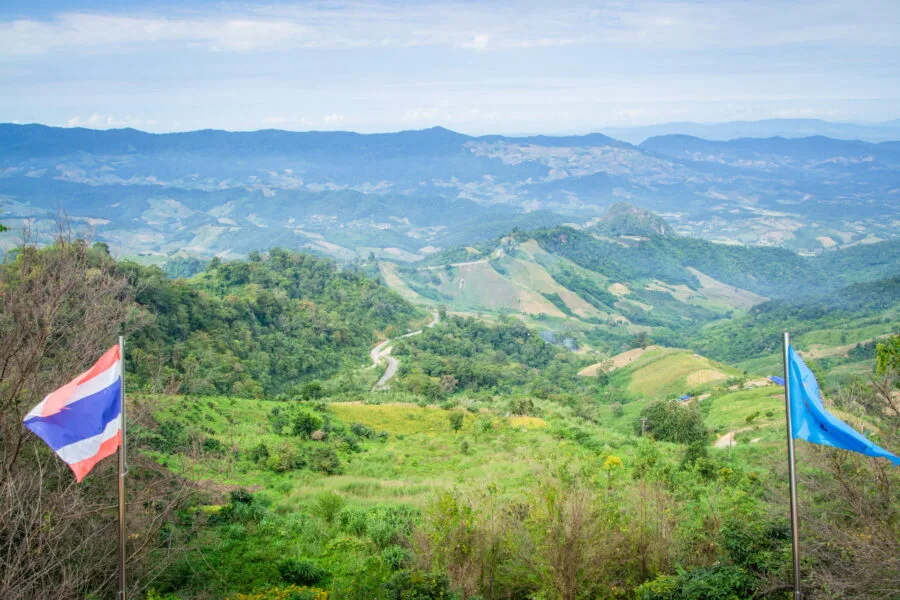
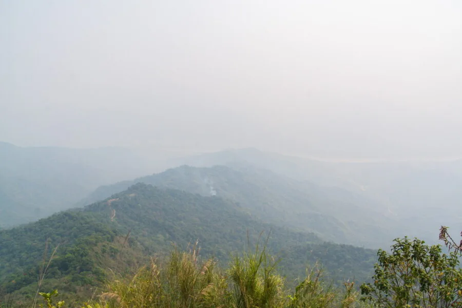
Along the way, several viewpoints are worth a stop. You can admire the intermediate valley and another mountain range opposite, which separates this whole region from the vast plains extending from the banks of the Mekong to the north, up to the Phayao province, 100 km further south.
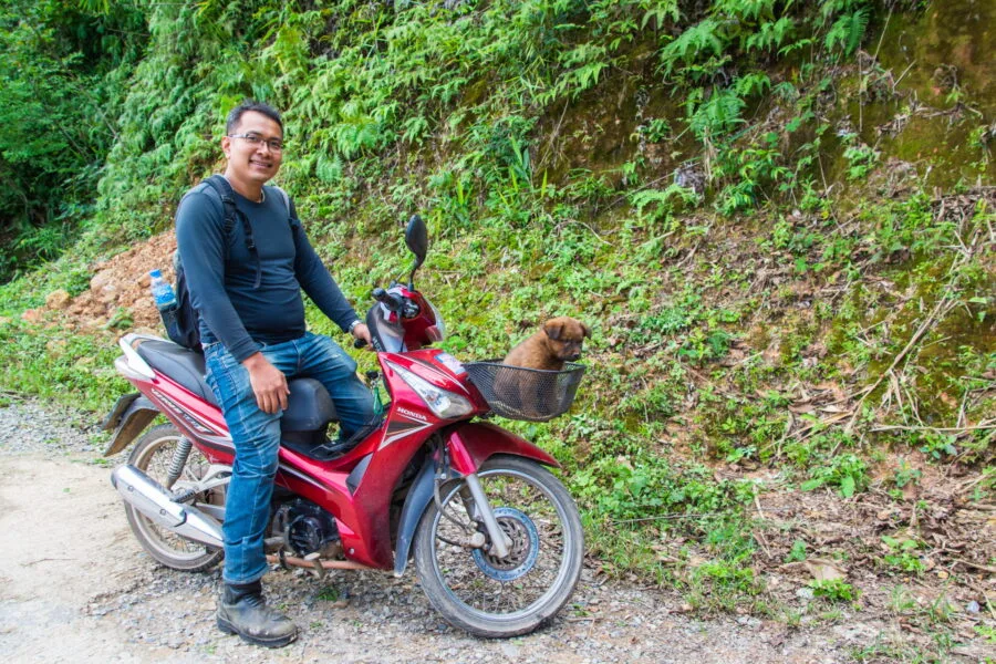
Whether you're driving a car or motorbike, this is a road worth enjoying, taking the time to take a few breaks to enjoy the beautiful views of this rural and little-known Thailand.
Doi Pha Tang: a spectacular panorama in just a few steps
Reach the Doi pha tang is even simpler than for Phu Chi Fah. From the parking lot, simply walk about 400 meters to reach the main viewpoint. Well, simple... let's say that it's significantly shorter than Phu Chi Fah, but in terms of effort, only the last section before reaching the summit is more demanding with a steeper slope.
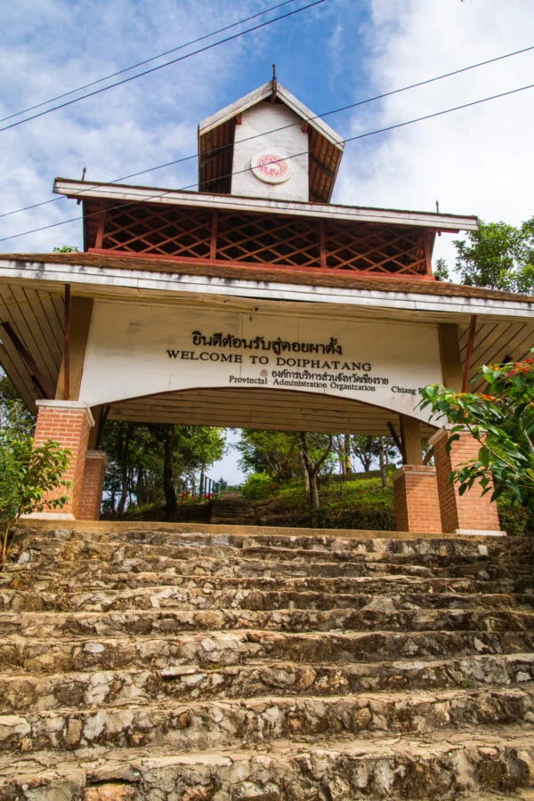
From the starting point, you will pass some souvenir shops and local restaurants before reaching the steps that mark access to the Doi Pha Tang trail. Shortly after, on the left, a short staircase descends towards a natural arch formed by the rock. The view is limited, but it doesn't cost anything to take a look.
Besides, the place has evolved quickly: during my first visit, there was only a simple dirt path to access it and no facilities. A few months later, the staircase appeared as well as a platform with a giant heart at the end (photo spot required)... Which just goes to show that even in such a peaceful corner, tourism evolves quickly!


Lazy-friendly alternative
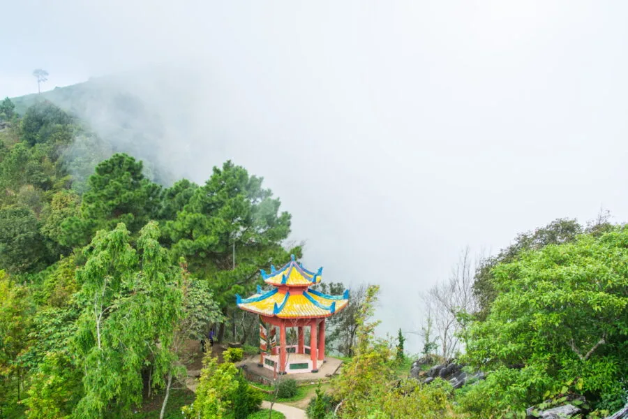
If you have too lazy to climb to the top, you can be satisfied with a first partial viewpoint. After the stairs of the main entrance, continue straight, and you will reach a lookout located near a shelter with Chinese architecture.
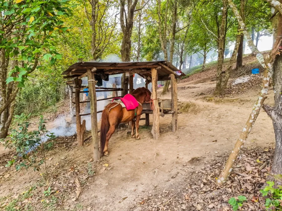
Another "solution" (even if I don't really endorse it, and what's more, I don't know if they are there all year round): small ponies are offered to go up to the summit, an activity that might please children... but which, in my opinion, doesn't really have a place here.
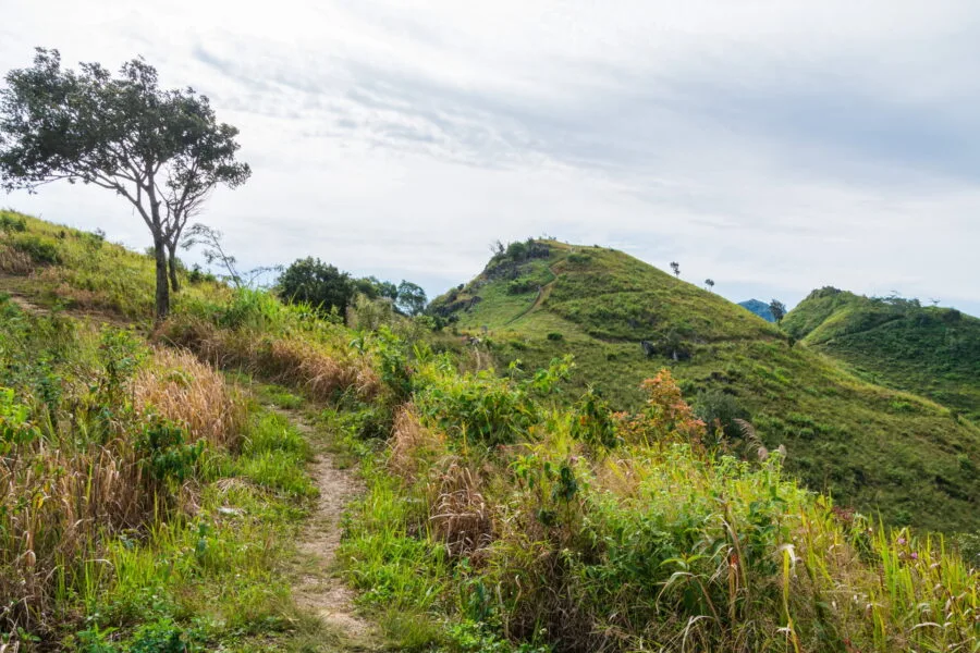
A gentle climb
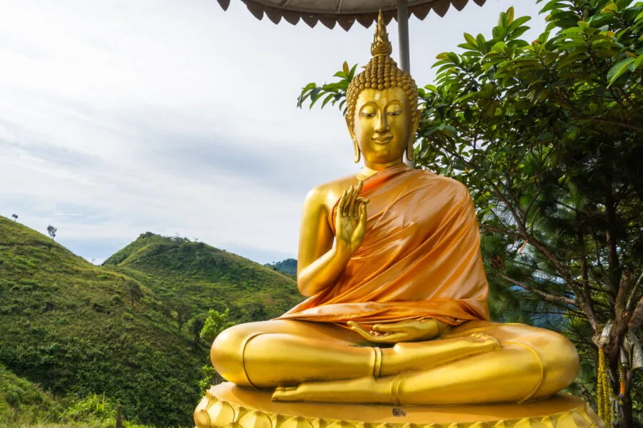
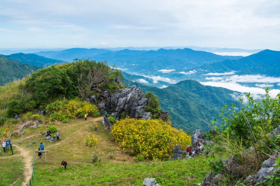
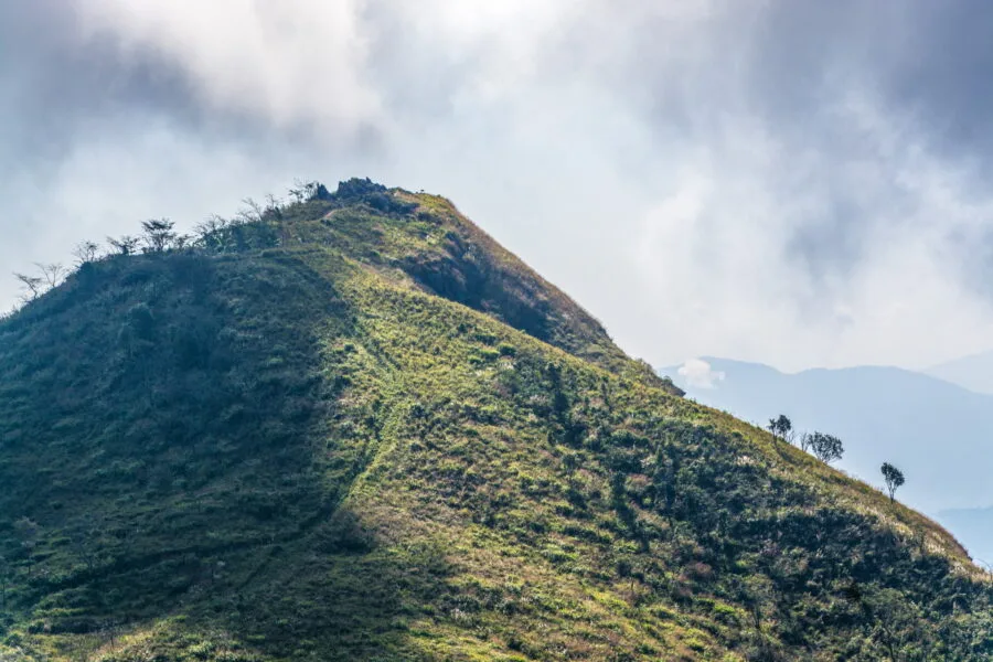
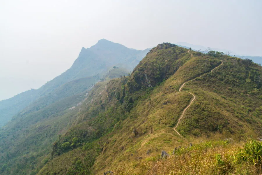
From the start of the trail, a statue of Buddha sits under an umbrella, as a first landmark before attacking the climb. The path then runs along the mountain ridge with a relatively gentle climb.
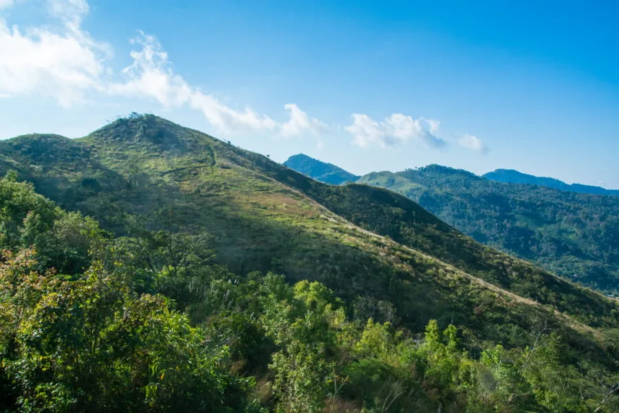
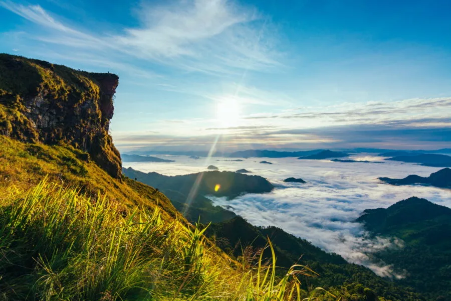
Less than 200 meters further, we can already climb on a small hill offering a superb first view of Laos.
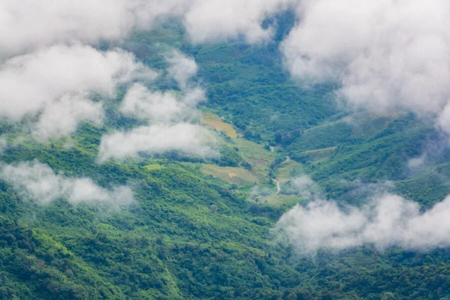
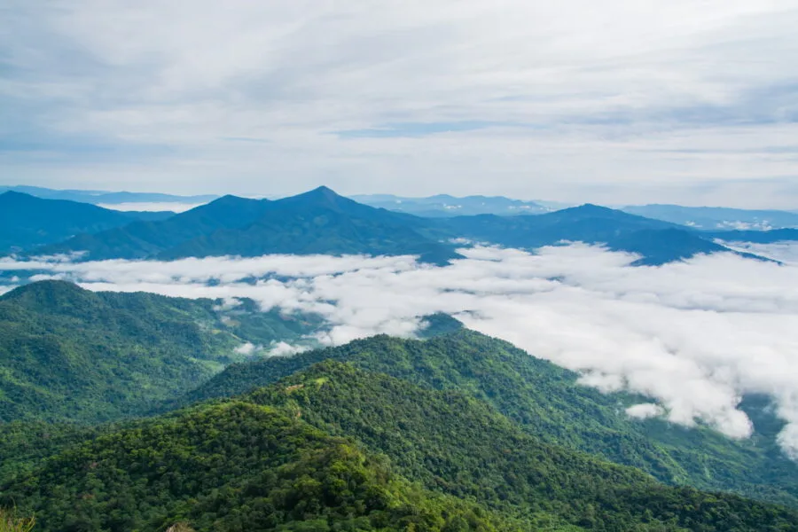
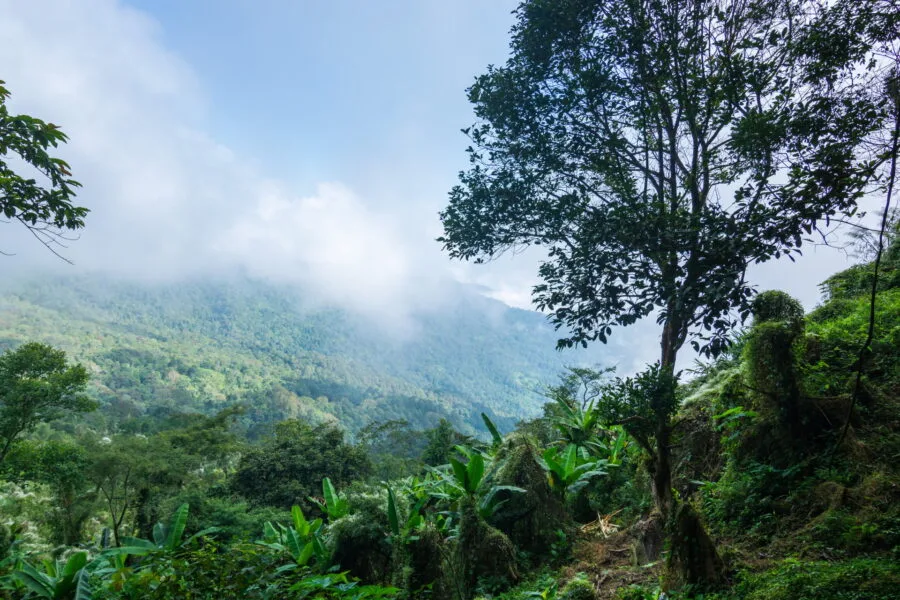
On my first visit, the valley was still covered with clouds, making the atmosphere almost unrealSome would be satisfied with that... but I wanted to go all the way!
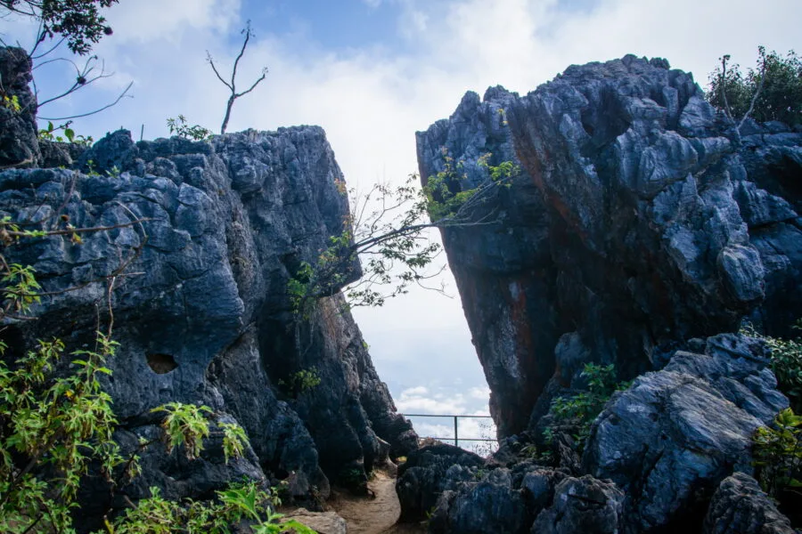
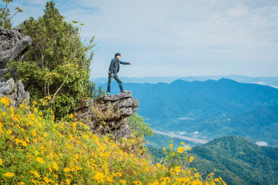
The path continues on 500 meters along the mountain ridge, with another viewpoint slightly higher at the end. On the way, we arrive at one of the most famous photo spots from Doi Pha Tang: a “natural window” formed by two rock blocks, which perfectly frame the view of Laos.
The highest point of Doi Pha Tang
Nearby, a steep staircase leads to the final summit. This is the steepest section of this high altitude walk, but nothing insurmountable.
One last effort, a little out of breath, and I finally reach the summit of Doi Pha Tang. Just enough time to gather my wits, and already, a detail catches my eye: a rusty bell, suspended at the edge of the void.
Its appearance is sketchy, but on closer inspection... it is actually a recycled shell tip ! A relic reused in an unusual way, as we sometimes see in Thailand.
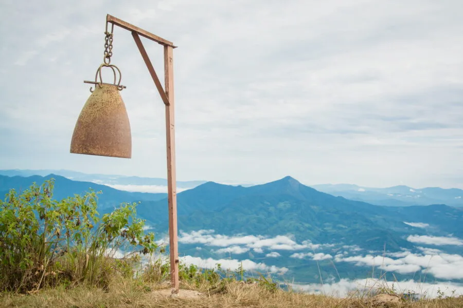
Some visitors make it resonate in celebration – a fun tradition, especially when you consider that Thais are generally not great walkers and that every climb becomes a small feat.
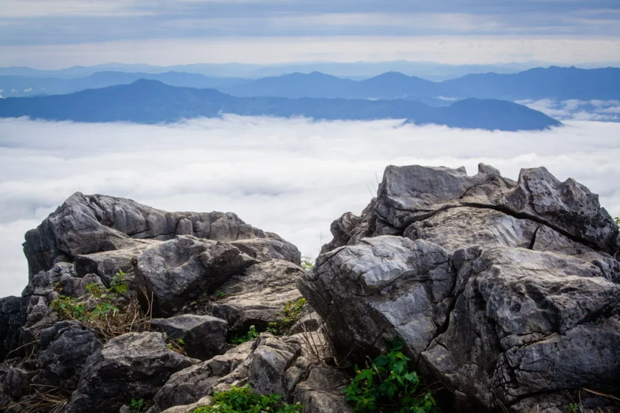
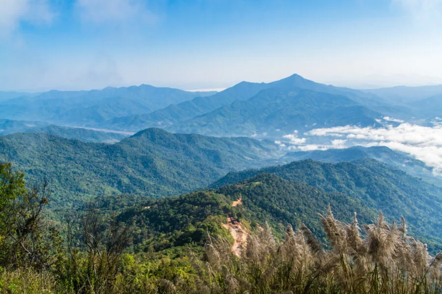
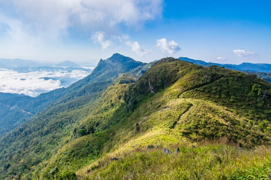
View side, we find a panorama similar to that of the first point of viewMore the mountains are better visible on the Thai side, as well as the ridge that continues further. And here, once the clouds have cleared, we can see the Mekong winding in the distance, bordered by mountains as far as the eye can see.
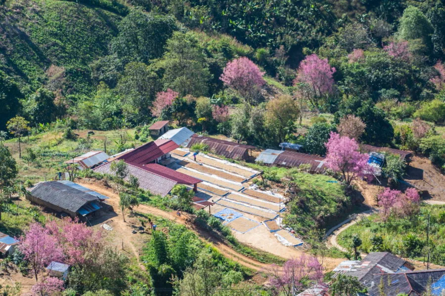
According to the time of year, the crest is dotted with Mexican sunflowers (this was the case in November, during my first visit). In January, flowering trees brighten the surroundings with pink, while in Mar, those are white flowering trees who take over.
One last crest for the more curious
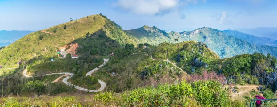
From the parking lot, I noticed another trail that starts from the north side of the mountain. It leads to another viewpoint called Noen 104 (badly placed on Google Maps, but right in this area).
Due to lack of time, I haven't gone through it completely, but I still went up on the first meters. Of the, I had a great view of the whole of Doi Pha Tang, a last panorama before getting back on the road.
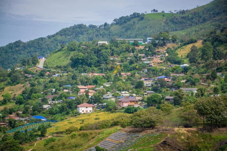
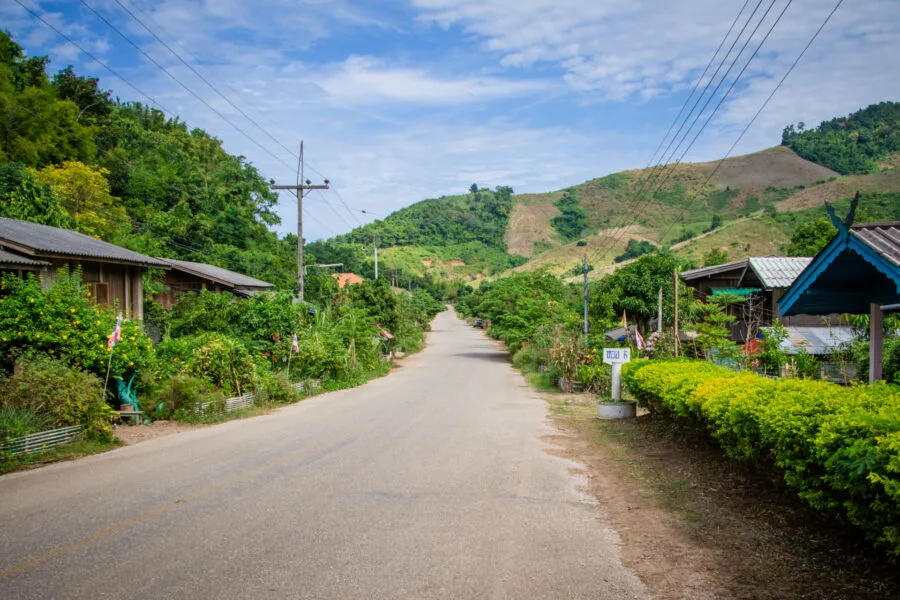
Ban Pha Tang and the “Chinese” villages
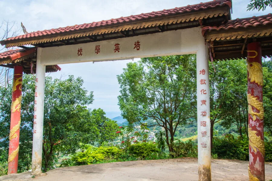
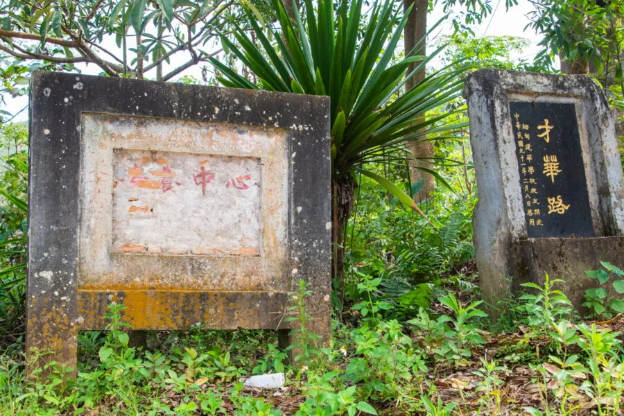
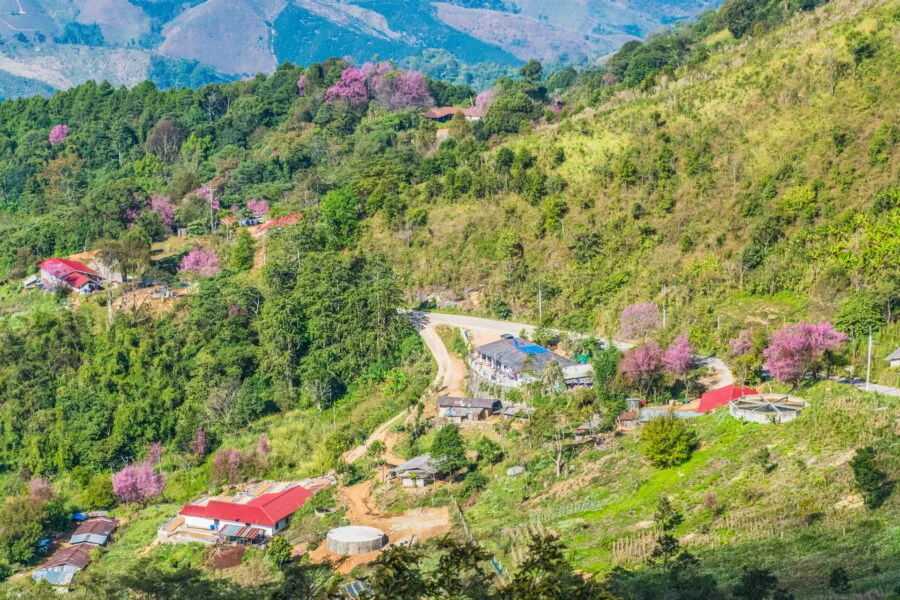
Besides its landscapes, Doi Pha Tang is distinguished by its villages steeped in Chinese culture. Here, the Hmong and the Yao have preserved their traditions and a way of life inherited from Yunnan.
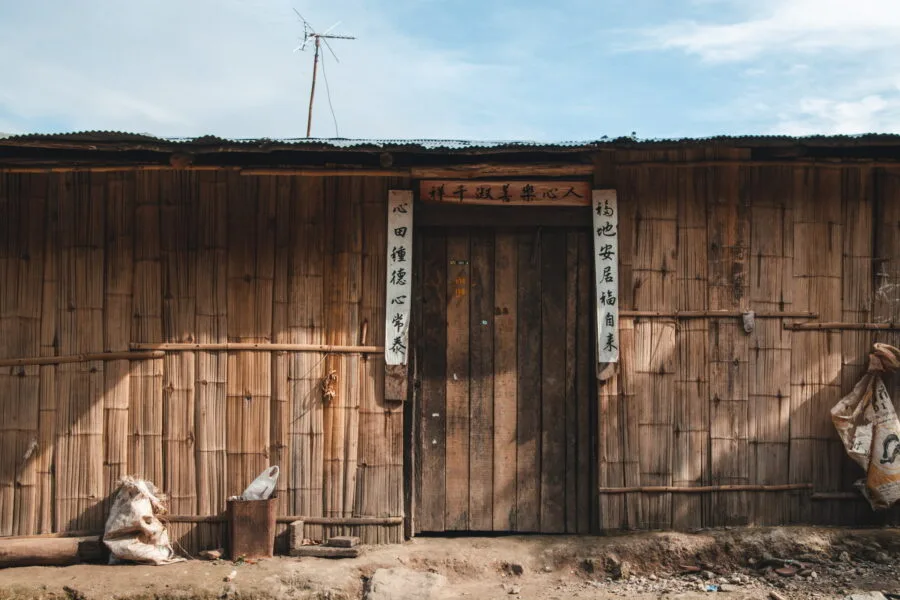
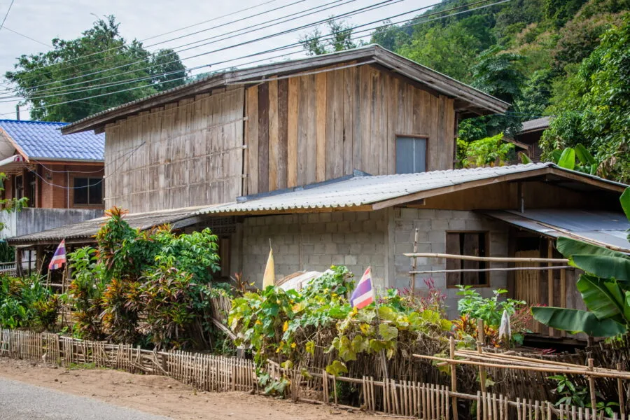
From the moment I arrived in the village of Pha Tang, the presence of this culture was evident. Chinese signs and steles were displayed everywhere, and the inscriptions on the fronts of the houses reinforced this connection with their origins.
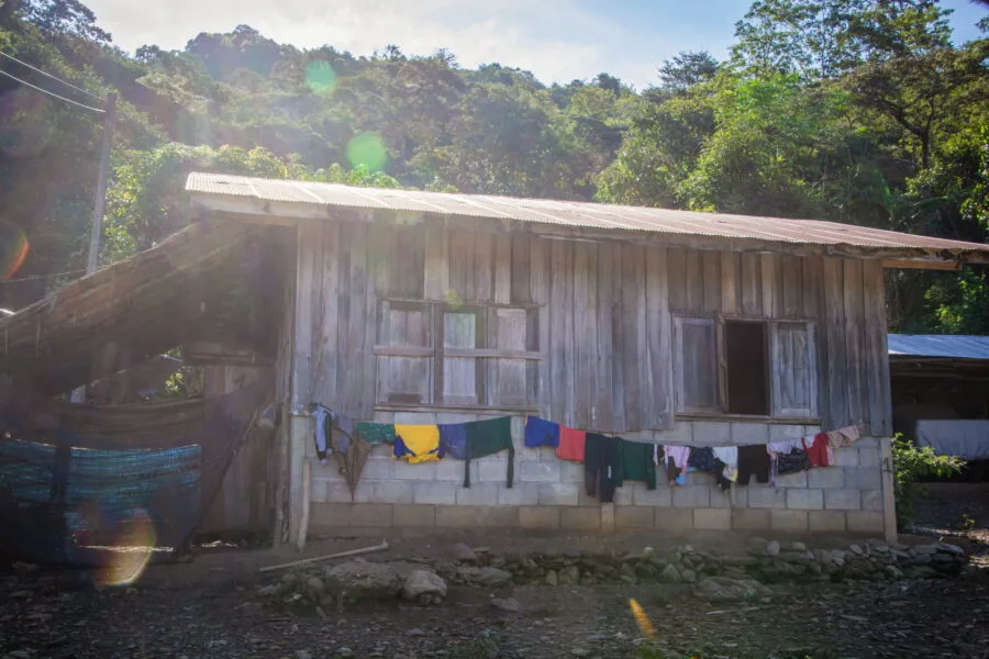
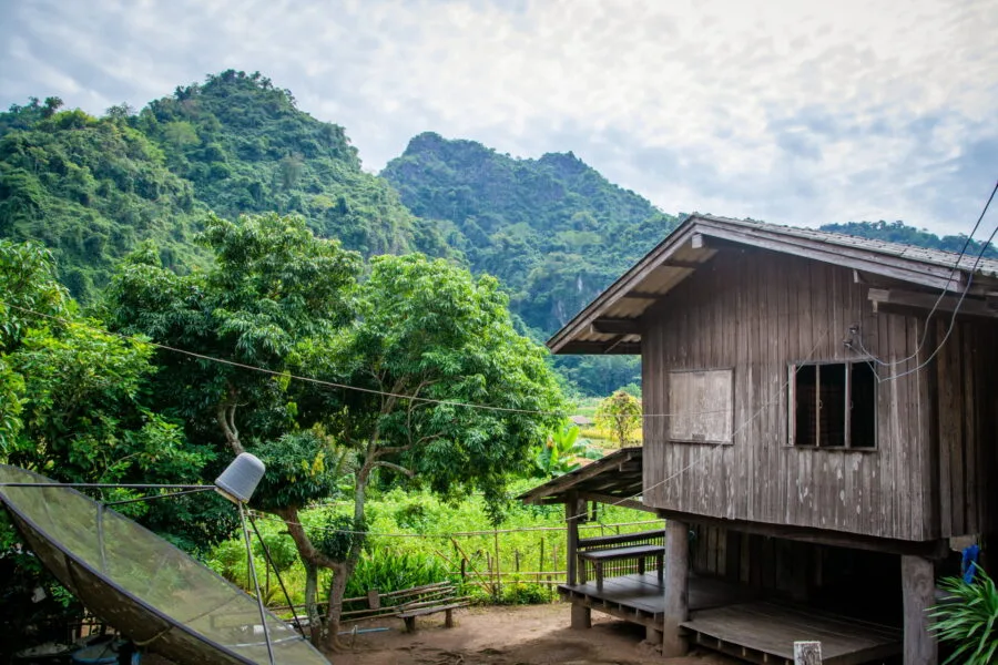
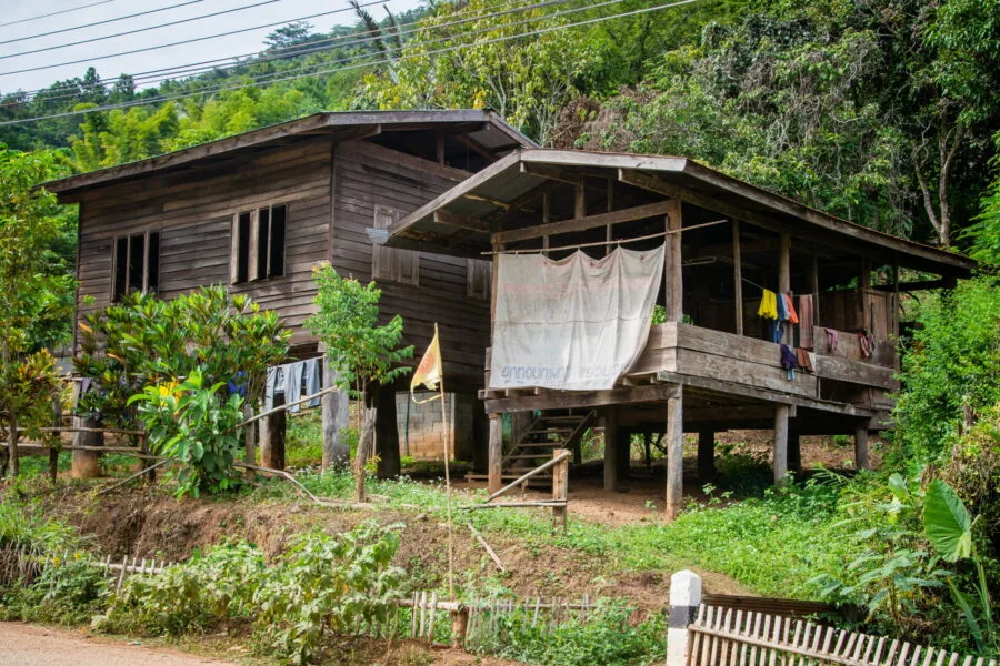
Some homes still have a rudimentary appearance, with walls covered with bamboo as insulation, reinforcing this rural and preserved atmosphere. A contrast that has nothing to do with the lifestyle of Sino-Thais living in the city as well as in Chinatown in Bangkok or to Phuket town.
Here we are far from the classic tourist circuits about the ethnic groups of northern Thailand. No tourist folklore, no artificial staging, just an intact daily life, sheltered from mass tourism.
A place out of time
During my visit, I only came across a few locals, but this simple glimpse gave me want to come back and explore more this region where, for a moment, we forget that we are in Thailand.
It's a similar feeling to the one felt at Mae Salong, another bastion of the Chinese diaspora, since we are facing the same case, it is also about descendants of KMT soldiers.
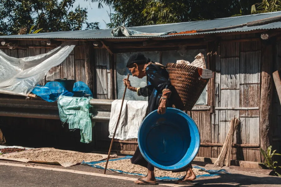
These Chinese roots are anchored in their daily lives where many still speak Mandarin among themselves, smoke pipes, and their gastronomy is very inspired by the flavors of Yunnan. I was even able to meet elders still wearing their traditional clothes, although this phenomenon is unfortunately going to become rarer...
Despite this strong identity, it remains Thailand, and there are many Buddhist temples there. In the heart of Ban Pha Tang, I went to the main temple with the explicit name of Wat Pha Tang. Its architecture is modern concerning its viharn but it is built on a rocky spur, where is arranged a panoramic platform.
From here, the view of the road that awaited me to reach the valley is breathtaking. I didn't linger too long in the village, only encountering a few intrigued but kind glances. I later learned that there is also the remains of a KMT soldiers' camp in this area, a piece of local history to explore next time.
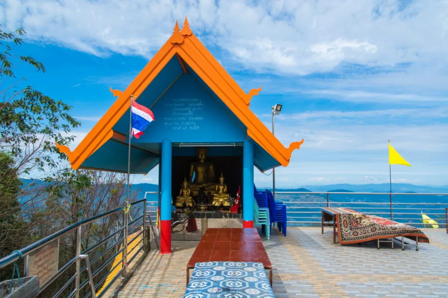
In this same area, if you follow the road leading to the village school, you will have a little higher another hilltop temple. This one, much more Chinese in style, reminds us once again that this region of northern Thailand is a bridge between two cultures.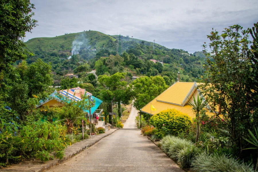
At the foot of Doi Pha Tang
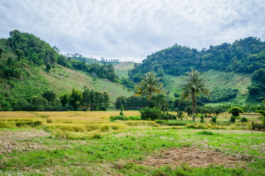
The descent into the valley is just as interesting as the ascent. There are just 15 km between Doi Pha Tang and Route 1155, which runs along the valley, but the valley itself offers plenty of scenery.
Once there, the next logical step after visiting Phu Chi Fah and Doi Pha Tang is to continue north to reach Chiang Khong. This is precisely what I did during a later stroll in the area, since I was heading to the town opposite, Houai Sai, on the Laos side.
Houai Sai, located just across the Mekong, is a frequent crossing point to Laos, especially for those wishing to embark on a two-day cruise to Luang Prabang (see my article on Houai Sai and cruises on the Mekong).
But when I went to Doi Pha Tang the first time, I went back to the other side of Thailand to get to the Doi Ang Kang. Having reached Route 1155, I headed south. This took me through the small village of Ban Pha Lae, which, at first glance, appears to be just another typical Thai village.
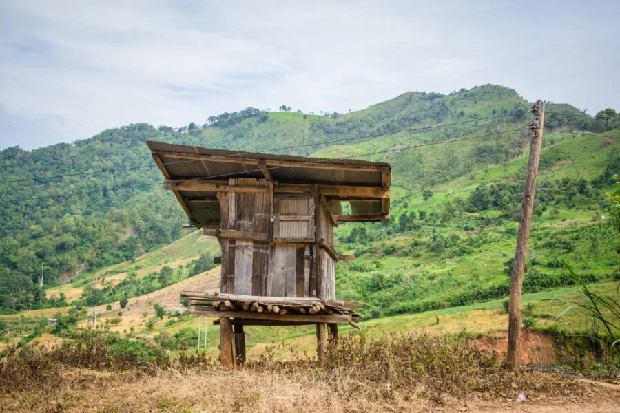
Stop at Ban Pha Lae village
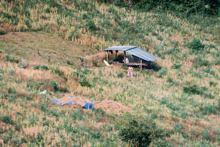
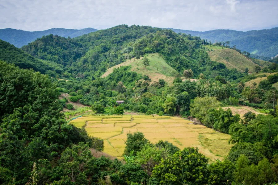
Actually, it is. This village exudes a peaceful atmosphere, with a discreet but certain charm. Probably that the rice fields still golden, just harvested, with these typical old wooden houses, and all surrounded by green hills had something to do with it!
After passing farmers enjoying the shade of their shelters, rather than simply passing by, I even decided to stop there for a moment.
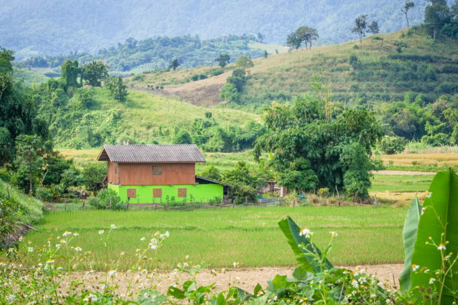
One of those impromptu stops that often make a trip even more memorable. I took the time to wander around, to capture a few photos... Because it's precisely this kind of place that I like, where normally no one would linger.
The rest of the journey continued on a beautiful road, winding through the mountain to Thoeng, 50 km furtherThe scenery changes: the mountains soften, the relief becomes more hilly, and in the hollows of the valleys, you can see rice fields.
A pure pleasure for lovers of road-trip !
How to get to Doi Pha Tang?
Le Doi pha tang is located about 110 km from Chiang Rai and only 20 km from Phu Chi Fah.
Ideal option : rent a car from Chiang Rai to freely enjoy the surrounding landscapes and mountain roads (see my article about driving in Thailand)
From Chiang Rai:
- The easiest way is to follow the same route as for Phu Chi Fah (is via the 1020 and the 1155, or by opting for a shorter route via the 1421 and the 4018 which joins the 1155).
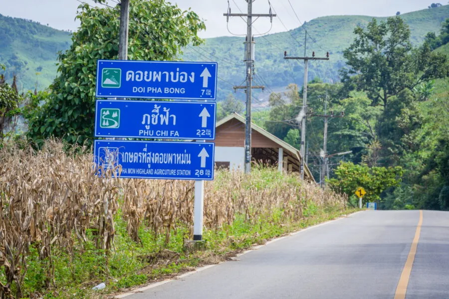
- Once on the 1155, just follow the signs indicating Phu Chi Fah then join Doi Pha Tang.
- It is also possible to go there without going through Phu Chi Fah continuing longer on the 1155.
- Important landmark : Just before a village, you will see a blue sign indicating Phu Chi Dao, an intermediate peak located between Doi Pha Tang and Phu Chi Fah. Doi Pha Tang is indicated but it is a separate sign, not very visible.
From Chiang Khong (Laotian border with Houai Sai):
- Follow the 1155 route, which runs along the river Mekong, before climbing towards the mountain via the same village mentioned as a landmark just before.
- At the crossroads, a sign indicates the village of Ban Pha Tang.
From Phu Chi Fah:
- 20 km scenic road along the mountainside (route 1093).
- The only downside: Seeing crops is nice, but visually it can be a bit "brutal." Some areas have been cleared a bit too much for intensive farming. Here, forests often only cover the ridges and peaks of the mountains, which is a bit of a shame.
- No public transport between the two. Maybe possible in high season or weekends to find a local pickup for the round trip, but nothing guaranteed.
Best time to visit Doi Pha Tang
Same story as for the Phu Chi Fah, winter (of November to February) is the best time to enjoy clear landscapes and sea of clouds.
November – February :
✅ Best season for the sea of clouds (especially early in the morning).
✅ Cool and pleasant temperatures.
✅ Landscape still very green after the rainy season.
✅ Thai sakura blooms across December and January.
March – May (hot season) :
❌ Drier landscapes, yellowed grass.
❌ Heat haze and pollution linked to burning.
✅ Advantage: Some trees are still in bloom in March.
(I.e. June – October (rainy season) :
✅ Lush, green landscapes.
❌ Frequent rain and sometimes slippery trails.
Ideally, arrive before 9 a.m. to see the sea of clouds.
I've never been to Doi Pha Tang at first light, but given its setting, I think it offers an interesting and probably quieter alternative to the popular Phu Chi Fah.
Where to eat and sleep in Doi Pha Tang
Accommodations
If you are not planning to go see the sunrise at Phu Chi Fah, sleeping directly in the village or near Ban Pha Tang can be a good alternative. The accommodation offer is more limited there than in Phu Chi Fah, but you will still find some local guesthouses at the foot of the mountain.
⚠️ Few are bookable online, but you can locate them on Google Maps and contact them directly.
⏳ Please note: In high season (from November), places go fast !
If there is still availability, here is two addresses that I spotted:
- Ban Chomdoi Resort PhaTang :
Located in 3 km from the junction leading to the parking lot of the Doi pha tang.
600 baht in low season, 900 baht in high season. - Phatang Sky View Camp (ผาตั้งสกายวิวแคมป์) :
A little more expensive (from 900 baht in low season), but the location offers a superb view of the valley.
️ Good plan : It has from his own restaurant, practical if you are staying on site.
Restaurants
- At the Doi Pha Tang parking lot, you will find some local stalls perfect for a quick meal.
- Don't expect English menus, it's 100% local here!
- If you want more choice, head to Ban Pha Tang, just 2 km from the parking lot.
Doi Pha Tang or Phu Chi Fah? Why choose?
In my eyes, the two sites are worth the detour, and since they are close, it would be a shame to miss out on one or the other, in short, the ideal is to combine the two.
✅ Phu Chi Fah is iconic for a sunrise with sea of clouds.
✅ Doi pha tang is more quiet but just as spectacular.
Did you like the article? share on Pinterest!

Have you heard of this place before?